VIDEO: Work Week Outlook; Early May Ideas…
You must be logged in to view this content. Click Here to become a member of IndyWX.com for full access. Already a member of IndyWx.com All-Access? Log-in here.
You must be logged in to view this content. Click Here to become a member of IndyWX.com for full access. Already a member of IndyWx.com All-Access? Log-in here.
You must be logged in to view this content. Click Here to become a member of IndyWX.com for full access. Already a member of IndyWx.com All-Access? Log-in here.
You must be logged in to view this content. Click Here to become a member of IndyWX.com for full access. Already a member of IndyWx.com All-Access? Log-in here.
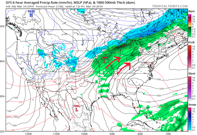
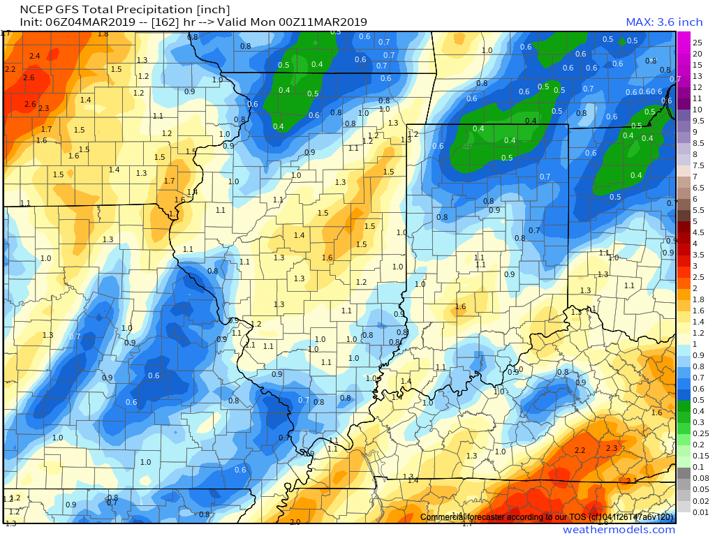
Scattered showers will spread across central Indiana at times through the day. Most of this rain will be light in nature through the afternoon hours, but a couple of moderate showers are also possible.
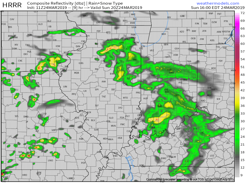
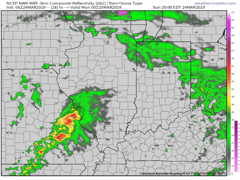
A surface low will track east across the lower Ohio Valley tonight and this will result in more concentrated heavy rain falling across the southern portion of the state this evening into early Monday morning. This is a bit further south than model guidance suggested yesterday. Additionally, a couple of strong thunderstorms are also possible tonight across far southern Indiana.
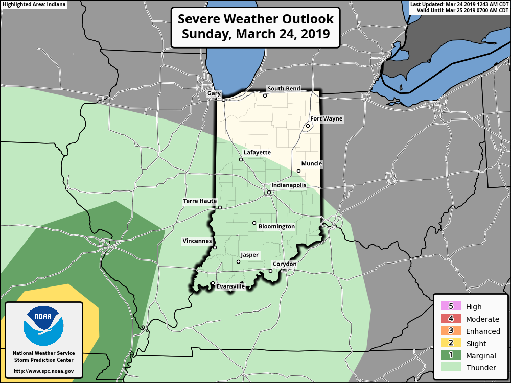
It wouldn’t surprise us to see the Storm Prediction Center (SPC) include portions of southern Indiana in a ‘Marginal’ or ‘Slight’ risk of severe weather tonight with future updates.
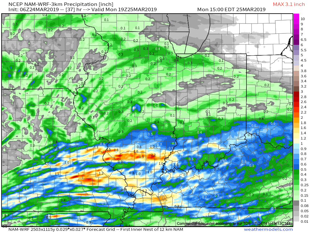
With the more southern track now expected from this storm system, the corridor of .50″ to 1″ rainfall totals will settle across the southern portions of Indiana, with 0.10″ to 0.25″ expected for central Indiana on average.
Rain will come to an end for all of the state by mid to late morning Monday with dry conditions returning Monday evening into the middle of the week, thanks to high pressure.
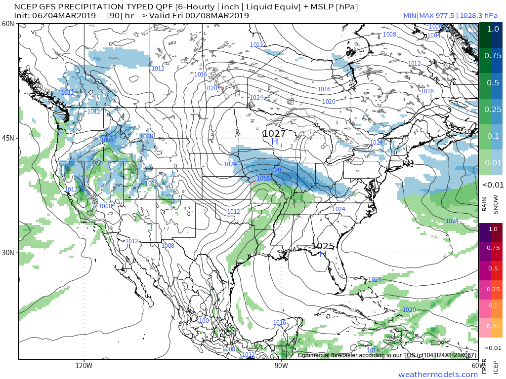
Dry and pleasant conditions will remain in place through the daytime hours Thursday before a storm system approaches Thursday night into Friday. The gusty southwesterly air flow in advance of this storm will help pull warmer conditions northeast into the Ohio Valley. Highs between 65-70 are on tap by Thursday afternoon. Unsettled weather is anticipated to remain through next weekend along with progressively colder conditions.
It’s a frigid start to the day, especially by March standards. With a fresh snow cover down, many reporting sites are now approaching zero. Officially, Indianapolis is down to 4 (F) as of this update at the 7a hour. For the most part, dry conditions will prevail today, but we could notice a couple of very light snow showers/ flurries at times this morning.
An upper level disturbance will pass through here Tuesday and again could be enough to ignite light snow showers.

The primary story through midweek is the cold as highs don’t make it above freezing until Friday afternoon. With the increasingly high and more powerful March sun angle, that’s another impressive feat.
Attention will shift to the threat of a stripe of accumulating snow Thursday evening into Friday.
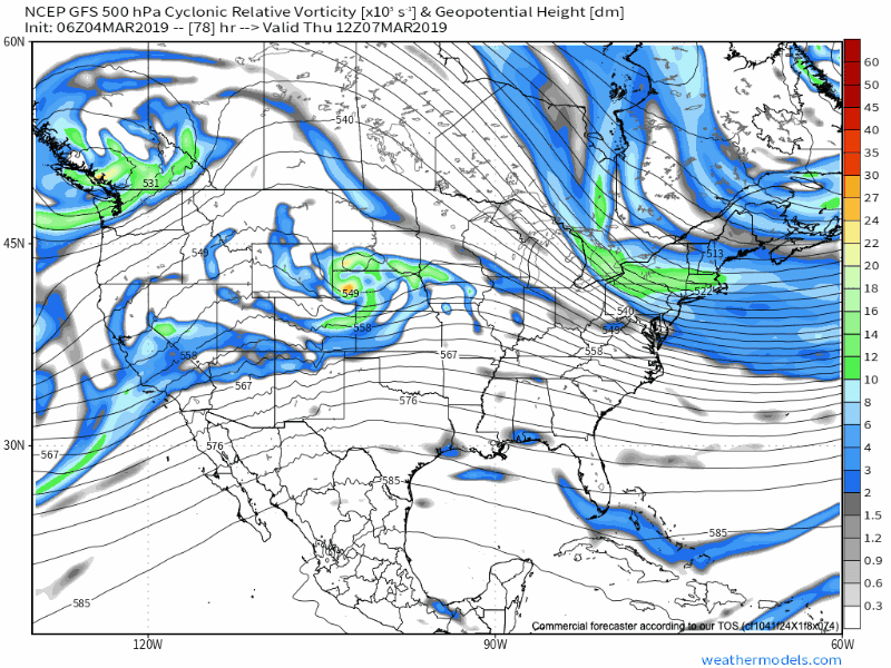
As this upper level wave scoots southeast out of the central Plains and across the Ohio Valley, a band of accumulating snow will occur to the north and northeast of the track. As things stand now, we expect snow to build in here Thursday evening, continuing into Friday. While we still have time to watch things unfold, this is the kind of system that could deposit a few/ several inches of wet snow. Stay tuned.
Just as soon as we get rid of our late week snow maker, a new storm system will approach this weekend with the threat of heavier rain and embedded thunder late Saturday into early Sunday.
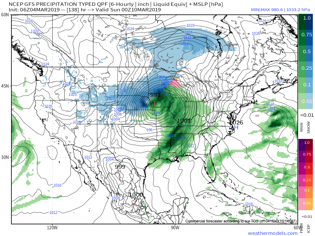
Rainfall totals of 0.75″ to 1.25″ are possible with our weekend system before precipitation ends as wet snow showers/ flurries next Sunday.
We’ll have an updated video discussion this evening looking more in-depth at the long range pattern… Make it a great Monday!