Busy Weather Week…
|
Mon. |
Tue. |
Wed. |
Thr. |
Fri. |
Sat. |
Sun. |
|
|
|
|
|
|
|
|
|
53/ 77 |
53/ 80 |
65/ 85 |
54/ 69 |
48/ 64 |
44/ 63 |
44/ 68 |
Beautiful Open To The Work Week…Canadian high pressure will remain in control of our weather as we open up the new work week. Look for plentiful sunshine and seasonably cool temperatures.
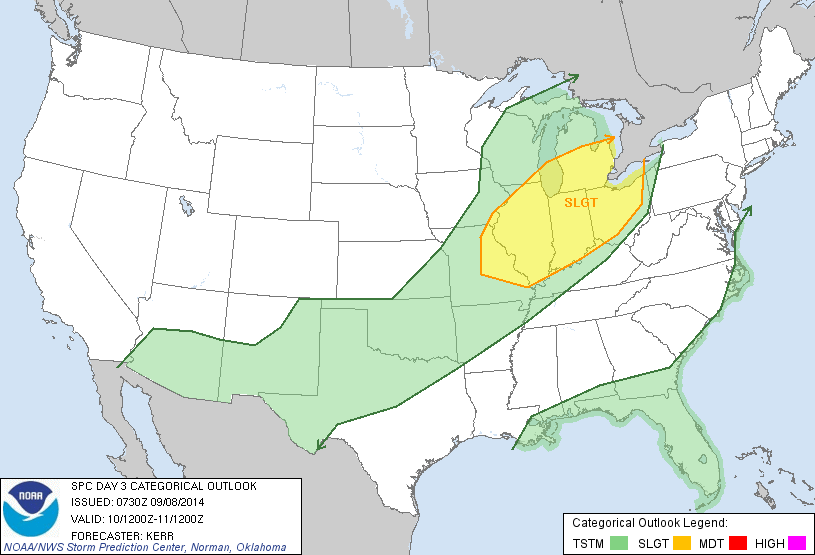
Humidity Builds; Severe Chances Wednesday…Tuesday will be a transition day between the cooler, drier feel from the weekend and a briefly warmer and much more humid regime for mid week.
An isolated shower is possible Tuesday, but most communities will remain rain-free. Our focus will remain on Wednesday as a severe weather episode is possible. A strong autumn cold front will slice into a warm, humid, and unstable air mass Wednesday afternoon and strong to severe thunderstorms will erupt. All modes of severe weather will be in play Wednesday and we target the afternoon into the evening for the best chances of severe. Locally heavy rainfall is also a good bet. We’ll have more details on timing and threats as we move forward.
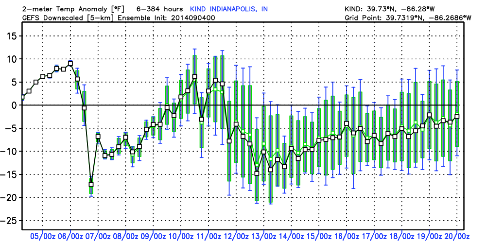
Unseasonably Chilly…A late October-like air mass will invade as we wrap up the work week and head into the weekend. Jackets and sweat shirts will be needed as temperatures fall to levels more than 15 degrees below normal. Dry and crisp air will remain in place through the weekend.
7-Day Precipitation Forecast:
- 7-Day Rainfall Forecast: 1.5″ – 2″
- 7-Day Snowfall Forecast: 0.00″
Brian Jessen sent in this beautiful sunrise photo taken in Brownsburg early this morning. Thanks, Brian!