Category: 7-Day Outlook

Fantastic Friday; Storms Return Saturday Evening…

Screen Shot 2016-05-06 at 7.41.04 AMHighlights:

  • Pick of the week is today
  • Evening severe potential Saturday
  • Unsettled stretch continues

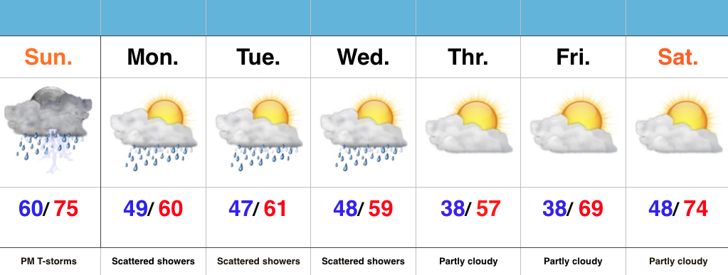
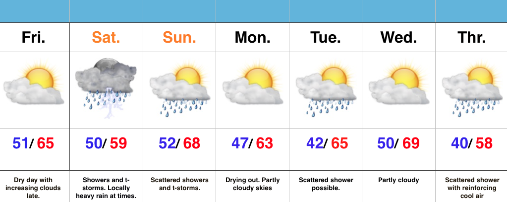
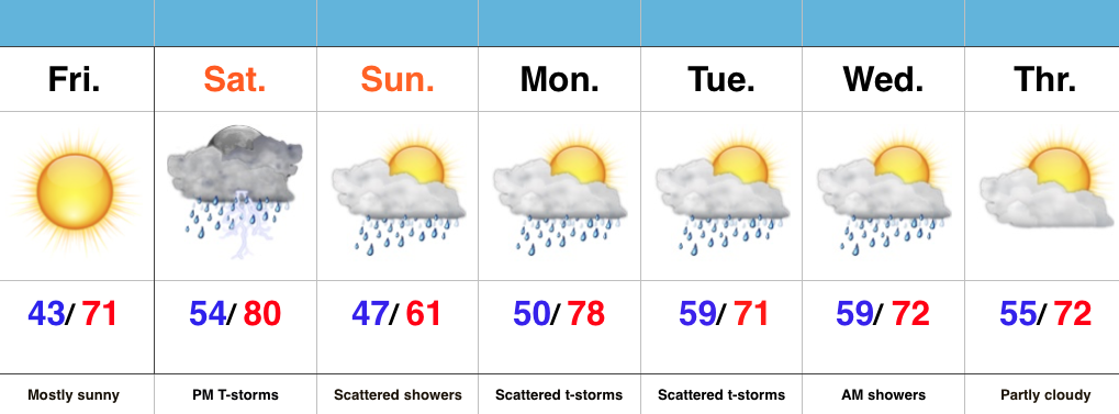
Have The Sunglasses Handy Today…Today is easily the pick of the week as high pressure supplies sunshine and a cool start.  With the May sun angle in place, chilly morning lows in the lower 40s will quickly rise into the lower 70s for afternoon highs.

A cold front will approach Saturday and slice into a briefly warm and humid air mass in place across the region.  With highs approaching 80 and dew points surging into the lower 60s, don’t be surprised by strong to severe thunderstorms across central IN during the afternoon and evening hours.

The cold front will slip to our south for Sunday, but remain close enough to continue shower chances across central parts of the state.  It’ll be a much cooler day with a north wind in play.

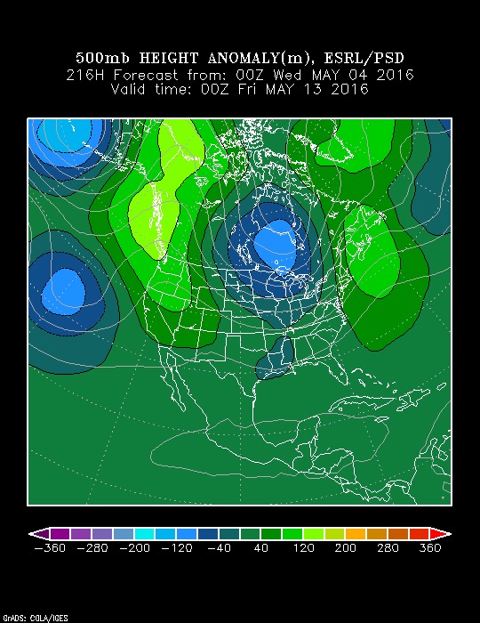
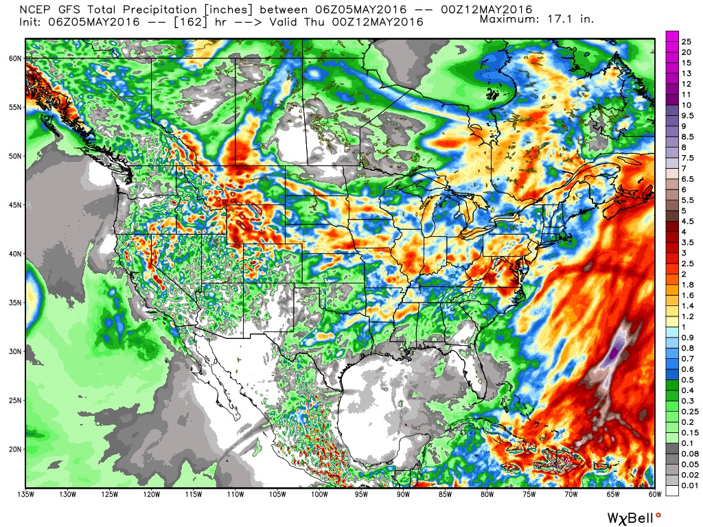
As we move into the new work week, we’ll continue the active and unsettled theme.  While it won’t rain the entire time, expect numerous showers and embedded thunderstorms through mid week.

Permanent link to this article: https://indywx.com/fantastic-friday-storms-return-saturday-evening/

Hang In There Friends…

An upper level low is still impacting our weather this morning, but this feature isn’t wasting any time scooting southeast. In fact, by this afternoon, we should be looking at increasingly sunny skies and temperatures that will slowly recover from the chilly, raw readings of this morning.

With the increasing sunshine, temperatures will recover into the lower 60s today (still below average, but an improvement).


High pressure will build into the region to wrap up the work week and provide a delightful close to what’s been a rather gloomy week. Mostly sunny skies and temperatures into the lower 70s are on tap.

That said, this is still an active weather pattern that will require close attention in the week ahead.

The anamalous trough will “relax” and give way to transient ridging, but there are indications of another trough setting up Days 8-10. Giving the pattern, it’s likely that the aforementioned trough will be deeper (more significant) than what model data currently portrays (image 3).


It’s a rather wet pattern, as well. 7-day rain numbers of 1″-1.5″ seems reasonable with locally heavier totals. 


Our next chance of rain comes Saturday in the form of scattered, mostly PM variety, storms.

More later! Make it a great Thursday! 

Permanent link to this article: https://indywx.com/hang-in-there-friends/

Monday Afternoon Video Update…

It’s a cool, gloomy open to the work week.  We’ll turn even cooler by mid week, BUT changes are coming that promise increasingly warm and sunny conditions by the weekend.…

You must be logged in to view this content. Click Here to become a member of IndyWX.com for full access.  Already a member of IndyWx.com All-Access?  Log-in here.

Permanent link to this article: https://indywx.com/monday-afternoon-video-update/

Strong Storms This Evening; Cool Open To May…

Screen Shot 2016-05-01 at 10.57.11 AMHighlights:

  • Strong storms develop this evening
  • Scattered showers through mid week
  • Unseasonably cool open to May

Watching For Evening Storm Development…The morning has gotten off to a beautiful start across central IN, but the sunshine will likely be enough to help destabilize things just enough to assist in afternoon/ evening thunderstorm development.  Additionally, a frontal boundary remains draped across the state and we’ll await a wave of low pressure to move along the front this evening.  A few strong to severe thunderstorms will be possible with large hail and damaging straight line winds the biggest concerns.  We’ll keep an eye on the radar later today.

We’ll flip the page and turn much cooler for the upcoming week.  Reinforcing cool air will be accompanied by showers at times through the mid week period, but we should turn drier late week (and eventually warmer).

Permanent link to this article: https://indywx.com/strong-storms-this-evening-cool-open-to-may/

Dry Time Is Brief; Wet Saturday Ahead…

Screen Shot 2016-04-29 at 7.52.07 AMHighlights:

  • Friday sunshine before clouds increase late
  • Unsettled weekend
  • Reinforcing cool air next week accompanied by showers

Enjoy The Sun While We Have It…A dry day is on tap and while it’s gotten off to a sunny start, clouds will be on the increase late today.  Those clouds will deliver rain and scattered thunderstorms Saturday.  Some of the rain may be locally heavy.  We’re looking at widespread 1″-1.5″ totals, but there will be locally heavier amounts.  While scattered showers and thunderstorms will remain Sunday, the wetter of the two weekend days is slated for Saturday.

The work week will start dry with increasing sunshine, but cooler.  Reinforcing cool air will blow in Tuesday and again Thursday.  Each cool air reinforcement could be accompanied by a scattered light shower.  That said, next week looks significantly drier with compared to this week.

Permanent link to this article: https://indywx.com/dry-time-is-brief-wet-saturday-ahead/