Updated 05.16.25 @ 7:25a Our Friday is dawning on a beautiful note (though a bit on the humid side). Unfortunately, the sunny skies we’ll enjoy this morning will take on…
You must be logged in to view this content. Click Here to become a member of IndyWX.com for full access. Already a member of IndyWx.com All-Access? Log-in here.
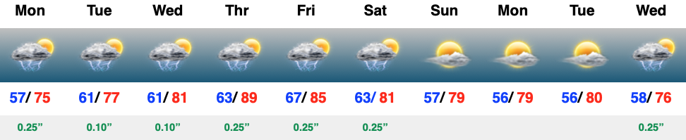
Updated 05.15.25 @ 7:33a Rain and storms will dominate headlines over the upcoming 7-day period. The good news is that we should squeeze in a nice weekend, overall (after early…
You must be logged in to view this content. Click Here to become a member of IndyWX.com for full access. Already a member of IndyWx.com All-Access? Log-in here.
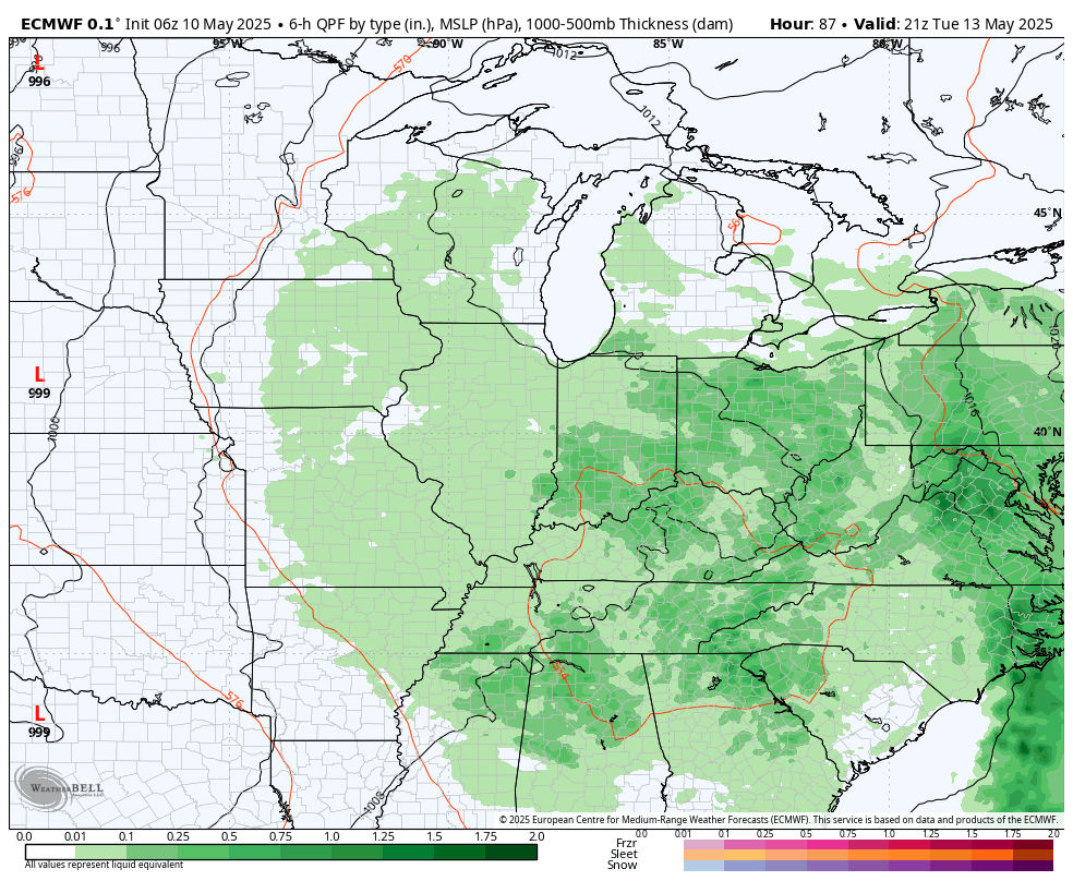
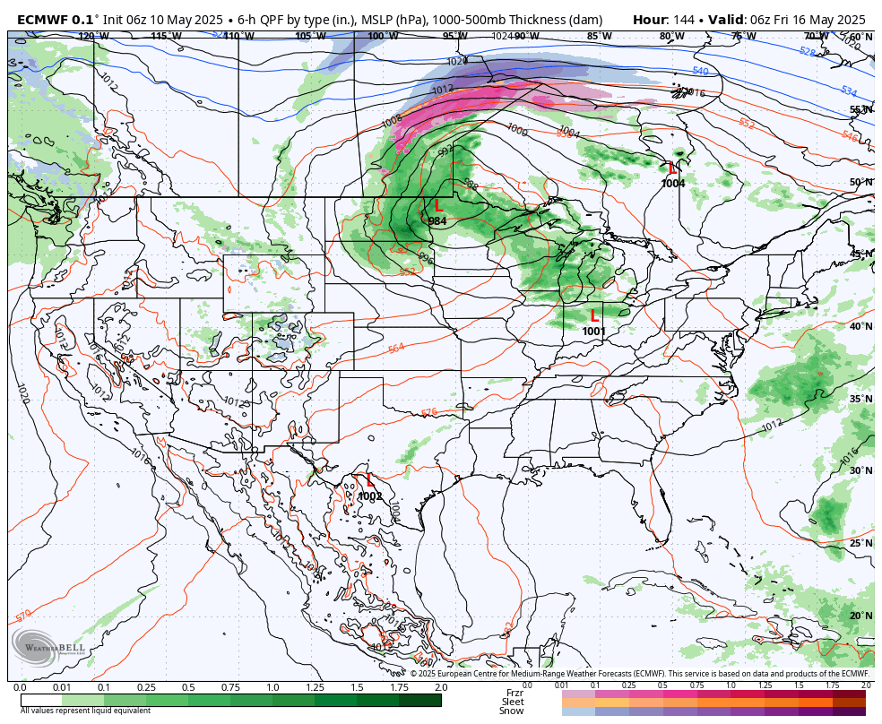
The upper low that’s been impacting the Deep South for the past several days is finally starting to lift north. That means our region will start to turn more unsettled today with showers and embedded thunder lifting in from the south. It won’t rain the entire time by any stretch of the imagination, but we should be prepared for at least scattered coverage of showers/ t-storms from this feature through Wednesday (less coverage Wednesday compared to that of today and Tuesday).
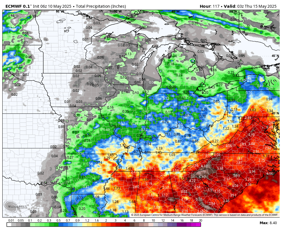
Then attention will shift to an approaching cold front Thursday afternoon and evening. As the front slices into a warm, unstable, and humid airmass, strong to severe thunderstorms will be possible here Thursday afternoon and into the evening.
Updated 05.11.25 @ 9:34a We couldn’t ask for better weather for Mother’s Day. While we’ll note a few mid and high level clouds streaming in from the south, they won’t…
You must be logged in to view this content. Click Here to become a member of IndyWX.com for full access. Already a member of IndyWx.com All-Access? Log-in here.
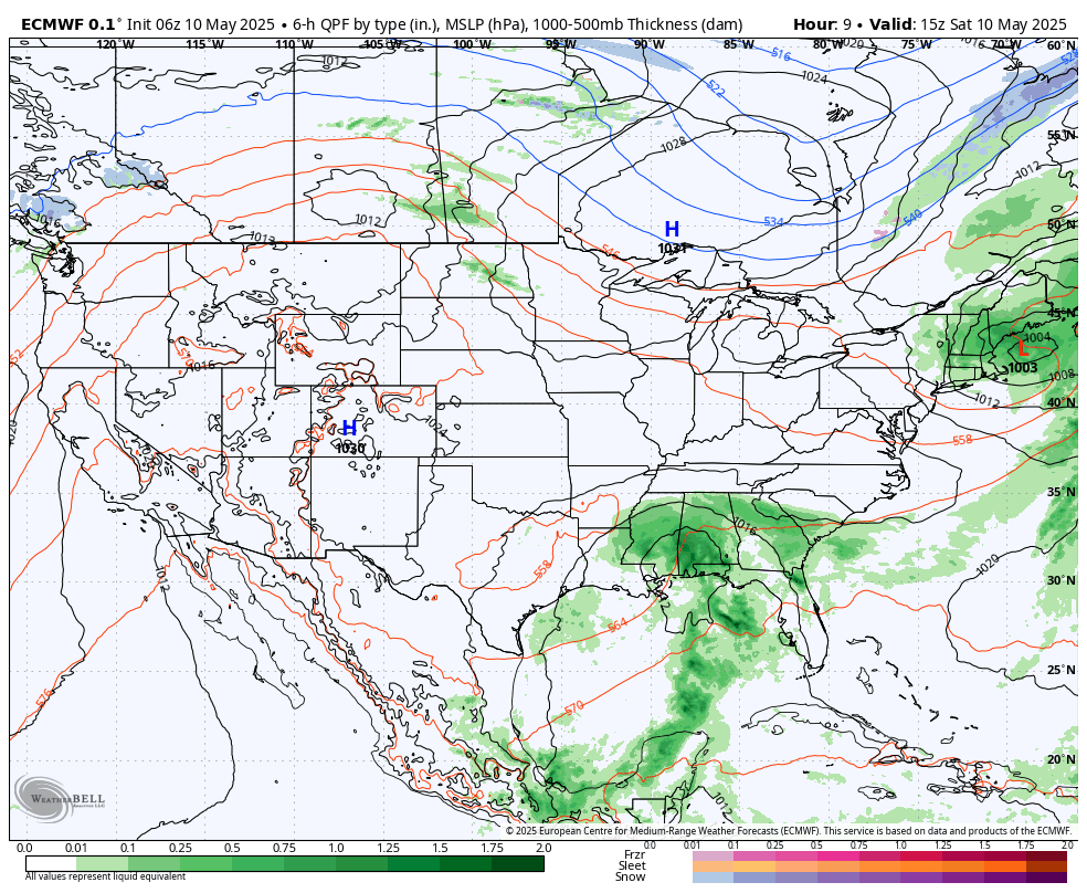
Mother’s Day weekend couldn’t be any more spectacular! High pressure will support plentiful sunshine and pleasant temperatures today that will warm to around the 80° mark for Mother’s Day, itself.
That same storm system you see off to our south this weekend will lift north through the early part of the work week and present an opportunity for scattered showers and embedded thunder to return around these parts Monday and Tuesday.
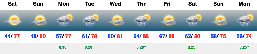
0.25″ to 0.50″ should be most common during this time period, but there will be some localized 0.50″ to 1″ amounts.
A cold front will approach late week with the opportunity of stronger storms. Could a few of these be severe Thursday? Yes, but still too far out for specifics. We’ll also really notice an uptick in warmth and humidity as we close the work week (some communities will flirt with the 90° mark).
Looking further ahead, out towards the all-important Memorial Day/ Indy 500 weekend shows a pattern that will generate a cooler and likely wetter time of things, relative to normal. We’ll be able to start getting more specific regarding Memorial Day weekend late next week.