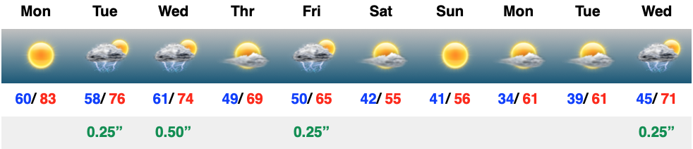
It doesn’t get any better around these parts this time of year than what we experienced Monday. Unfortunately, today marks the return of unsettled weather that will continue through midweek. The reward after going through a few days of rain/ storms? An incredible weekend, complete with a return of sunshine!
We couldn’t ask for better weather to kick off the new work week. Plentiful sunshine, temperatures heading for the 80s, and a generally light, variable wind will make it tough to work indoors today. Rain and storm coverage will grow in the coming days…
Permanent link to this article: https://indywx.com/video-gorgeous-monday-transitions-to-unsettled-times-cooling-this-weekend-gives-way-to-renewed-warming-in-the-10-15-day/
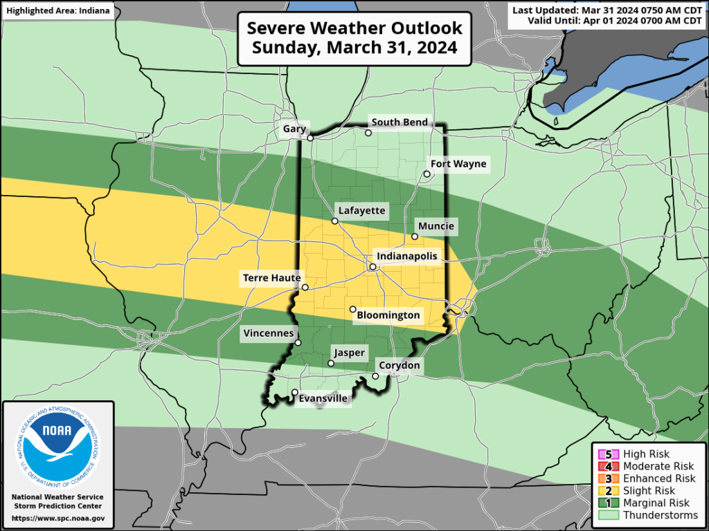
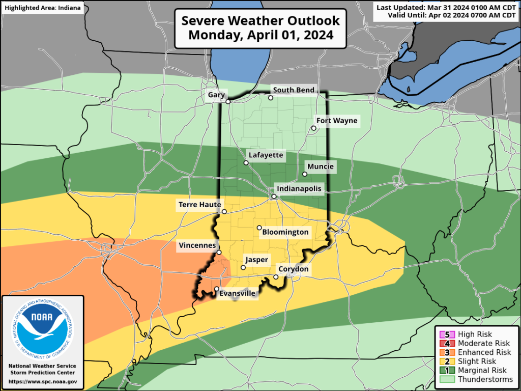
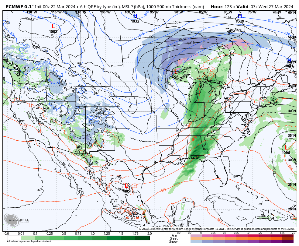
The upcoming immediate term will be headlined by a multi day heavy rain and severe weather episode. A stalled frontal boundary will serve as the pathway for multiple waves of low pressure to ride along through Tuesday. In addition to a heavy rain and flooding threat (primarily targeting immediate central and north-central Indiana), we’ll also likely have to deal with (3) rounds of severe storms. We’ll allow our short-term products to handle those severe threats, but just know all modes of severe are on the table with the greatest emphasis being on large hail with this setup. Should a couple discrete cells develop near or just south of the boundary then an elevated tornado threat would ensue. Again, we’ll have a fresh post hoisted later this afternoon or evening on that.
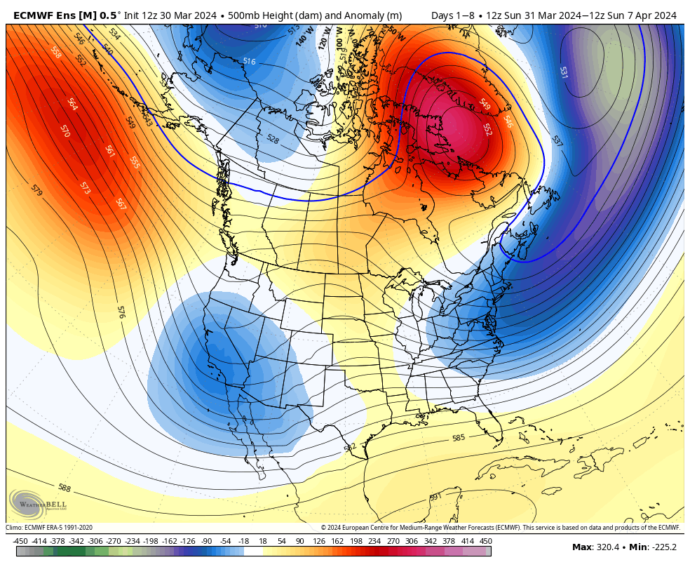
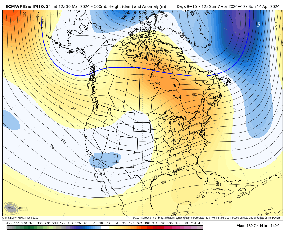
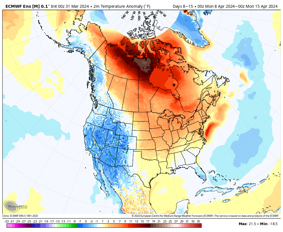
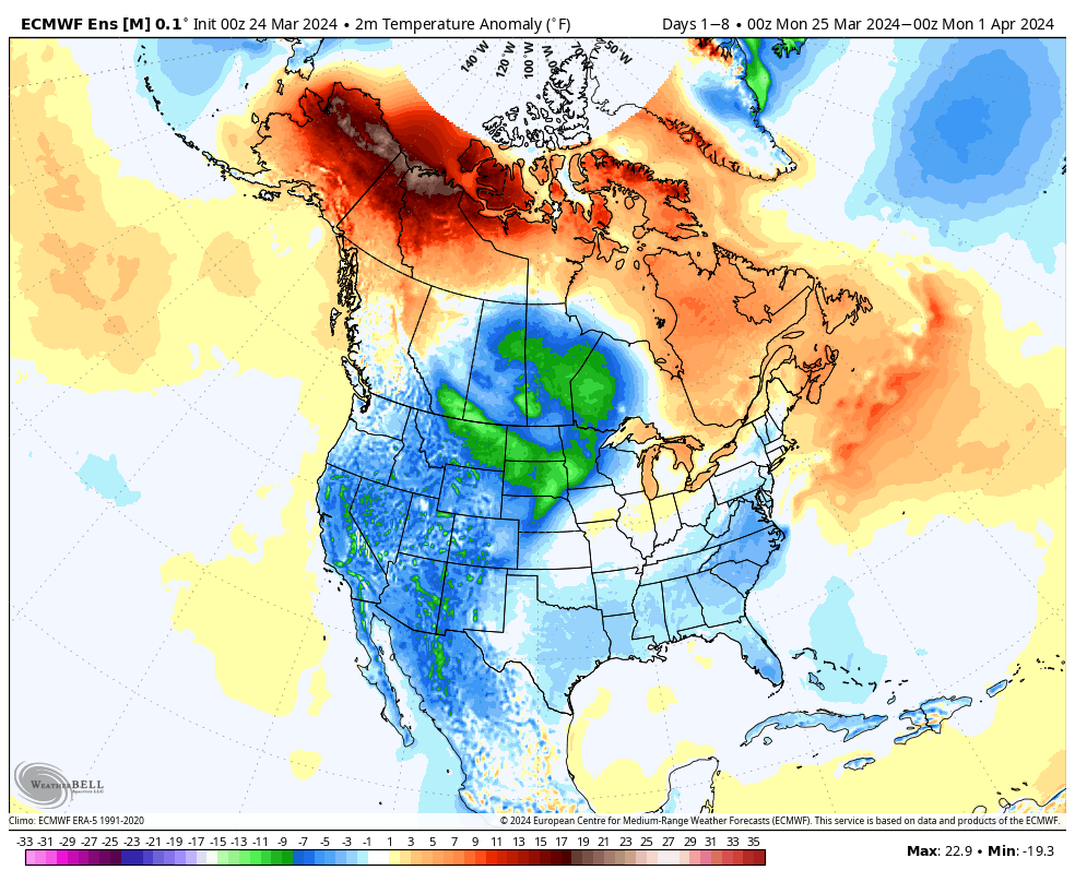
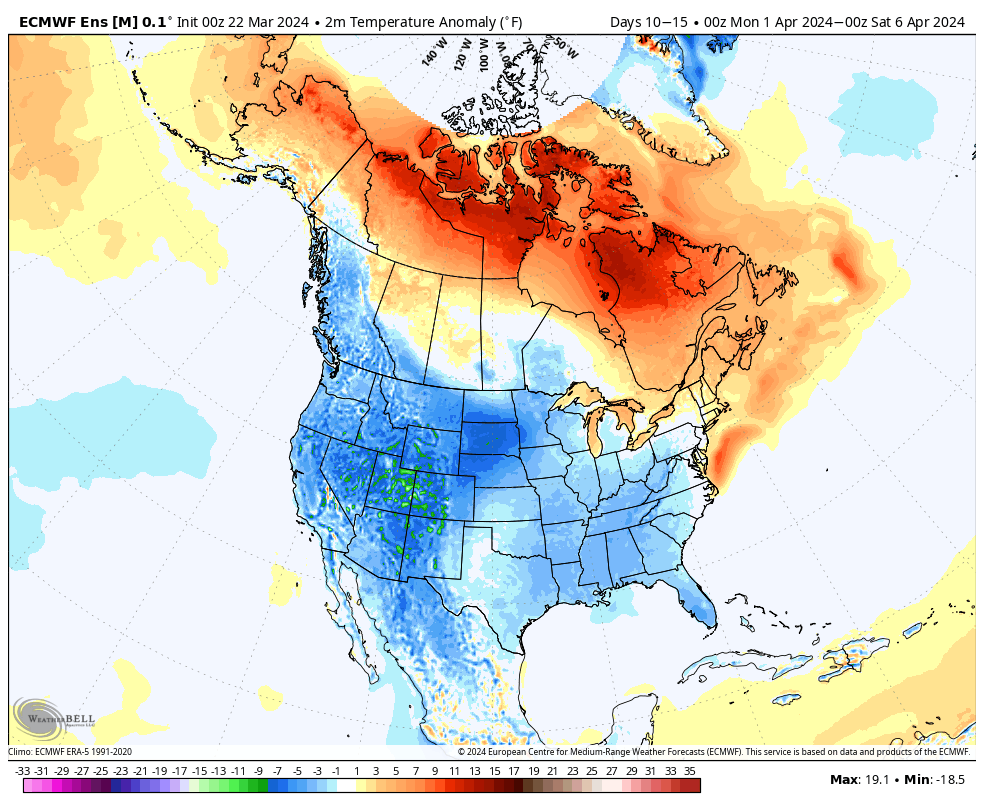
Overall, there’s no change in the idea of an active pattern continuing from Week 1 (image 1 below) into Week 2 (image 2 below).
The cooler pattern behind our early week storm system will reverse in significant fashion Week 2. – Transitional regime at its finest.
Week 1 temperature anomalies
Week 2 temperature anomalies
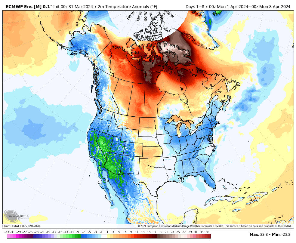
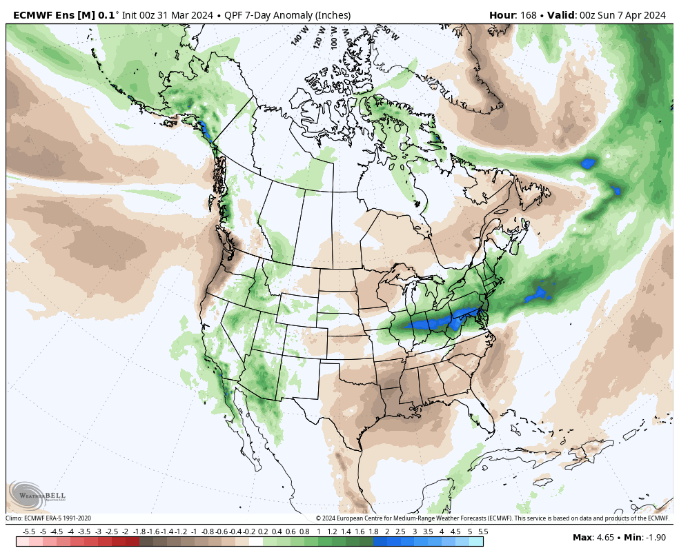
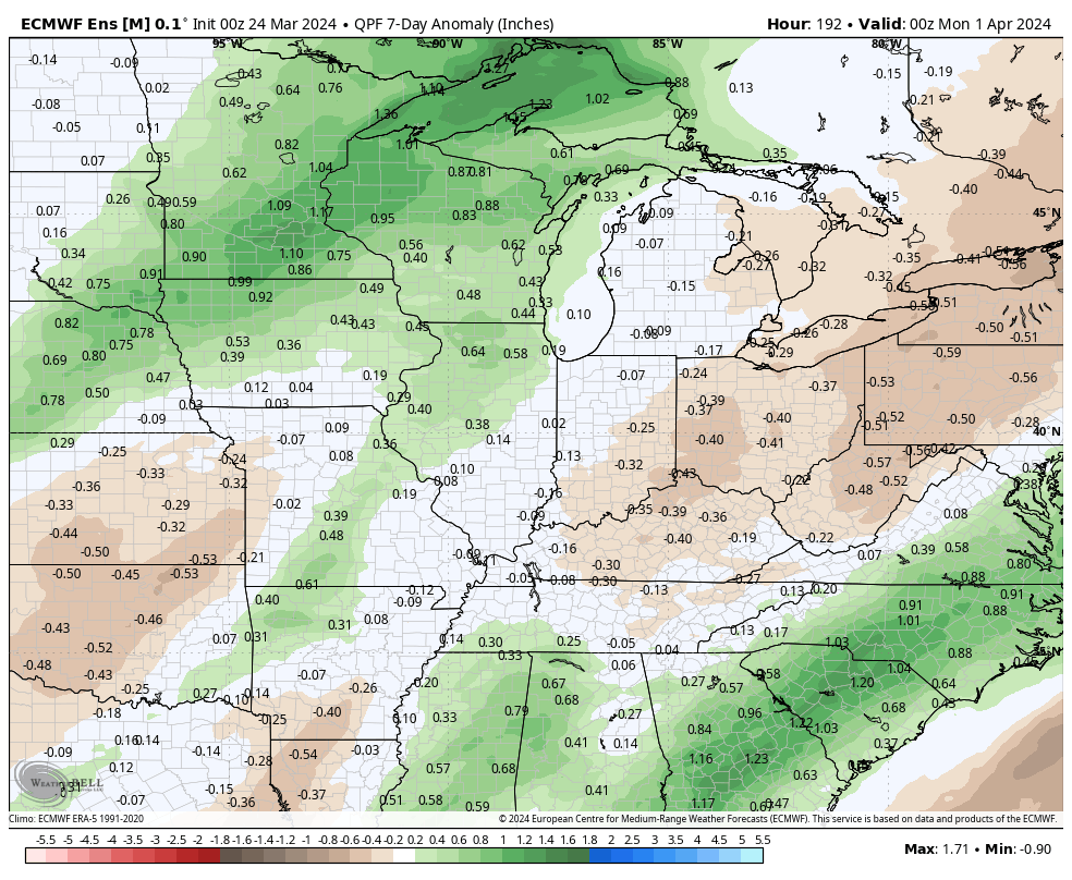
The busy nature of the pattern is reflected in the upcoming 2 week precipitation anomalies.
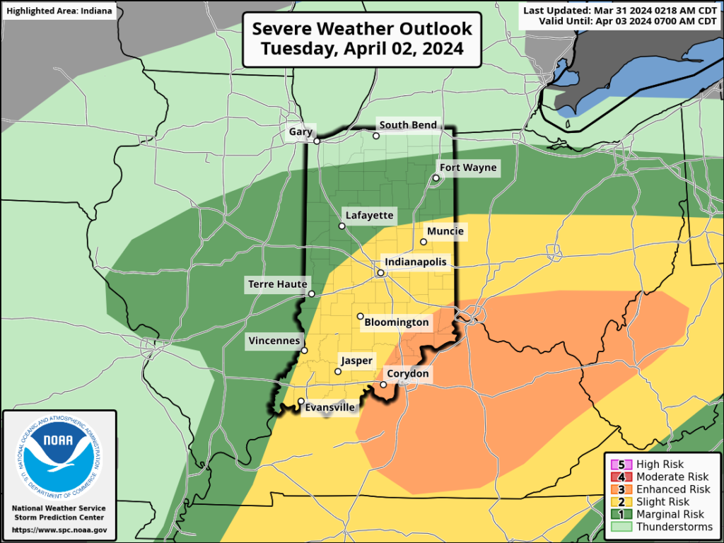
Severe weather will be possible at least across a portion of our immediate viewing area starting this evening and continuing daily through Tuesday.
Colder air will crash in here Wednesday and as an upper low swirls overhead, wet snow will develop. Snow may even fall heavily enough to accumulate on grassy surfaces in spots Wednesday night into Thursday morning.
While a period of unsettled weather looms late Monday and Tuesday, the majority of the upcoming week will feature quiet conditions across our neck of the woods. We’re watching Tuesday afternoon for the potential of severe weather across the state.
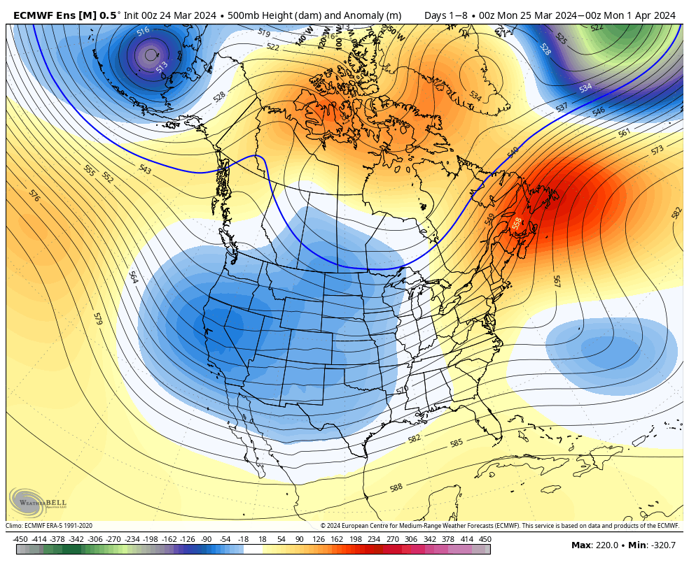
The ‘mean’ trough will settle into the western CONUS and that’s where the coldest anomalies will setup shop.
A trough will take up residence across the West with only glancing blows of cooler air, locally.
A chilly week is in store for the West with the temperature swings balancing out very close to average across our area this week.
Rainfall will run average to slightly below average in the week ahead south and east.
Forecast period: 03.24.24 – 03.31.24
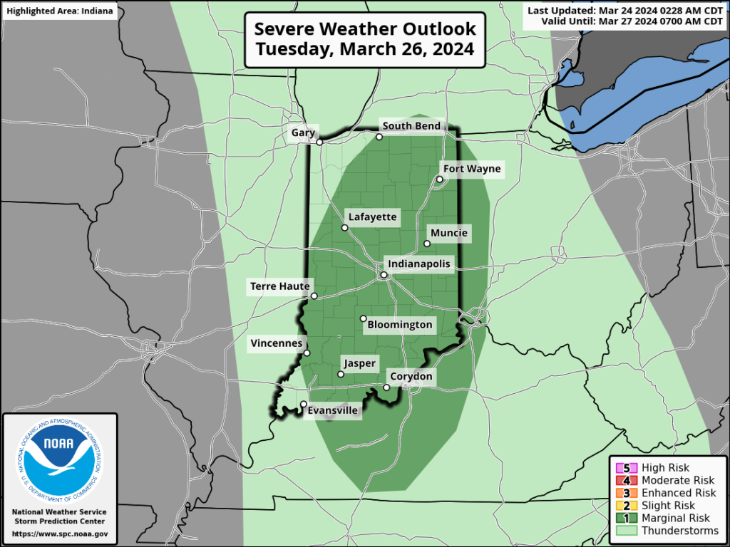
We’ll close the weekend with quiet conditions in place. Anticipate gusty winds to kick up Monday as our next storm system approaches from the west. This will also deliver a few showers Monday night before heavier rain and embedded thunder arrives Tuesday predawn. An additional round of thunderstorms is expected Tuesday afternoon and a few of these could become strong to severe (damaging straight line winds are of greatest concern, but an isolated tornado can’t be ruled out).
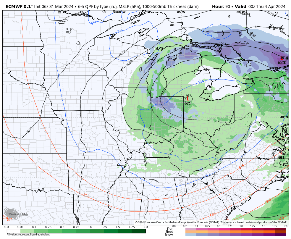
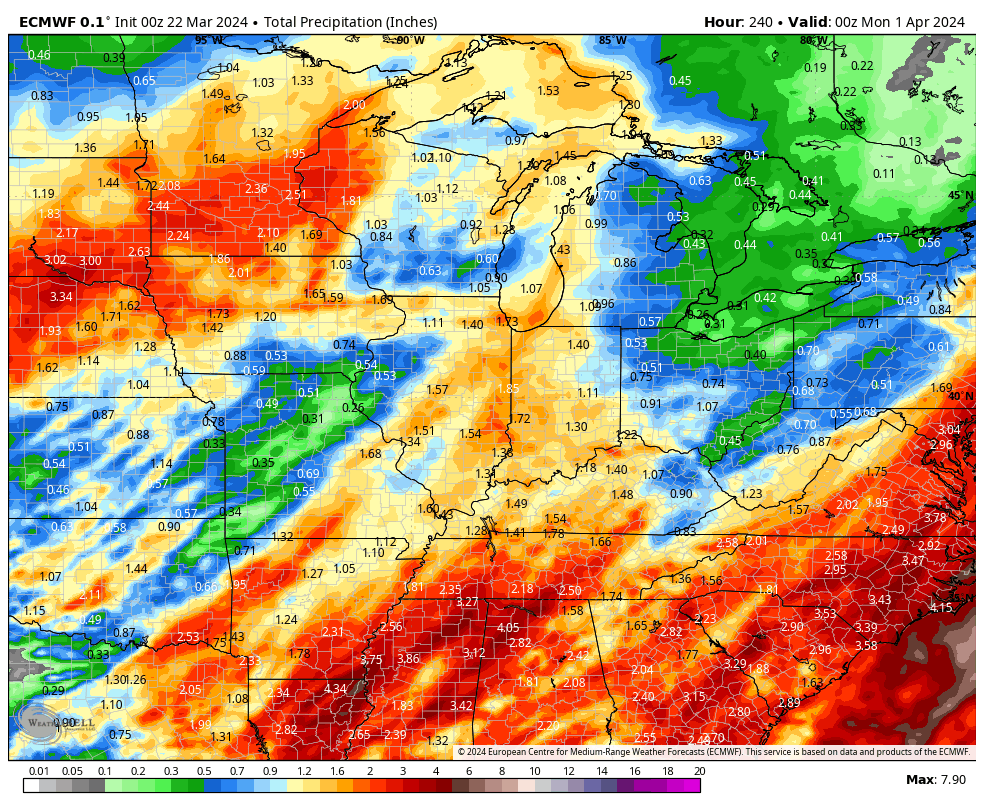
A cold front will sweep east and end the rain/ storm threat Tuesday night with calmer weather returning for mid and late week. The next chance of rain will arrive next weekend. Speaking of next weekend, though early, model guidance is suggestive that we may be looking at a heavy rain event around the time that we close out March and open April. Just something we’ll be keeping an eye on in the days ahead.
The ‘mean’ trough position will take up shop across the western portion of the country over the upcoming week before shifting into the East in the 10-15 day period. We reiterate while the balance of the upcoming 2 weeks will run cooler than normal, we don’t see anything significantly colder than normal on the horizon and also plenty of transitional warmth ahead of approaching storms.
Note how the trough shifts east late in the period.
Day 1-5Day 5-10Day 10-15
Back to the immediate term, we’ll only see a few light showers later this afternoon (trace to 0.10”). Greatest coverage should arrive after lunch, continuing into mid-afternoon. Again, “light” is the key word.
Colder air arrives for the weekend, itself. We can expect mid to upper 20s both Saturday and Sunday morning.
A new, stronger, storm will blow into town with more in the way of widespread heavier rain and thunder Monday night into the day Tuesday.
Another system will follow late week and next weekend.
1” to 2” is a good bet across the greater region by next Sunday. (The bulk of this falls with our Monday night and Tuesday system).