Highlights:
- Scattered showers; unseasonably cool today
- Brighter; warmer days ahead
- Questions next week in regards to rain/ storm potential
A vigorous upper level low will pivot through the Ohio Valley Thursday. This will provide the threat of a shower really at any point through the day. Unseasonably cool air and a gusty wind will also be in place. This will be a brief set back from what, otherwise, is a full-blown burst into spring/ early summer type weather over the weekend into next week.
We’ll keep a very close eye on the placement of a ridge to our southeast early next week as this will mean the difference between a mostly dry and warmer pattern and one that could, potentially, be periodically stormy. As things stand now, models are trending drier, with the so-called “ring of fire” pattern placed just north of central Indiana. We’ll keep a close eye on things.
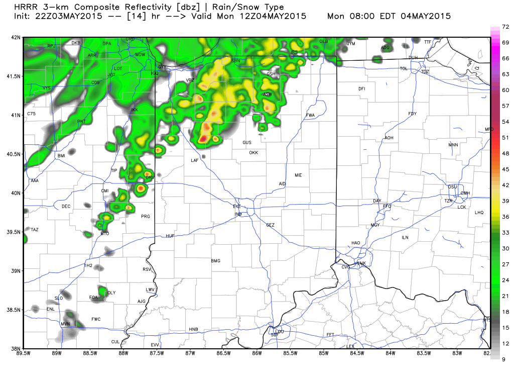
 Simulated radar (above) shows scattered showers dotting the region Thursday, thanks to a potent upper low moving through the Ohio Valley. Unseasonably chilly air (forecast highs in the mid/ upper 50s shown below) and gusty winds will also accompany this system. Rainfall amounts will be light for most and generally under one tenth of an inch.
 Our weather early next week will largely depend on the strength and placement of a ridge of high pressure centered over the southeast region. Models today have trended drier for our immediate region and, as such, we’ll follow suit with our forecast above. That said, we note models can struggle with the precise details of these patterns in the mid range and things could trend back towards the direction of stormier times. Stay tuned.
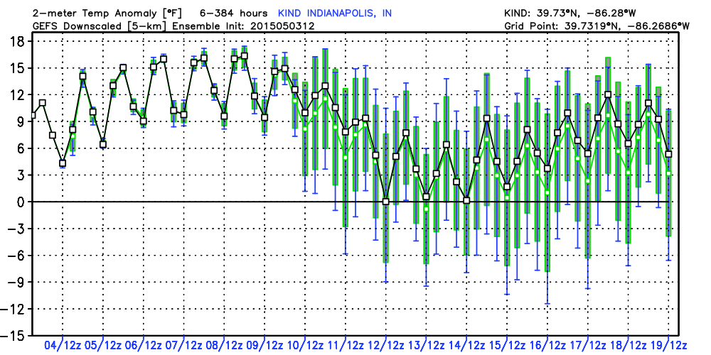
 Regardless of storm chances next week, temperatures will be drastically warmer than what we’ve dealt with over the past couple weeks. Ensembles (below) show the warmer than average pattern engulfing the region and a large portion of the Ohio Valley and Mid West.