During the late summer and early autumn months we were trying to look at the big picture and potential drivers in the overall weather pattern for the upcoming winter and openly admitted the challenges that were ahead. Here we are now into the second half of December and a much colder and snowier-than-average month is a virtual lock at this point. Furthermore, consider this has all taken place without the presence of a favorable NAO or PNA. Sometimes you have to look for other drivers in a pattern- in this case, the EPO, as well as a growing early fall snow pack across the border to our north. Additionally, we made mention of the likelihood of a southeast US ridge periodically making itself known through the winter of ’13-’14. You can read all of our thoughts posted earlier this fall here, or by clicking the Thoughts On Winter ’13-’14 page above.
As we look ahead towards the upcoming wintry challenge, we’re confident of the overall pattern, but the sensible weather that’ll ensue is still up for great debate. “Gut” tells me central Indiana will be looking at a rain to freezing rain scenario, but this is far from set in stone, and sometimes forecasters who go simply off their instinct can get burned. The pattern is one that (once again) will feature a pressing arctic front against resistance from the southeast US ridge. With this type of scenario, I would advise against looking at each and every individual operational model run, but instead invest time studying the ensembles- an average of several multiple model runs as opposed to just one operational model run. I can guarantee a variety of wild solutions ahead in the days to come, based off the operational runs. (Heck, just the past 24 hours have been reason enough to have the dramamine on hand :-)). That said, let’s take a look at the latest GFS and European ensembles, two models that we rely heavily on in the mid range weather pattern.
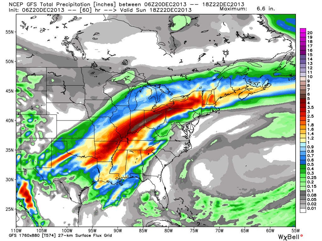
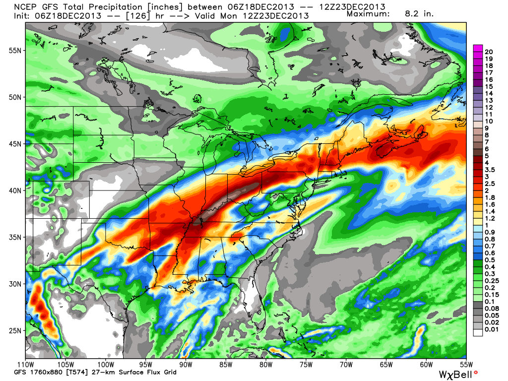
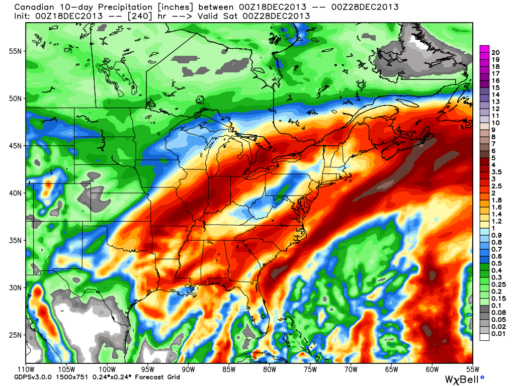
First, the GFS, valid Saturday through Monday.


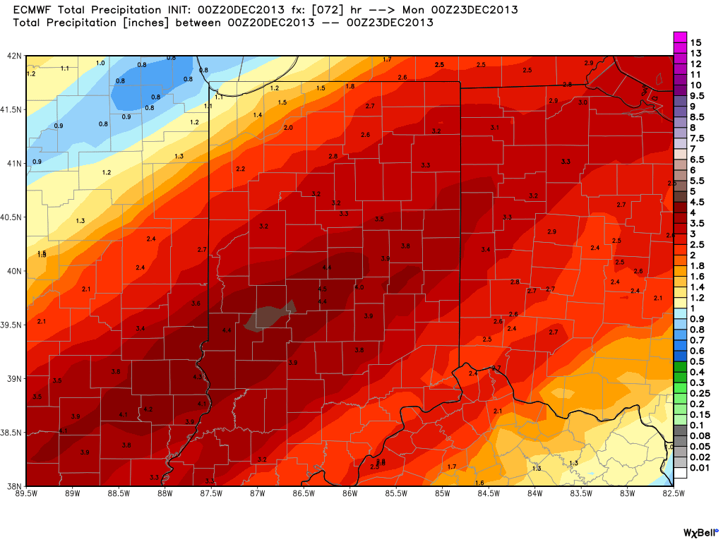
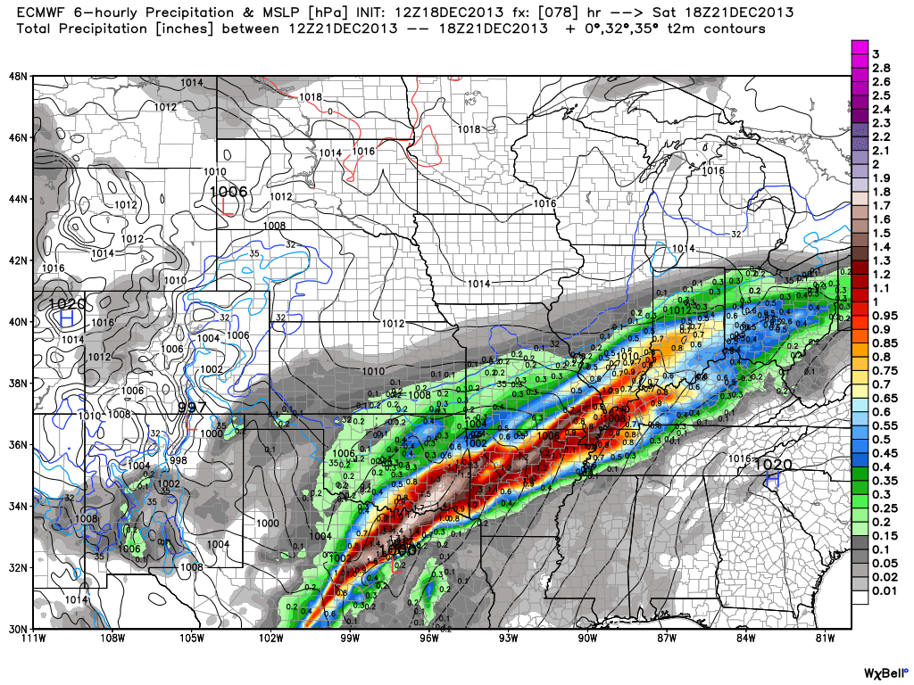
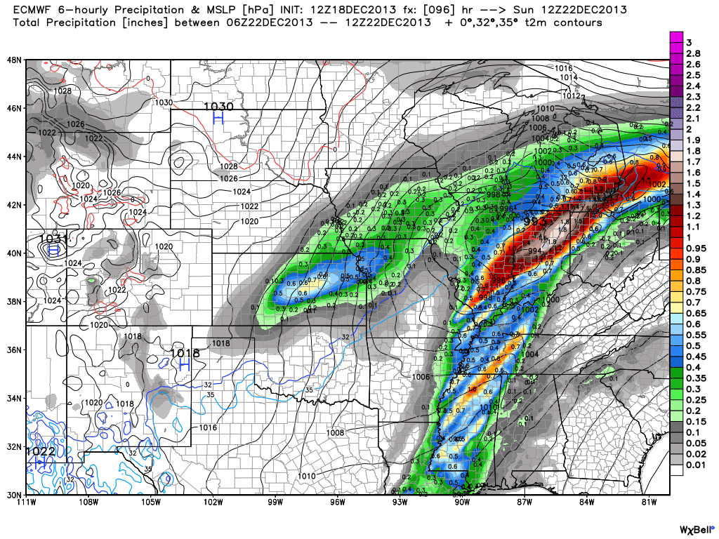
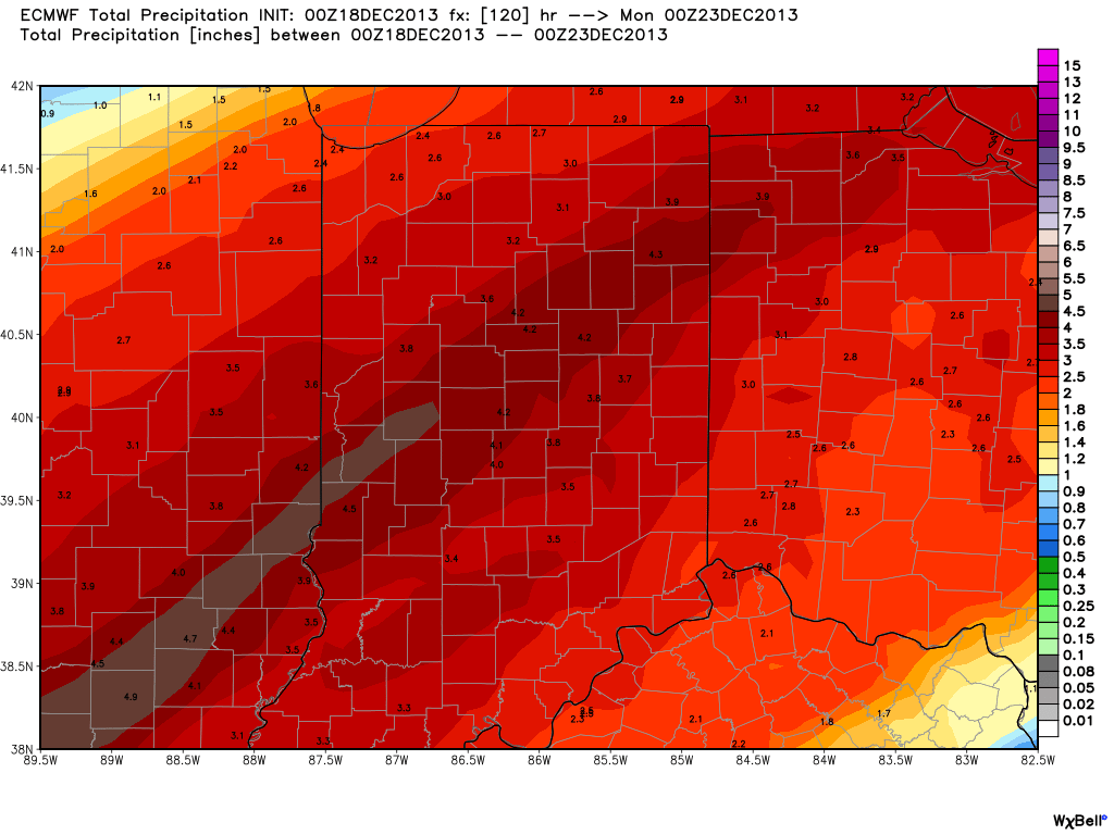
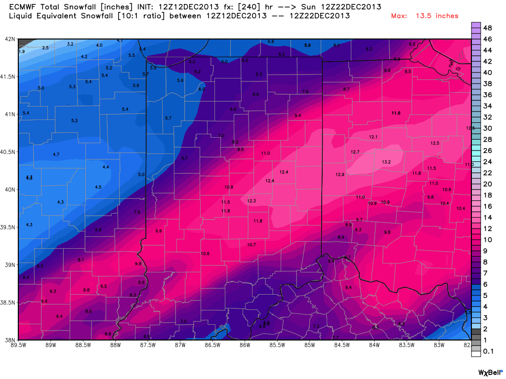
Now, here’s a look at the latest European ensembles (left), again valid Saturday-Monday.


So what do all of these cool maps tell us? Simply put, that “wintry mischief” is brewing for the weekend. That much we know, but the details have to be ironed out. It’s likely heavy snow and a significant ice storm looms for some of the Mid West and Ohio Valley for the upcoming weekend. Is that Indianapolis or Chicago? Perhaps in between? It’s too early to know. Additionally, in the “warmer” sector, heavy rains are likely to combine with an impressive early season snow pack for some to lead to flooding concerns.
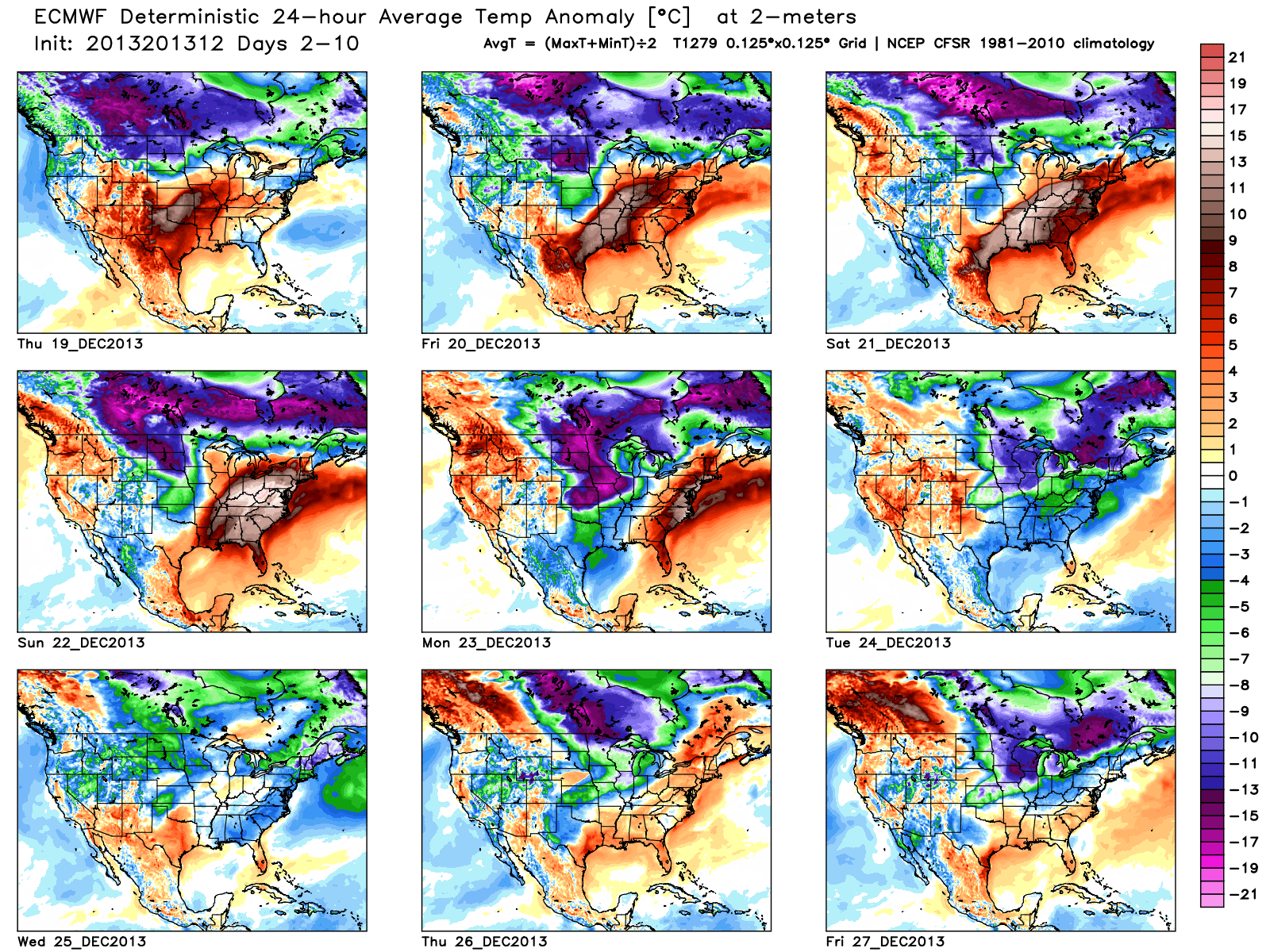
A couple of additional items to note. Many times at this stage in the game (still 5+ days out) with this type of pattern, forecast models really struggle with handling low level cold air. Cold air is very dense and, in this type of set up, can easily drain much further east and south than forecast at this juncture. Additionally, sometimes the modeling can put too much “umph” into the associated surface wave that moves along the arctic front resulting in a further north track than what may actually occur when the event draws closer. Just something to keep an eye on as we draw closer…
Needless to say, it’ll be particularly important to keep a close eye on the developing weekend forecast as we move forward. It’s likely folks in the Ohio Valley region have to deal with significant precipitation amounts in the Saturday-Monday time period, including rain, freezing rain, and snow.


