As I write this, central Indiana is undergoing yet another winter storm that will dump a fresh 3-5″ of snow by midnight Sunday morning. We’re well on our way to reaching the snowiest January ever at IND and with the pattern ahead through the end of the month, we very well may just do it. Before we discuss snow, let’s take a look at the coming shots of arctic air.
While no weather event is identical to another, it’ll be rather easy to compare the coming arctic attack to that which we experienced earlier this month. That said, there are a couple of important things to consider. This next wave of arctic air will blow into town when “average” temperatures are at their lowest of the calendar year. Secondly, data continues to suggest this isn’t just one arctic plunge, but more of a longer duration event when compared to the bitter blast earlier this month. Needless to say, we’ll need to go into our preparation mode for another round of severely bitter air for the upcoming week.
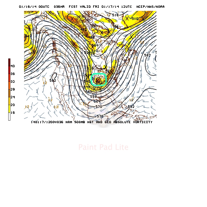
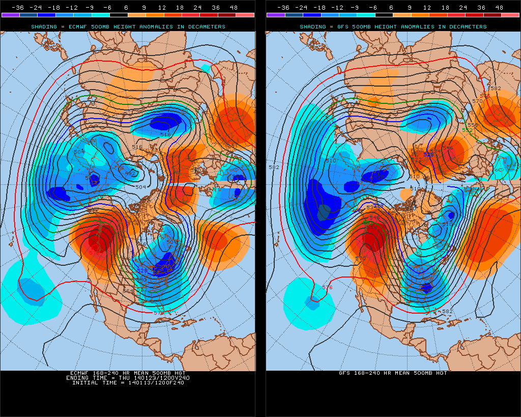
Let’s look at the model data- note the eastern trough re-amplifying through the period, backing up our idea that this is a rather prolonged arctic event ahead. As of now, we focus on late in the work week/ next weekend when air temperatures plunge to their respected lowest values (below zero), but want to stress the entire period will be downright cold (much colder than normal), and the long duration event will put more strain on pipes, etc. than a quick-hitting, in and out, arctic outbreak…
When we talk about a longer duration arctic outbreak we’re talking about the possibility of below zero temperatures Wednesday night, Thursday night, Friday night followed by another arctic push that sends lows below zero next Sunday and Monday nights. Stay tuned.
The winter of 2013-2014 is off to a record pace as far as snow totals go. While we’re not staring at any sort of significant winter storm over the upcoming week, a fast northwest flow can present challenges galore, and any clipper stands the chance to be an “overachiever” as they race southeast over the upcoming week. We fall back on the disclaimer we’ve mentioned in previous posts with clipper systems…the track and strength will be tough for forecast models to iron out until 24-48 hours out. Secondly, with arctic air firmly in place, snow ratios will be more common around the 20:1 level as opposed to the “normal” 10:1 ratio.
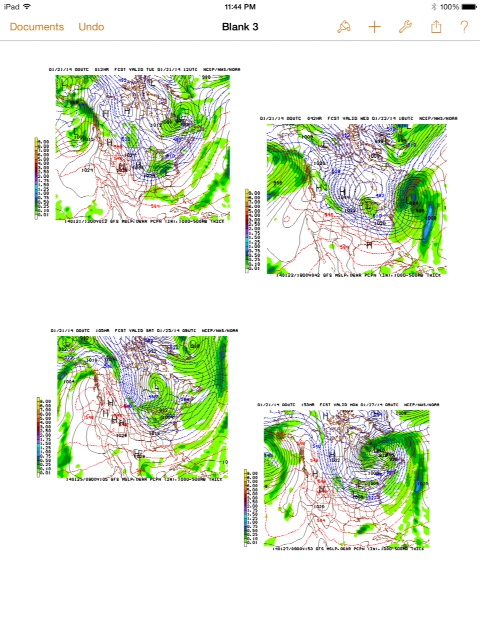
Let’s look at the upcoming snow threats over the next several days…
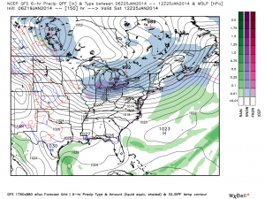
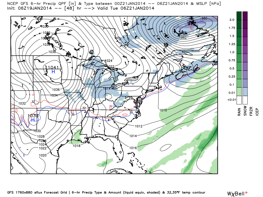
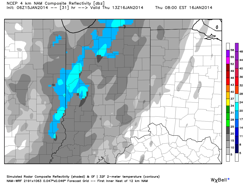
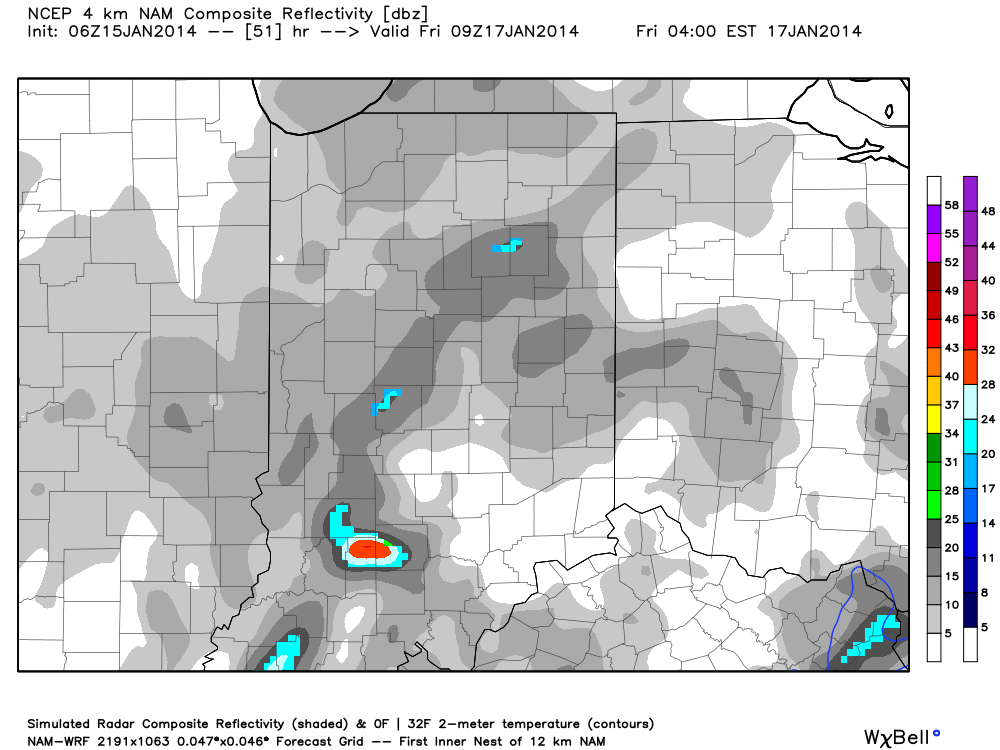
Our first light snow threat blows in tomorrow night into Tuesday.

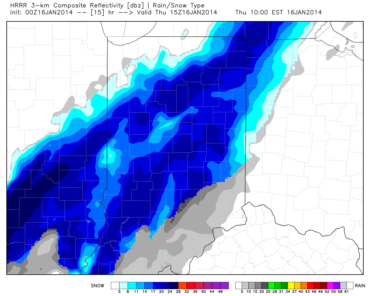
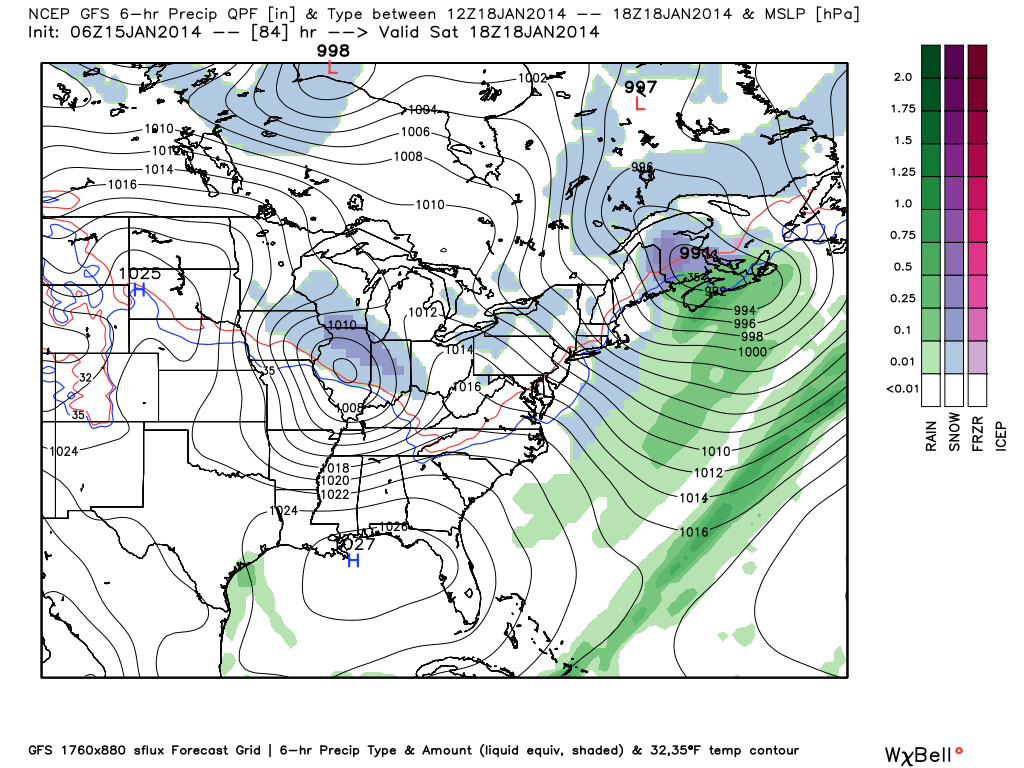
We then target Wednesday night-Thursday.

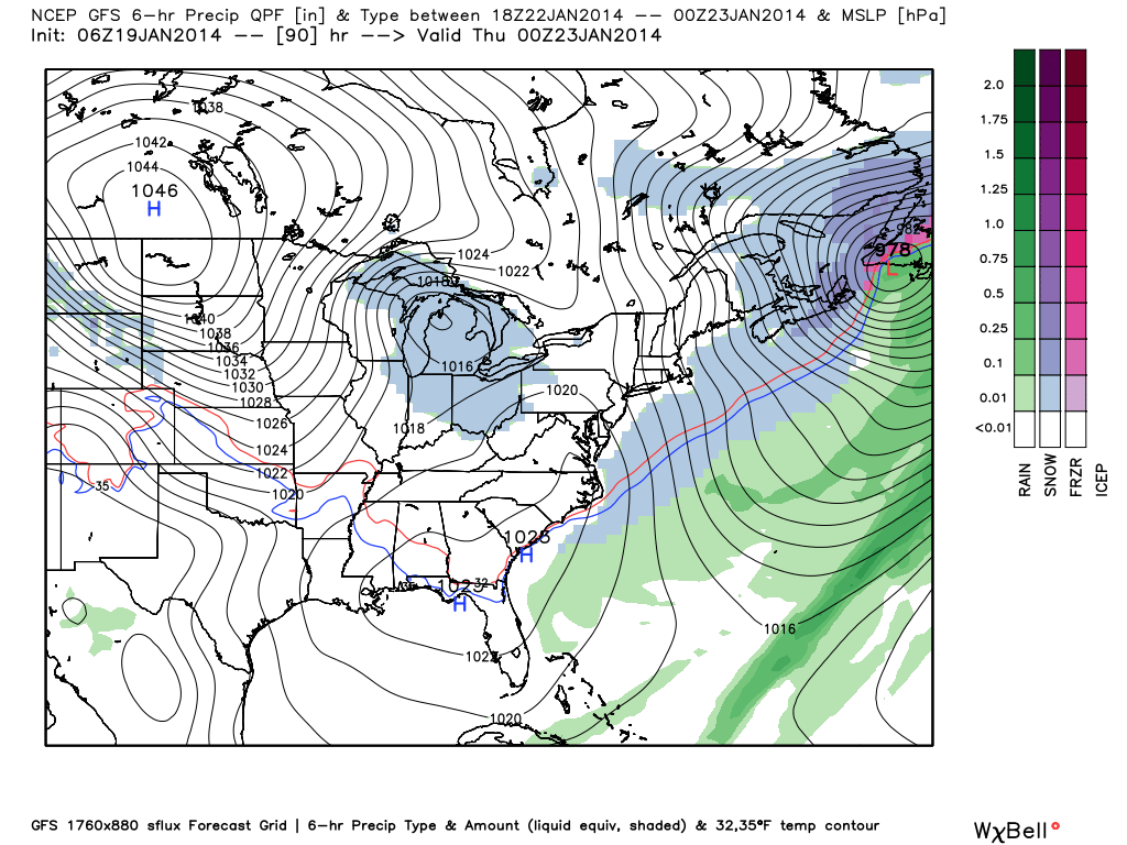
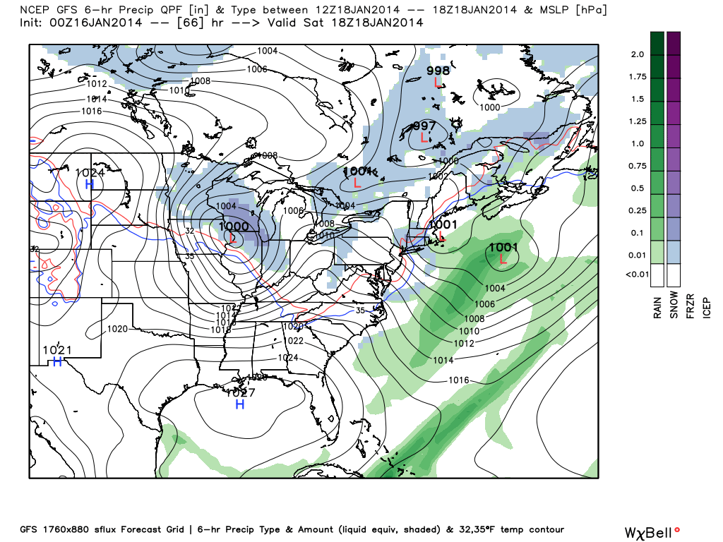
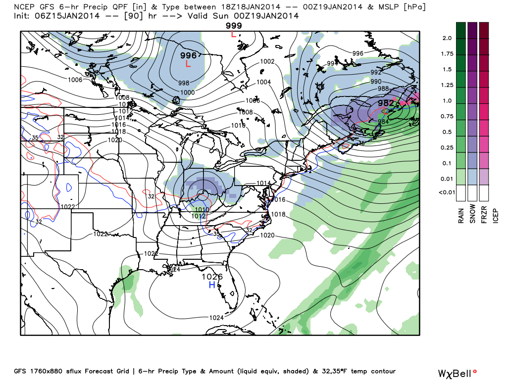
Finally, we’ll keep a close eye on late week/ next weekend for yet another potential snow event.