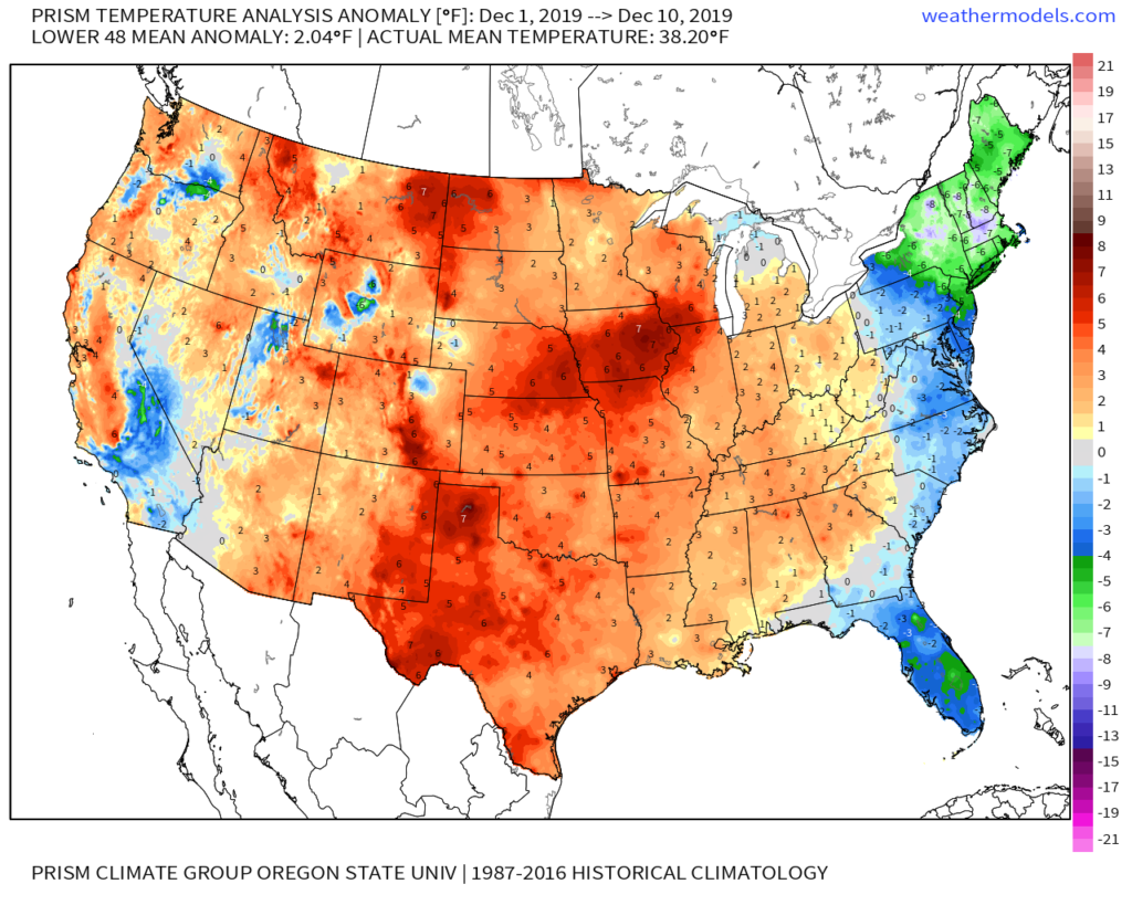
Through the 11th, December is running 1.6° above normal in Indianapolis. This milder than normal theme is rather widespread so far this month through the Lower 48.
As we look ahead, there are continued reasons to believe the pattern will begin to go through more of a transition towards an ultimately more sustained cold pattern as January evolves. We think that transition really started early this week and will feature plenty of “back and forth” over the the next 2-3 weeks before settling into the more sustained cold regime. There will be storms and “rumors of storms” that we’ll have to track through the transitional period, including smack-dab in the heart of the holiday season this year.
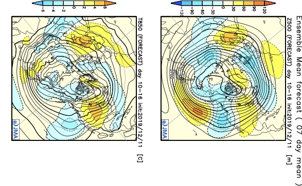
The latest JMA Weeklies (update each Thursday morning) shows this “fight” over the next 1-3 weeks.
JMA Weeklies Day 3-9 shows the cold returning to our portion of the country.
The pattern warms significantly across the Plains in the 10-16 day time frame and some of this milder air will try and eject east into the Ohio Valley.
Without blocking in place, the way the JMA Weeklies handle the pattern is likely, but the Weeks 2-3 time period does have a chance to offer up a headache or two as the models may begin to adjust to an increasingly “blocky” time of things.
There are at least “hints” that some of the teleconnections that would promote more of a blocky pattern are beginning to align. We caution though that this does take time for these feature to mature and begin to ultimately have a greater impact on our pattern.
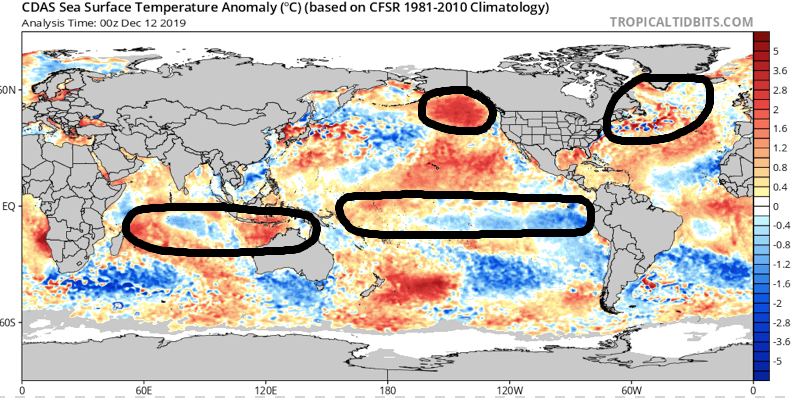
The latest GEFS insists on a developing negative EPO in the medium to longer range. We know this favors eastern cold. Eventually, this should, indeed, take place, especially due to the northeast Pacific SST configuration and help drive more long-lasting cold, locally.
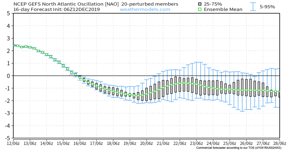
Interestingly, the GEFS also depicts a developing negative NAO mid and late December. This can help result in more sustained cold across our portion of the country into the northeast.
As we revisit the latest SST configuration, there’s continued reason to be very excited about this winter if you’re a fan of colder and snowier than normal conditions. We always knew December would be the tough month before the pattern settles into the mean winter pattern late December into March. Now, time to just sit back and watch things unfold. 🙂
Now, back to the short-term. Despite forecast models very much still in (2) separate worlds, we’ve dug into analogs and looked through countless similar patterns from the past. As model consensus develops (hopefully sooner rather than later), let’s see if they (speaking specifically to the GFS and European) converge on this similar solution for best chances of accumulating snow:
We still have many details to sort through and we caution that this system is far from being etched in stone. You’ll want to keep close tabs on latest developments over the next couple of days. With that said, we’re looking for potential wintry impacts here across central Indiana beginning Sunday night and continuing through Monday.
This evening’s video update will focus solely on the Sunday-Monday system, including the latest model developments from 12z. Have a great Thursday!
You must be logged in to view this content. Click Here to become a member of IndyWX.com for full access. Already a member of IndyWx.com All-Access? Log-in here.
Permanent link to this article: https://indywx.com/2019/12/11/several-opportunities-for-wintry-weather-over-the-next-couple-of-weeks-but-many-details-to-sort-through/
You must be logged in to view this content. Click Here to become a member of IndyWX.com for full access. Already a member of IndyWx.com All-Access? Log-in here.
Our December thoughts remain unchanged, and the increasingly active 2nd half of the month will provide challenges. This is in the face of what should still be a relatively mild pattern- or only marginally cold for the most part. This is likely the beginning of the transition towards more sustained cold, wintry times as 2020 gets underway, but there will be a big fight in the midst of the transition.
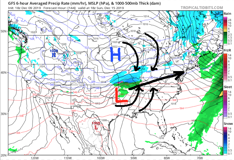
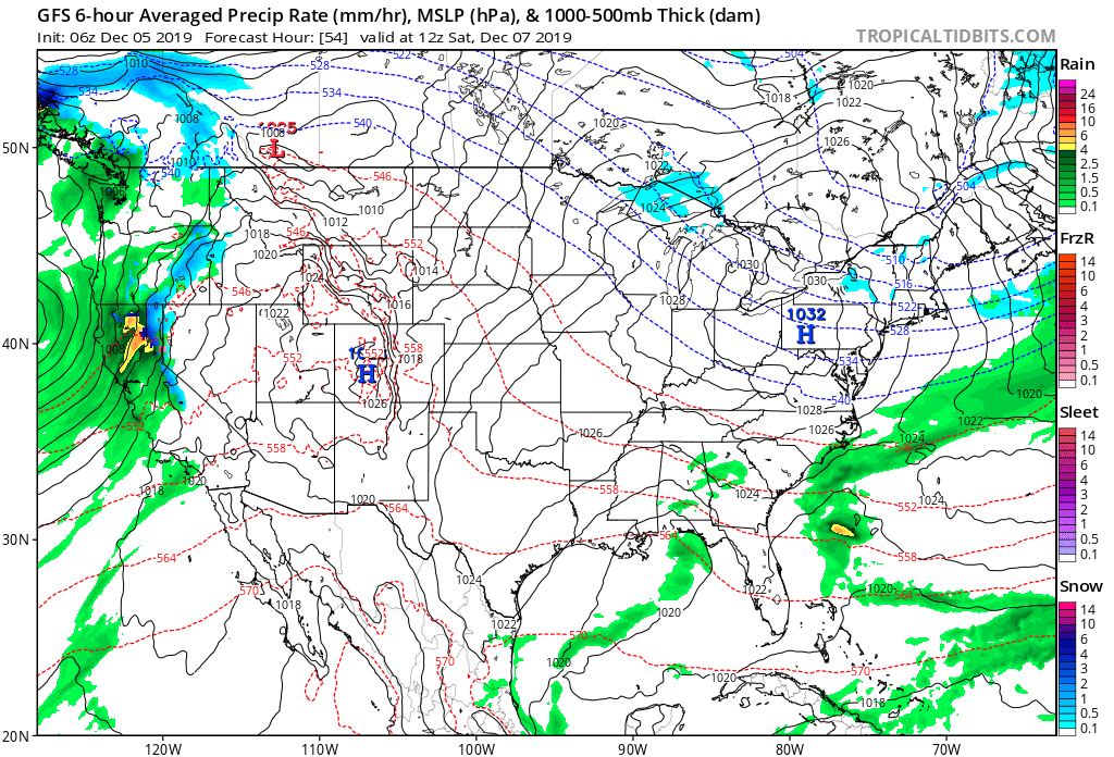
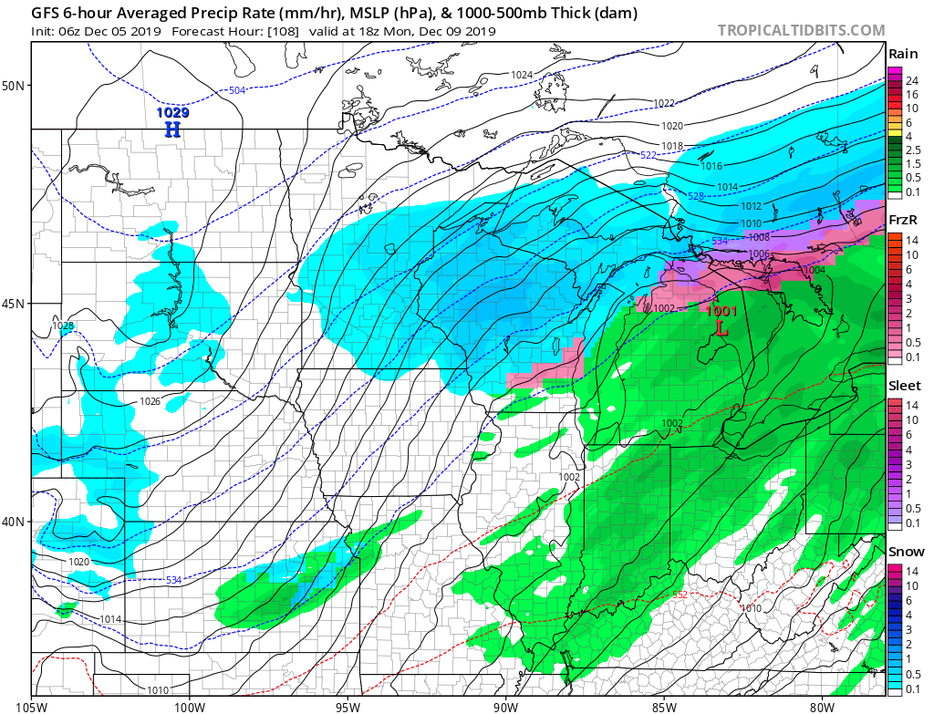
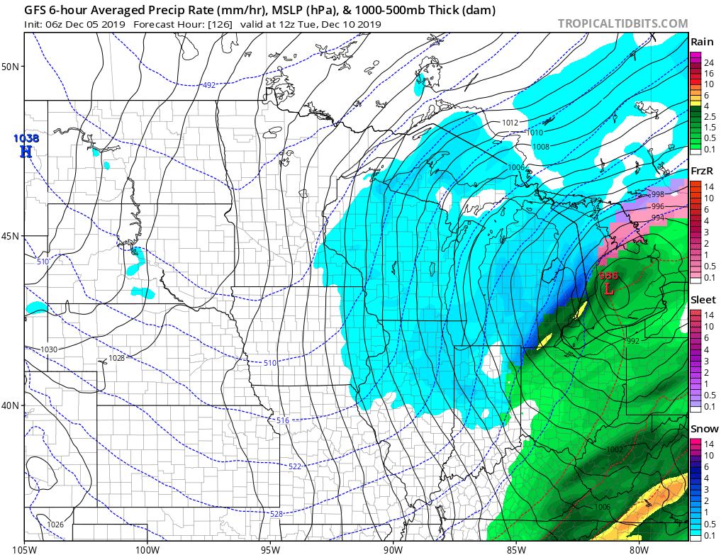
The first challenge awaits late in the weekend and early next week and today’s model data is in more agreement with the handling of a set of features that may produce a stripe of accumulating snow from the central Plains into the Ohio Valley during the aforementioned time period.
The set-up is one that should feature a surface wave develop in the central Plains (likely TX/ OK panhandle) Saturday afternoon. From there the wave of low pressure will scoot across Arkansas and into the lower Ohio Valley. There are some intriguing details present with this system that have been missing from other systems we’ve seen from late fall into the early portions of meteorological winter: 1.) Timing of the system with at least marginally cold air drilling in behind departing EC system. 2.) Position of the surface high funneling cold air into the system (as opposed to departing as the system arrives). 3.) Overall modeled favorable track.
Now, there are obviously some questions remaining that will have to be answered in the days ahead (always the case when a feature is 6-7 days away), but it’s most certainly something to keep close tabs on as we move forward. As things stand now, I’d monitor the Sunday-Monday time frame for possible wintry impacts across central Indiana.
This has our attention and subsequent updates will follow as we move forward.
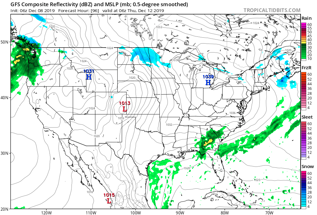
The image above isn’t to be taken verbatim, but instead used as an example of how the multiple features at play could come together to potentially lead to an accumulating snow event from the central Plains into the Ohio Valley early next week.
You must be logged in to view this content. Click Here to become a member of IndyWX.com for full access. Already a member of IndyWx.com All-Access? Log-in here.
Our weekend will wrap up on a pleasant note. Though clouds will be on the increase, temperatures will rise to much warmer than normal levels by early-December standards. Highs today will top out in the lower to middle 50s with increasing cloudiness.
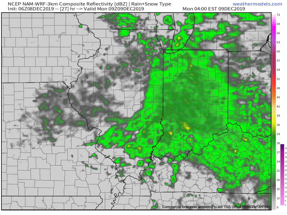
Those clouds will eventually give way to rain during the overnight hours. A few sprinkles are possible this evening, but it’s not until midnight and into the predawn hours that the more concentrated rain will arrive.
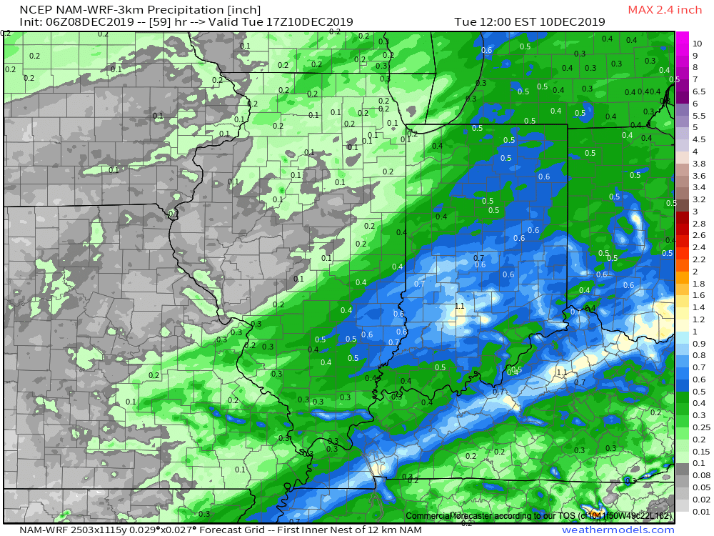
Most of central Indiana can expect rainfall totals between 0.50″ and 1.00″ Monday. The steady rain Monday morning will taper to showers during the afternoon hours.
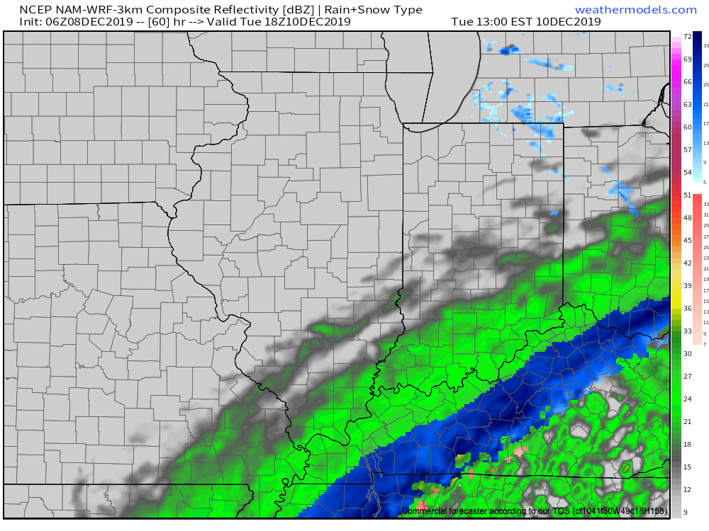
Colder air will pour into the state Monday night and gusty northwest winds. This cold air mass will eventually “catch up” with the moisture to our southeast and lead to a flip to snow for places from central and eastern KY into the Appalachians Tuesday. Meanwhile, lake effect snow showers will develop across northeast Indiana. For the most part, despite some light snow showers Tuesday morning, central Indiana shouldn’t expect anything “exciting” in the winter weather department.
High pressure will settle overhead through the midweek stretch with sunshine returning along with seasonably cold conditions.
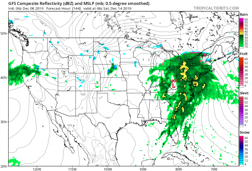
Thereafter, a developing storm system in the Gulf of Mexico will lead to an active close to the week. Low pressure will form in the central Gulf Friday afternoon before tracking up along the Appalachian chain into the weekend. With a lack of cold air and retreating high (orientation of the cold air supply/ high pressure system is critical this time of year), this should be another mostly wet and not white weather maker.
Cold air will eventually wrap into the system from the west late in the weekend and could lead to precipitation ending as wet snow, but this idea is far from being “etched in stone.”
Video update will come a bit later with fresh 12z thoughts, along with a look-ahead to Christmas. Make it a great Sunday, friends!
You must be logged in to view this content. Click Here to become a member of IndyWX.com for full access. Already a member of IndyWx.com All-Access? Log-in here.
You must be logged in to view this content. Click Here to become a member of IndyWX.com for full access. Already a member of IndyWx.com All-Access? Log-in here.
Another day of sunshine is on deck with temperatures approaching the 50° mark for many central Indiana communities. Not bad at all by early December standards, huh?
Clouds will increase tonight and remain with us through the end of the work week. These clouds are associated with a system that will scoot by well to our south. Some light rain will likely impact areas south of Indianapolis Friday morning into the early afternoon, but central Indiana should remain precipitation-free.
High pressure will dominate our weekend weather, continuing to lead to quiet conditions along with a return of sunshine.
The next round of more widespread precipitation will push into the state Sunday night into Monday. Even this isn’t anticipated to be significant with most central Indiana reporting sites receiving rainfall amounts of half an inch or less by Monday evening.
As the surface wave pulls up to the northeast, MUCH colder air will whip into the region Tuesday. Light snow will develop as the moisture departs, but we’re still not expecting this to be a big deal in the snow department (dusting to less than 1″ type event as of now).
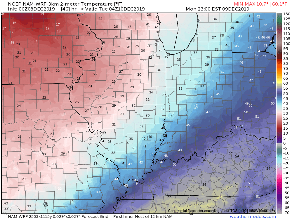
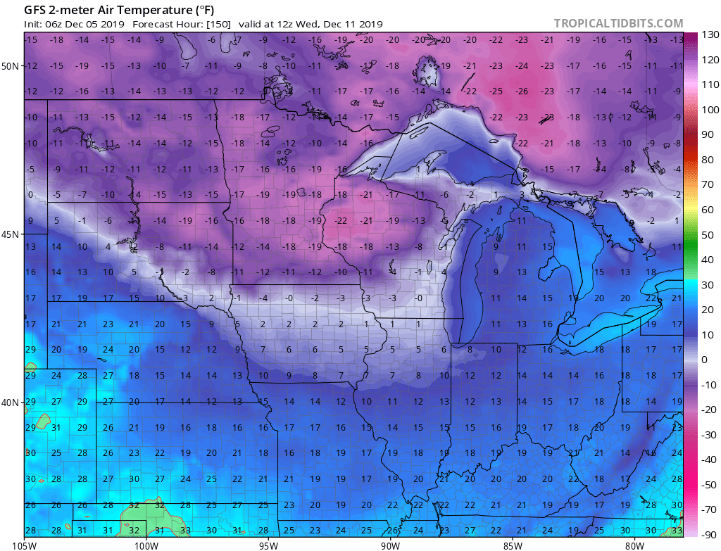
However, the cold is another story. Wednesday morning will feature lows in the lower to middle teens with single digit wind chill values. In the it could “always be worse” department, check out those temperatures our friends across the upper Mid West and northern Plains will have to deal with…
A fascinating case study lies in front of us as we go through the next couple of weeks. This evening’s video update dives deeper.
You must be logged in to view this content. Click Here to become a member of IndyWX.com for full access. Already a member of IndyWx.com All-Access? Log-in here.