 Highlights:
- Crossing our fingers for a few looks at the sun
- Windy, rainy conditions return
- Spring-like weekend ahead
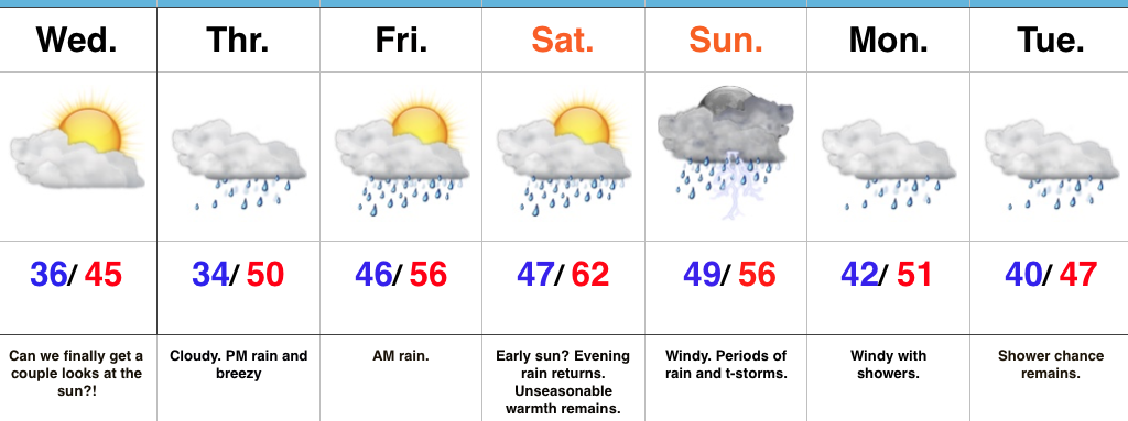
Hang On To The Rain Gear…We’re in the midst of a downright gloomy stretch of weather and, unfortunately, the overall trend remains locked in to a dreary regime. That said, there will be an opportunity for at least a few looks at the sun Wednesday as we’ll be in between storm systems. Our fingers are crossed!
Any sun will quickly fade and give way to increasing clouds Thursday and blustery, rainy conditions by the afternoon. Rain will likely grow heavy at times Thursday night into early Friday morning before another stretch of briefly drier conditions build in Friday PM through early Saturday.
Our active pattern remains this weekend, as a wound-up storm system promises a wet, windy, and stormy close to the weekend. Similar to our late week storm, additional heavy rain seems likely, as a gulf connection will be in place. Though heavy rain will take the headlines, the “spring fling” is also noteworthy. Highs this time of year normally are in the middle 30s. For some through central IN, highs will approach a whopping 30 degrees above normal.
Upper level energy remains early next week with pesky showers continuing, along with breezy conditions.
Upcoming 7-Day Precipitation Forecast:
- Snowfall: 0.00″
- Rainfall: 1.50″-2.00″ (locally heavier totals)
