Updated 03.22.24 @ 7:56a
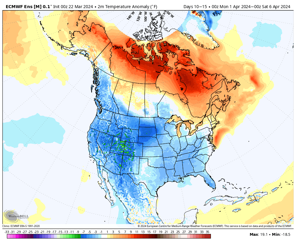
The ‘mean’ trough position will take up shop across the western portion of the country over the upcoming week before shifting into the East in the 10-15 day period. We reiterate while the balance of the upcoming 2 weeks will run cooler than normal, we don’t see anything significantly colder than normal on the horizon and also plenty of transitional warmth ahead of approaching storms.
Note how the trough shifts east late in the period.


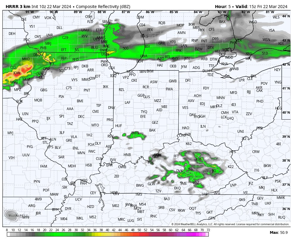
Back to the immediate term, we’ll only see a few light showers later this afternoon (trace to 0.10”). Greatest coverage should arrive after lunch, continuing into mid-afternoon. Again, “light” is the key word.
Colder air arrives for the weekend, itself. We can expect mid to upper 20s both Saturday and Sunday morning.
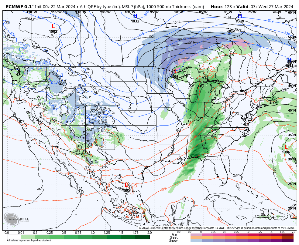
A new, stronger, storm will blow into town with more in the way of widespread heavier rain and thunder Monday night into the day Tuesday.
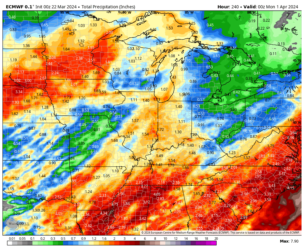
Another system will follow late week and next weekend.

1” to 2” is a good bet across the greater region by next Sunday. (The bulk of this falls with our Monday night and Tuesday system).
Leave a Reply