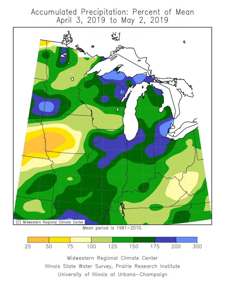
Rain has been dominating the weather pattern lately. A widespread portion of the Ohio Valley is running 125% to 175% of mean over the past (30) days. More specific to central Indiana, the bulk of this fell during the back half of April.

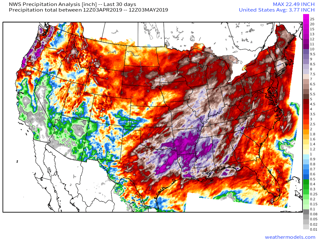
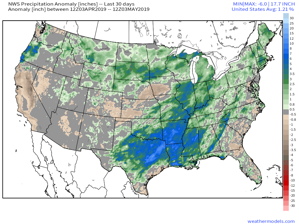
When we broaden out the scale, we note this wet pattern isn’t just an Ohio Valley problem, but focusing the heaviest rain on the Ark-La-Tex region.


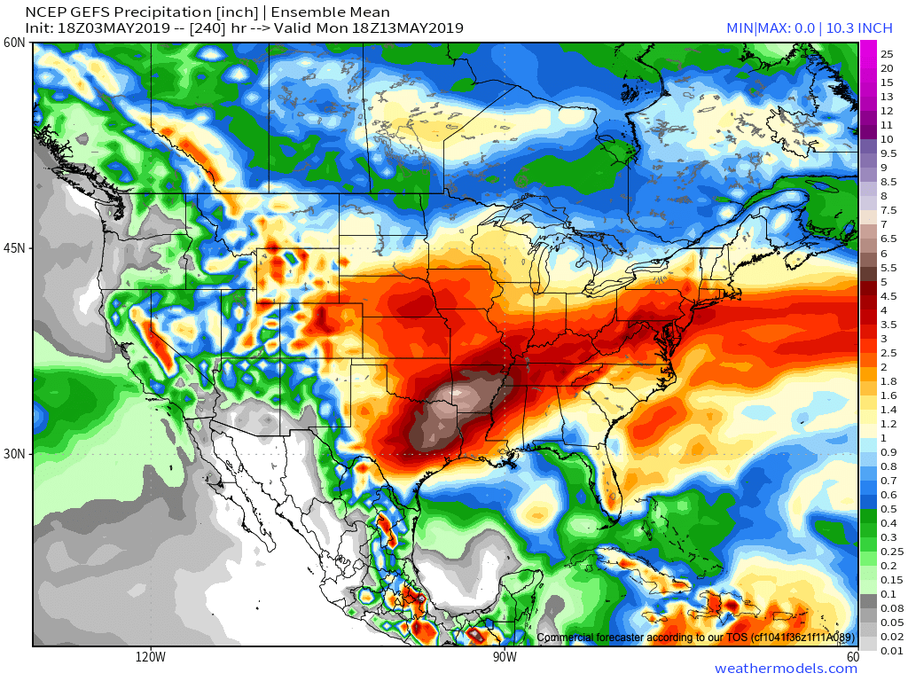
Unfortunately, when we look ahead to the upcoming couple of weeks, the pattern will continue to favor heavier than normal rainfall- not only locally, but especially centered in the area just mentioned- eastern TX, AR, and LA.

The reason behind this active and wet pattern? A persistent southeast ridge and mean trough digging into the southwest. This, combined with unseasonably cold air across the northern tier, helps set up a battle “in between” (from the s-central Plains into the Ohio Valley). Factor in the broad southwest flow aloft, and multiple disturbances will track in a southwest to northeast fashion next week, enhancing rain intensity and coverage at times. In parts of the Ark-La-Tex region, as much as 8″ to 10″ of rain may fall over the upcoming 10-days.
The excessive rainfall can also impact the upcoming season and we’ll dig in deeper here next week with our 2019 Summer Outlook.
