Updated 11.06.23 @ 7:26a
You must be logged in to view this content. Click Here to become a member of IndyWX.com for full access. Already a member of IndyWx.com All-Access? Log-in here.

Nov 06
Updated 11.06.23 @ 7:26a
You must be logged in to view this content. Click Here to become a member of IndyWX.com for full access. Already a member of IndyWx.com All-Access? Log-in here.
Permanent link to this article: https://indywx.com/2023/11/06/video-warm-midweek-trends-colder-for-the-weekend/
Nov 05
Updated 11.05.23 @ 1p
You sure would be hard pressed to find more pleasant weather conditions by early November standards. Plentiful sunshine can be expected today as high temperatures head into the 60s. While we’ll add clouds (and big wind gusts) Monday, highs will zoom into the upper 60s to lower 70s. Southwest gusts will approach 40 MPH at times to open the work week. We’ll keep the warm theme going through midweek.

A cold front will move through the region Wednesday evening. Forecast models continue to differ on rainfall amounts with this frontal passage, but excessive rain isn’t expected.
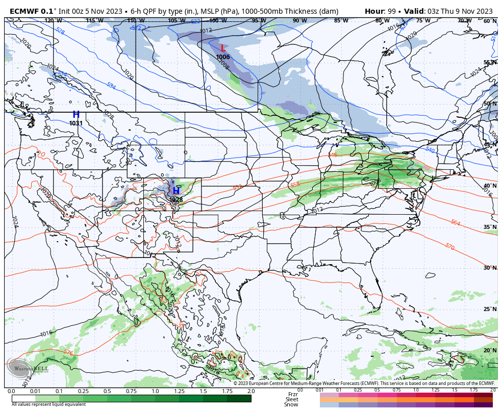
In general, this looks like a 0.10” to 0.25” type event but note the wetter European and drier GFS solutions below. Expect more agreement in the coming day or 2. Regardless, this isn’t a “big deal” type of event by any means.


Expect a more seasonable brand of air to filter in as we close the work week and head into and through the upcoming weekend. Dry conditions will also return. Highs will settle back into the lower 50s with overnight lows around freezing.
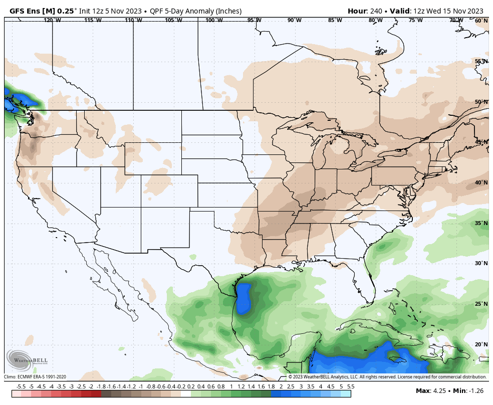
Speaking of dry, the theme over the next couple weeks as a whole continues to look drier and quieter than normal.
Permanent link to this article: https://indywx.com/2023/11/05/sunny-start-to-the-new-week-takes-a-gloomy-turn/
Nov 04
Updated 11.04.23 @ 8:35a
I. November has opened on a chilly note. Through the 1st few days of the month, Indianapolis is running a whopping 6° below average. Warming will take place in the days ahead and we’re not finished with the 70s just yet. Wednesday stands the best shot at 70° warmth but it’s an admittedly tricky forecast with a wavy front hanging nearby.

II. A cold front and associated area of low pressure will offer up the best chance of widespread rain midweek, but we’re still not talking about any sort of heavy rain amounts. The bigger deal will be the cooler air moving in behind this system for late week and next weekend.
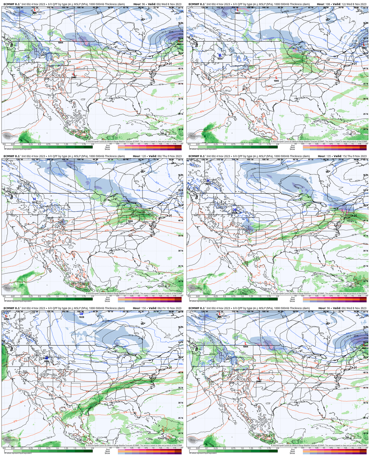
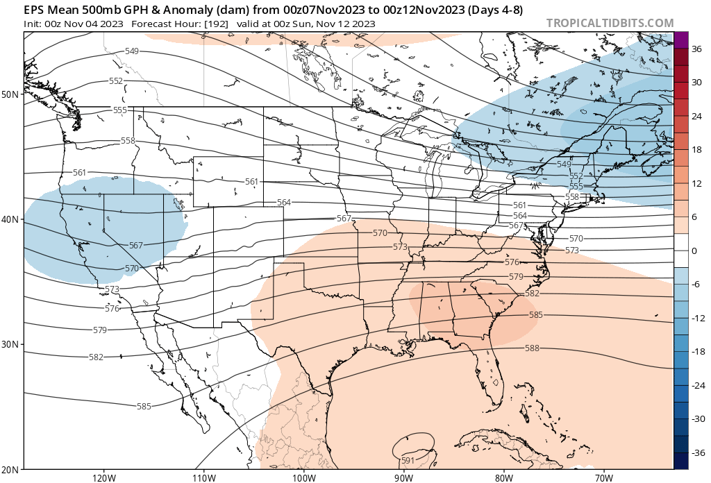
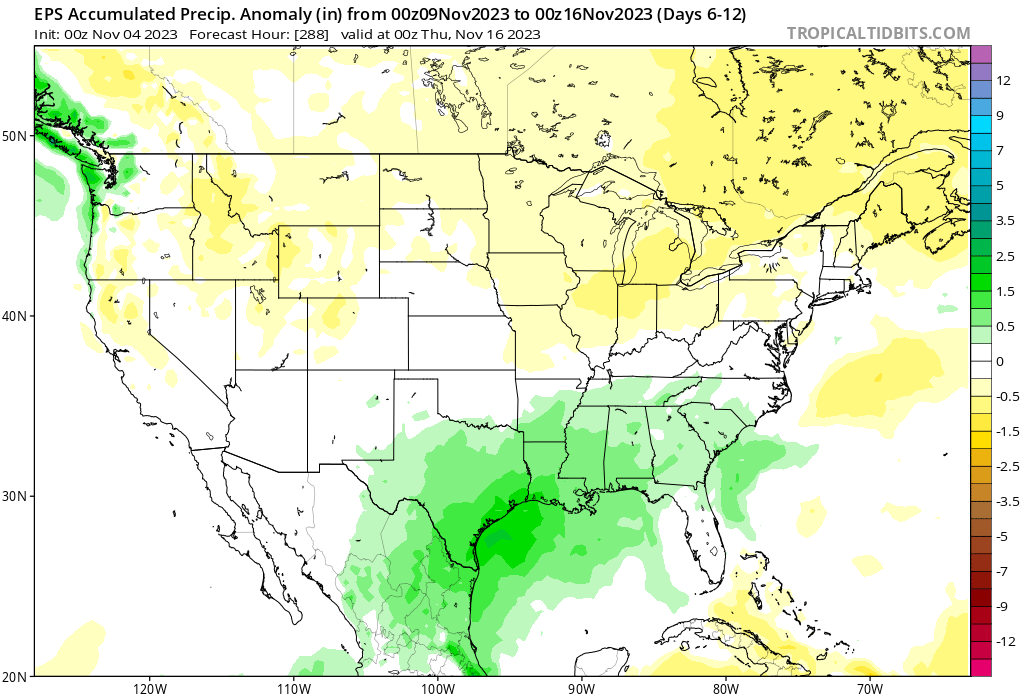
III. The type of air mass behind the boundary, though cooler, won’t have the same arctic nature to it that our last cold spell included. We’re talking a few days of highs in the 45° to 50° range and overnight lows in the lower 30s. An upper level ridge should return for mid month along with an unseasonably mild pattern. After midweek, the pattern as a whole is also a dry one into mid month.
Permanent link to this article: https://indywx.com/2023/11/04/saturday-morning-rambles-13/
Nov 03
Updated 11.03.23 @ 6:34a
You must be logged in to view this content. Click Here to become a member of IndyWX.com for full access. Already a member of IndyWx.com All-Access? Log-in here.
Permanent link to this article: https://indywx.com/2023/11/03/video-the-roller-coaster-ride-of-autumn-checking-in-on-the-new-european-weeklies/
Nov 02
Updated 11.02.23 @ 7:40a
You must be logged in to view this content. Click Here to become a member of IndyWX.com for full access. Already a member of IndyWx.com All-Access? Log-in here.
Permanent link to this article: https://indywx.com/2023/11/02/lr-update-looking-ahead-towards-thanksgiving/
Nov 01
Updated 11.01.23 @ 7:40a
You must be logged in to view this content. Click Here to become a member of IndyWX.com for full access. Already a member of IndyWx.com All-Access? Log-in here.
Permanent link to this article: https://indywx.com/2023/11/01/video-welcome-to-november/