
Updated 07.25.23 @ 5:13a
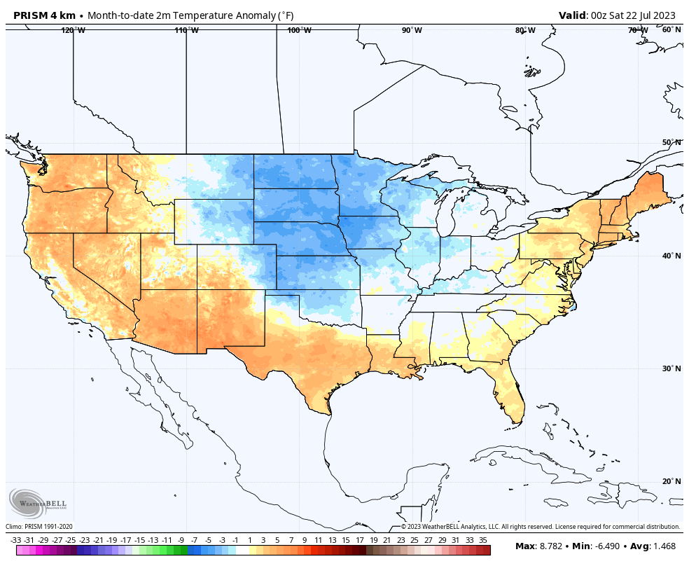
We’re running slightly cooler than normal, month-to-date, across central Indiana. (0.5° below normal at IND). Above normal temperatures have ruled the day along the coasts with the cooler anomalies in the Plains and into the western portions of the Ohio Valley.
A big flip in this regime will take place as we push through the upcoming work week. Note the expanding heat in areas where it’s been cool so far this month.

As the hot dome nudges east, central Indiana will make up for lost ground in the 90° department. In fact, the hottest and most humid air of the season will take up shop mid and late week. Low-mid 90s with overnight lows not falling below the oppressive 70° mark can be expected.
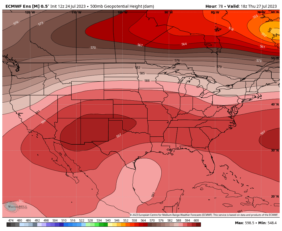
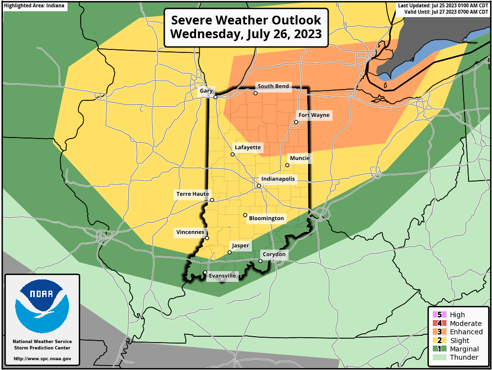
That said, we remain stubborn in believing this will be a transitional heat wave. The EPO (East Pacific Oscillation) and PNA (Pacific North America pattern) are both heading in directions that should force the ridge (hot dome) west in the Week 2 time period. This will open the door for cooler and more active weather to return, locally. We’ll likely have to deal with multiple strong-severe storm complexes tracking in northwest to southeast fashion into early August. Speaking of severe weather, all of the region is under fire for a couple rounds of storms Wednesday. Morning convection will likely remain below severe levels but a potent complex of storms is expected to redevelop Wednesday afternoon and evening. Given the ingredients and severe weather parameters in play Wednesday, all modes of severe weather will be possible, including the potential of a couple strong tornadoes. Needless to say, it’ll be a day to remain weather-aware.

In closing, when looking at the long range pattern, the wild card has to do with the MJO (Madden Julian Oscillation). Should this become more amplified, then the shift in the regime will be more dramatic. As it is, we’re far from ready to make a call on this becoming more amplified (a bigger driver in the pattern transition). The thought this could be heading into Phase 6 is less of a likely situation now compared to a few days ago, but we’ll continue to closely monitor the progression all the same. The combination of the EPO/ PNA trends will serve as the baseline in building our longer range forecast for now.