Updated 05.12.22 @ 11:08a In the air traveling back to home base this morning. We’ll get settled in and churn out a fresh client video update later this evening, including…
You must be logged in to view this content. Click Here to become a member of IndyWX.com for full access. Already a member of IndyWx.com All-Access? Log-in here.
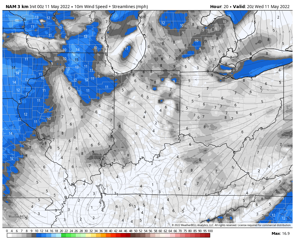
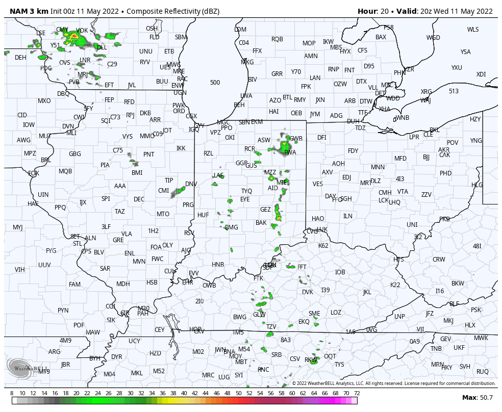
I. Even in “boring” patterns as a whole, there’s excitement to be found. That isn’t more evident than what we’ll notice today as a “back door” front will blow into the state. Before the front arrives from the east (hence, back door), dew points in the low to middle 70s (jungle-like feel) will combine with temperatures in the mid-80s to push heat indices into the 90° range. By mid-afternoon, we’ll note a wind shift taking hold from the east and a much more comfortable airmass oozing into the state from Ohio. This transition in air masses could spark an afternoon shower or thunderstorm- especially around Indy and points east.
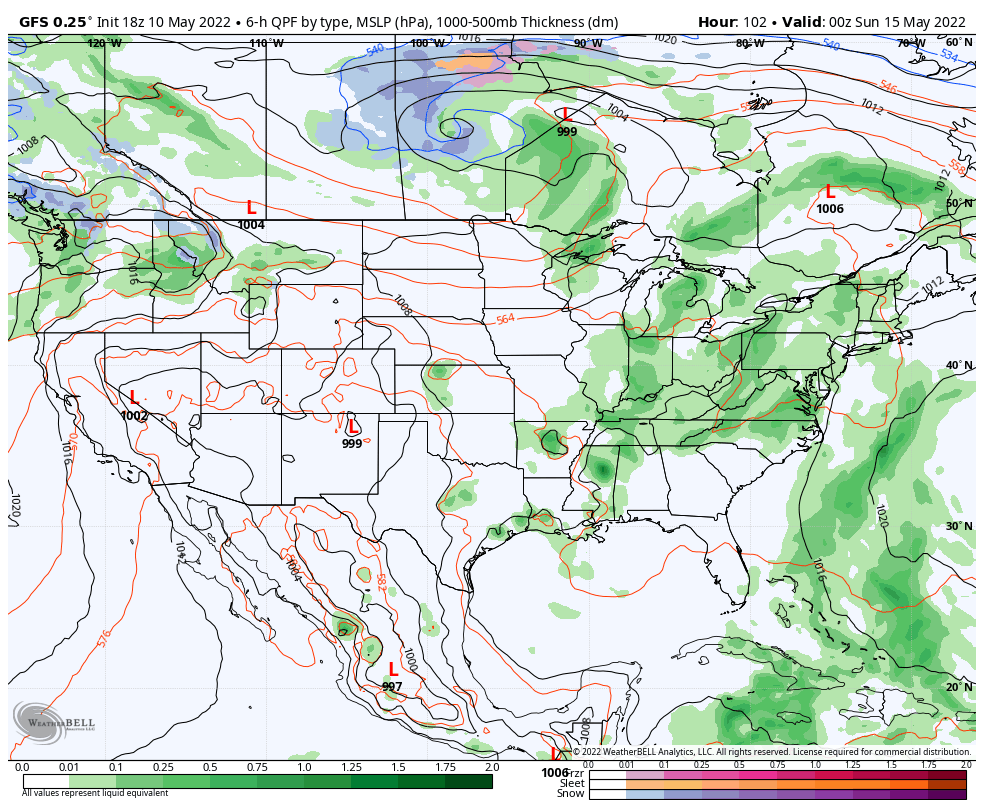
II. After Wednesday’s “excitement,” generally quiet weather will be with us to close out the work week. That will begin to change as we rumble into the weekend. A series of fronts will sweep through the area Saturday (image 1 below) and again Monday (image 2 below). Each of these will deliver a smattering of showers and storms (splash and dash variety), focusing in on Saturday afternoon and Sunday evening into Monday morning for greatest overall coverage. On average, area rain gauges likely accumulate between 0.40” and 0.60” between the (2) systems.
III. The MJO will, undoubtedly, have big impacts on our late May pattern. After remaining in the null phase for the better part of the past few weeks, things are getting quite amplified. What’s most interesting though is the difference between the way the GEFS and European handle things post 5/18. Do we circle back into Phase 7 (would extend the threat of cooler than normal temperatures, locally) or roll into Phase 8 (a warmer pattern for the Great Lakes and into the Ohio Valley)? Stay tuned. We continue to believe the more transitional regime is most likely as we push into Memorial Day…
There’s a reason we labeled the midweek pattern as a “taste” of summer. Thankfully, (speaking for most, I believe) we’re not ready to “lock and load” the summer like heat and humidity. In fact, we’ll get some relief from humidity by the latter stages of the work week. By early next week, highs will drop back into the lower 70s and overnight lows will fall into the 40s.
Pattern next week at this time will be feeling mighty different around these parts as a trough carves itself out across the Great Lakes/ Northeast.
Despite the roller coaster ride the next couple of weeks will likely deliver from a temperature perspective (remember, we have the MJO to deal with again now, too), the pattern, as a whole, looks drier than normal over the upcoming 10-14 days.
While the pattern is likely one to continue featuring wild swings in temperatures to wrap up the month, most of the frontal systems seem like they won’t deliver excessive rainfall amounts from this distance. It should be noted the European data above has plenty of support from its American and Canadian counterparts.
Permanent link to this article: https://indywx.com/transitional-is-the-theme-for-our-temperature-pattern-upcoming-10-14-days-precipitation-pattern-not-so-much/
You must be logged in to view this content. Click Here to become a member of IndyWX.com for full access. Already a member of IndyWx.com All-Access? Log-in here.
Permanent link to this article: https://indywx.com/video-pleasant-open-to-the-work-week-turns-more-humid-more-organized-rain-storm-chances-return-by-the-weekend/
You must be logged in to view this content. Click Here to become a member of IndyWX.com for full access. Already a member of IndyWx.com All-Access? Log-in here.