Updated 12.26.21 @ 7:38a
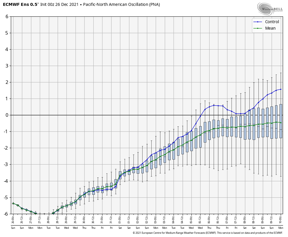
Over the past couple of weeks, several of the teleconnections (EPO, AO, and NAO) have been in favorable phases for cold air to take up residence in our neck of the woods. However the combination of Phase 6 of the MJO (image 1 below) and a deeply negative PNA (image 2 below) have fought off any sustained or significant cold.


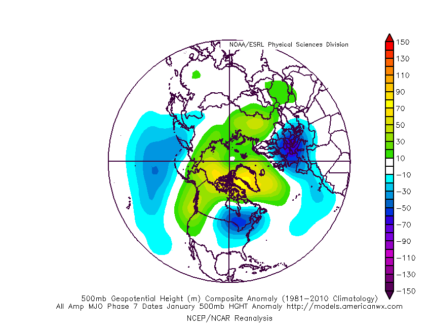
As we look ahead, there are changes in both of these critical pattern drivers. First, the MJO looks to continue progressing deeper into Phase 7. This is significant as today, though while officially in 7, we’re really still feeling the effects of 6. There’s a lean from guidance that Phase 8 is also within reach as we get towards mid-January, but we won’t get greedy. 🙂 If we can at least get deeper into 7, that will greatly lessen the influence of the warmth that continues to linger with Phase 6.

Note how the trough likes to settle into the eastern portion of the country during these phases.


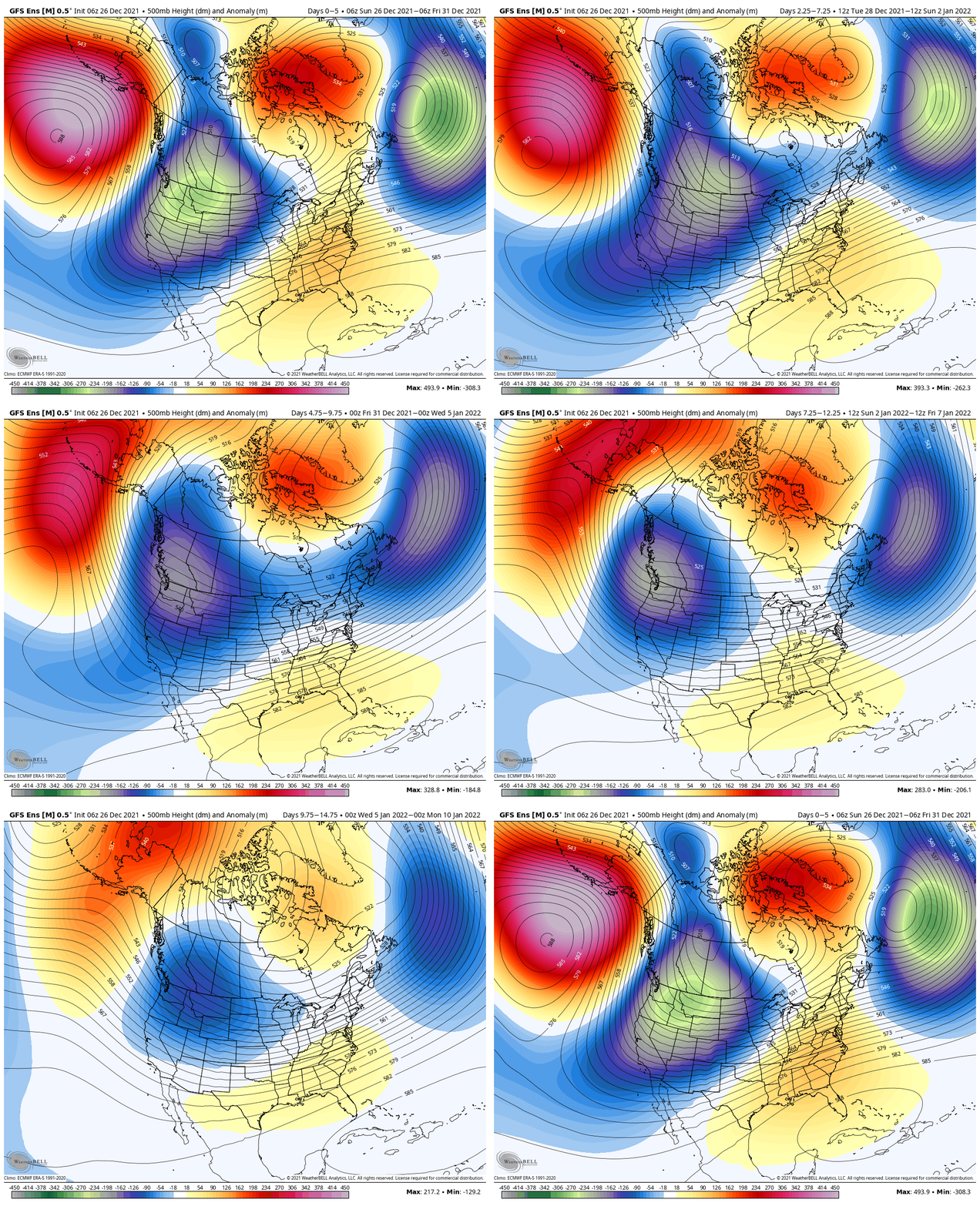
That then brings us to the PNA. Guidance is trending things closer to neutral towards Day 10. This is significant as it would allow the southeastern ridge to at least get beaten down (not totally squashed as long as we remain negative), but certainly enough to allow the cold currently bottled up out west to bleed east.

This can be illustrated best by looking at the 500mb pattern evolution over the next couple weeks per the latest GFS ensemble below.

To summarize, while we still have warm days ahead of us, there does at least appear to be a couple trends heading in the right direction for all of those longing for colder and potentially more wintry times as we get past the new year.
Hang in there you snow lovers. It’s far too early to jump off the ship…
