Updated 12.31.21 @ 8a
You must be logged in to view this content. Click Here to become a member of IndyWX.com for full access. Already a member of IndyWx.com All-Access? Log-in here.

Dec 31
Updated 12.31.21 @ 8a
You must be logged in to view this content. Click Here to become a member of IndyWX.com for full access. Already a member of IndyWx.com All-Access? Log-in here.
Permanent link to this article: https://indywx.com/2021/12/31/video-changeable-conditions-as-we-open-2022/
Dec 30
Updated 12.30.21 @ 8a
You must be logged in to view this content. Click Here to become a member of IndyWX.com for full access. Already a member of IndyWx.com All-Access? Log-in here.
Permanent link to this article: https://indywx.com/2021/12/30/video-more-significant-storm-as-we-usher-in-the-new-year-long-range-update/
Dec 29
Updated 12.29.21 @ 8:17a
You must be logged in to view this content. Click Here to become a member of IndyWX.com for full access. Already a member of IndyWx.com All-Access? Log-in here.
Permanent link to this article: https://indywx.com/2021/12/29/video-tracking-multiple-systems-in-the-week-ahead/
Dec 28
Updated 12.28.21 @ 7:52p
We’ve laid out our ideas and there’s certainly a lot on the table, but we’re now at the point to see whether or not the ground work that’s been laid will come to fruition. The active pattern has arrived and it’s this 10-day period of transition that we continue to believe will ultimately usher in a more persistent and prolonged cold stretch in the January 10th through 31st period.
The MJO is the kicker here and looks like we’re heading into Phase 8 (a notorious phase for eastern cold in January).

Do we stall in 8 or loop back into 7 for another late month tour through this cold phase? Time will tell.
Meanwhile, the PNA continues to look like it’s heading neutral to maybe even positive down the road.
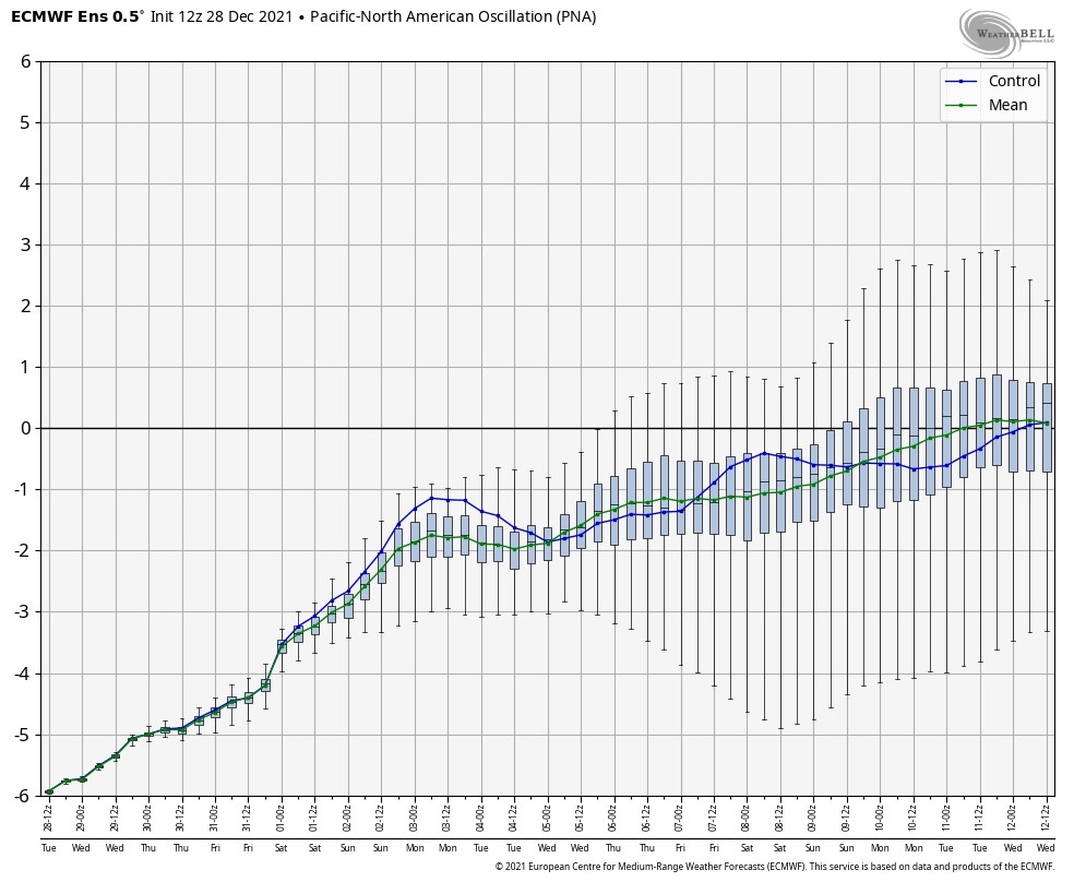
More on this and other teleconnections early in the morning as our hectic Christmas schedule transitions back to normal!
Permanent link to this article: https://indywx.com/2021/12/28/time-to-put-up-or-shut-up/
Dec 27
Updated 12.27.21 @ 4:58p
A busy weather pattern will be with us as we wrap up the year and head into 2022. The first in a seemingly unending series of systems will blow into town Tuesday and feature a period of heavy rain across central Indiana by afternoon, along with a shot of wintry weather for our neighbors across northern Indiana.

Additional (lighter) rain will arrive Wednesday evening. Rain will approach 3/4 of an inch across the greater Indianapolis area and snowfall should span within the 1” to 3” range for most across far northern Indiana Tuesday PM.

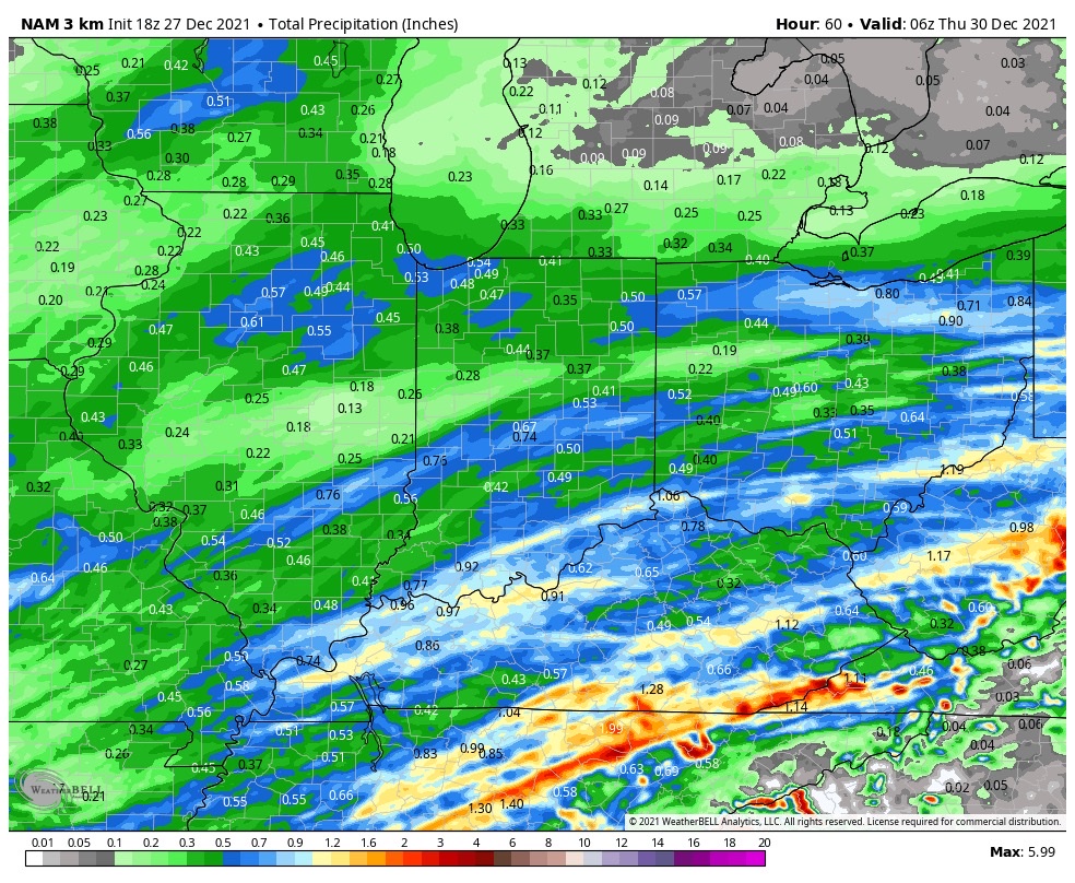

Additional storm systems will roll through here Wednesday night and Thursday and again Friday night and Saturday. The 3rd storm system appears to be the most significant within this batch and should lead to a messy New Year’s Day, including opportunity for additional heavy rain.


For those with travel plans north around New Years, expect the opportunity to encounter more impactful wintry conditions across areas just to our northwest with that system. Early indications suggest this could be a heavy snow maker for areas from the central Plains into the lower Lakes.
On that note, let’s keep close eyes on trailing upper level energy that may lead to a “surprise” second area of snow south with the New Year’s system. This is met with much lower confidence (always is with trailing upper lows in the medium term), but the overall pattern does support the potential of a secondary area of accumulating snow and we’ll keep a close eye on that moving forward. Ohio Valley, TN Valley, or even further east? Anyone’s guess at this point and we’ll continue to closely monitor…
Permanent link to this article: https://indywx.com/2021/12/27/busy-pattern-to-close-out-the-year-and-open-2022/
Dec 26
Updated 12.26.21 @ 7:38a
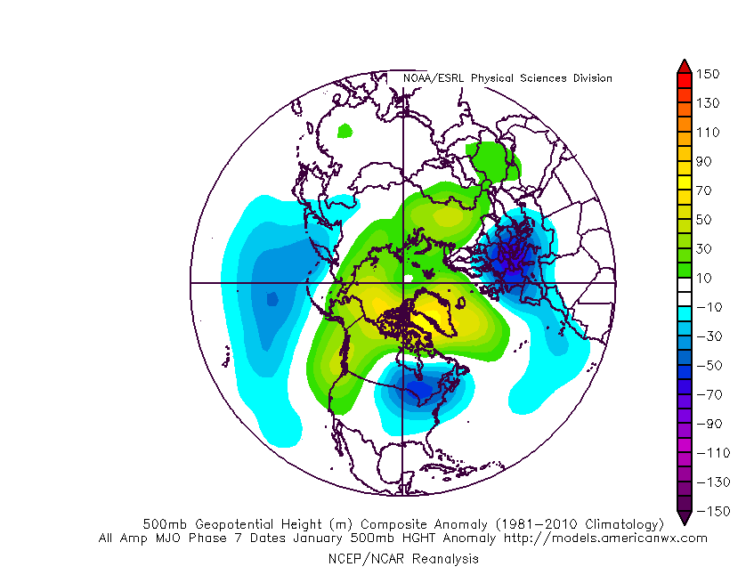
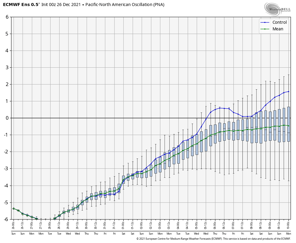
Over the past couple of weeks, several of the teleconnections (EPO, AO, and NAO) have been in favorable phases for cold air to take up residence in our neck of the woods. However the combination of Phase 6 of the MJO (image 1 below) and a deeply negative PNA (image 2 below) have fought off any sustained or significant cold.


As we look ahead, there are changes in both of these critical pattern drivers. First, the MJO looks to continue progressing deeper into Phase 7. This is significant as today, though while officially in 7, we’re really still feeling the effects of 6. There’s a lean from guidance that Phase 8 is also within reach as we get towards mid-January, but we won’t get greedy. 🙂 If we can at least get deeper into 7, that will greatly lessen the influence of the warmth that continues to linger with Phase 6.

Note how the trough likes to settle into the eastern portion of the country during these phases.

That then brings us to the PNA. Guidance is trending things closer to neutral towards Day 10. This is significant as it would allow the southeastern ridge to at least get beaten down (not totally squashed as long as we remain negative), but certainly enough to allow the cold currently bottled up out west to bleed east.
This can be illustrated best by looking at the 500mb pattern evolution over the next couple weeks per the latest GFS ensemble below.
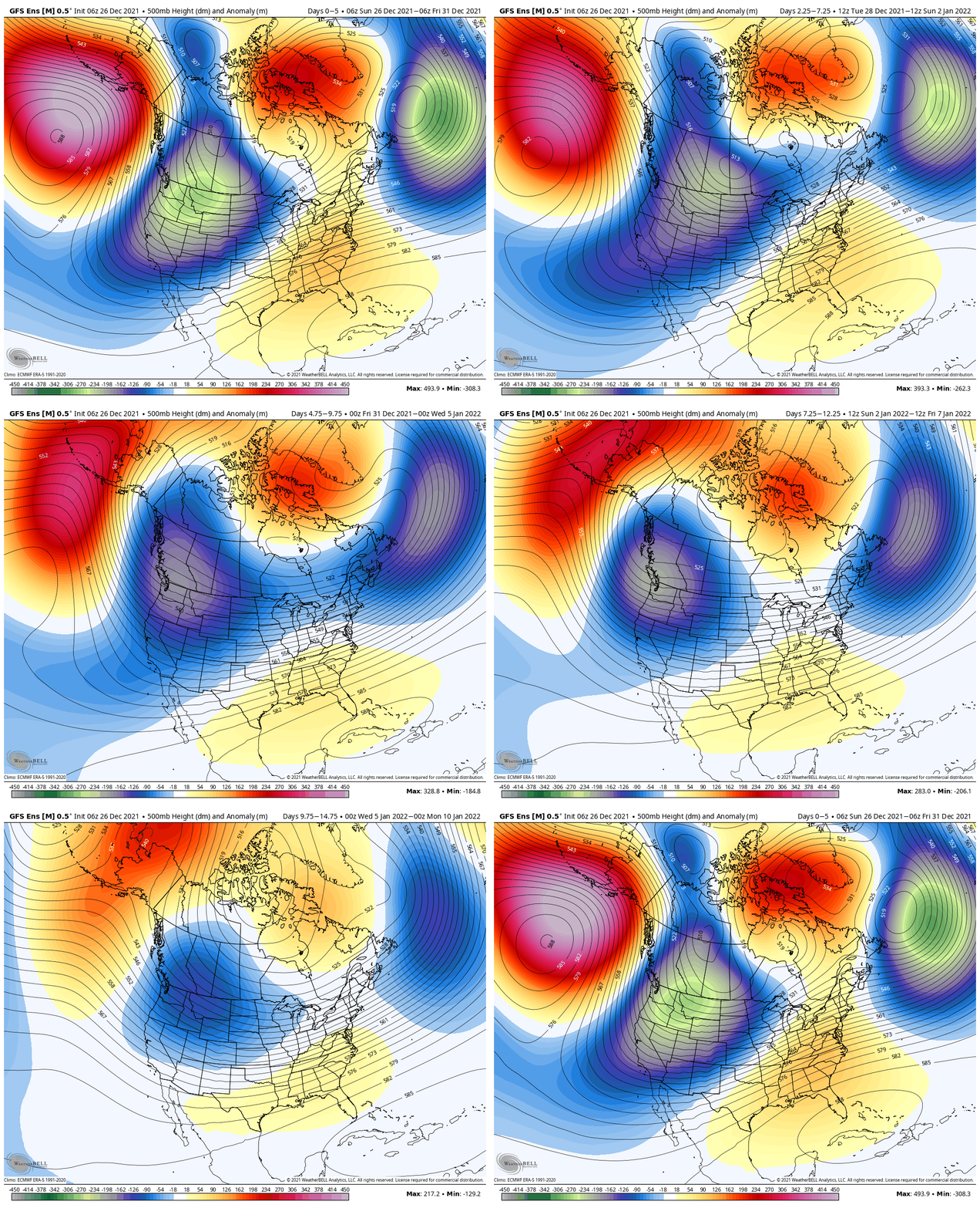
To summarize, while we still have warm days ahead of us, there does at least appear to be a couple trends heading in the right direction for all of those longing for colder and potentially more wintry times as we get past the new year.
Hang in there you snow lovers. It’s far too early to jump off the ship…
Permanent link to this article: https://indywx.com/2021/12/26/for-now-its-a-tale-of-the-mjo-and-pna/
Dec 25
Updated 12.25.21 @ 11:27a
First and foremost, from our family to yours, we want to wish you a very merry Christmas and the warmest of holiday wishes during this season!
A line of rain and embedded thunder continues to plague portions of central Indiana late Christmas morning. Localized training of heavy downpours has led to this being an “overachiever” in spots across the region (closing in on 2” in a narrow strip from Frankfort over to Elwood, for example).
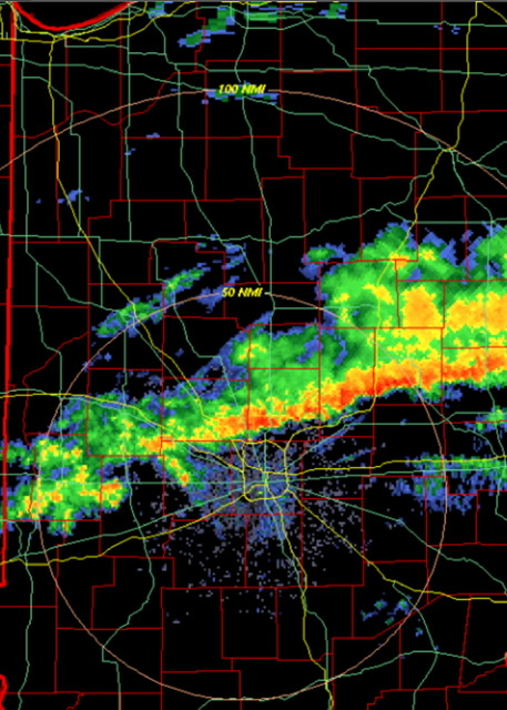
The trend should be a drier one through the afternoon as temperatures slowly begin to fall (how weird was it to walk outside on Christmas morning with temperatures in the lower and middle 60s?!).
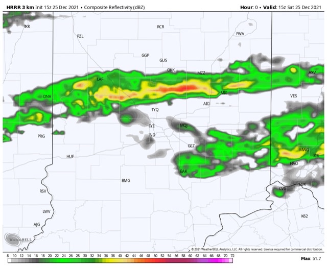
With that said, the damp theme this Christmas morning can serve as a hint to what lies ahead as we put a bow of 2021 and open up the new year. A very Niña-like pattern will force the storm track into the Ohio Valley, leading to multiple storms of significance as we go through the upcoming week to 10 days.
Sunday night into Monday, Monday night and Tuesday, followed by next Saturday into Sunday all appear to provide a good soaking to central Indiana.
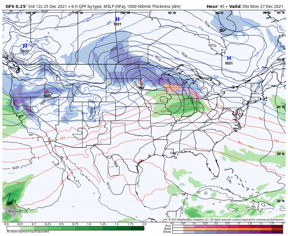

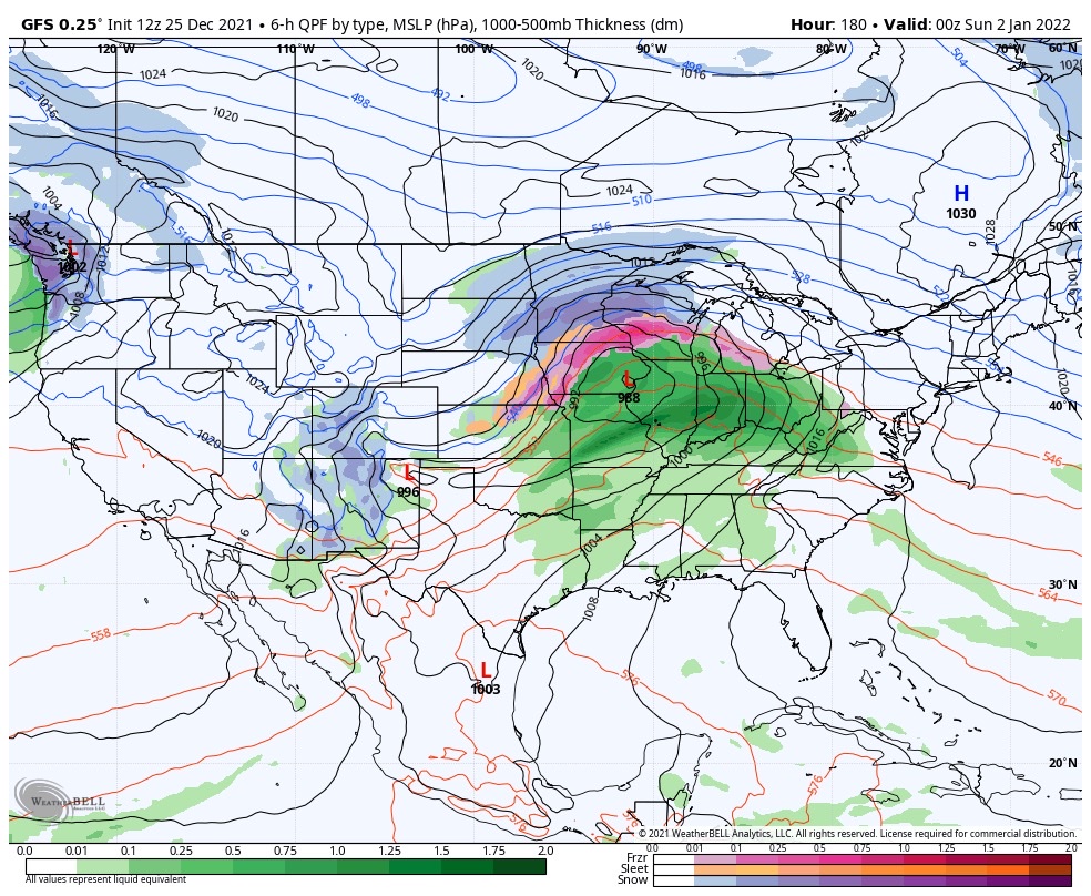
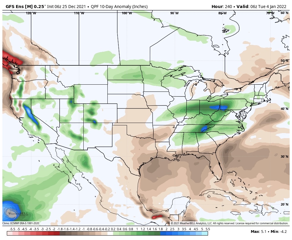
Certainly by the time all is said and done, widespread hefty totals are likely. We’ll have to hone in on specific numbers as we get closer, but it’s safe to say amounts in local rain gauges may approach 3”+ by Jan. 2nd. The heaviest rain appears slated with the storm Tuesday and again next Saturday.
Permanent link to this article: https://indywx.com/2021/12/25/harbinger-of-things-to-come/
Dec 24
Updated 12.24.21 @ 7:35a
You must be logged in to view this content. Click Here to become a member of IndyWX.com for full access. Already a member of IndyWx.com All-Access? Log-in here.
Permanent link to this article: https://indywx.com/2021/12/24/video-busy-short-term-pattern-drivers-behind-the-regime-into-mid-january/
Dec 23
Updated 12.23.21 @ 5:32a
You must be logged in to view this content. Click Here to become a member of IndyWX.com for full access. Already a member of IndyWx.com All-Access? Log-in here.
Permanent link to this article: https://indywx.com/2021/12/23/video-very-active-pattern-to-close-out-the-year/
Dec 22
Updated 12.22.21 @ 7:45a
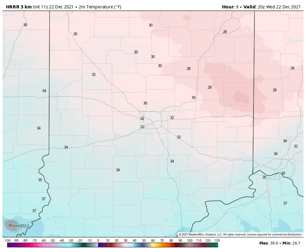
Average temperatures on the 22nd of December include a high of 38.6° and a low of 24.7°. We’ll be slightly under those levels today in what can be termed an “island” of cold in a “sea” of warmth. In fact, the month is running close to 7° above normal thus far.

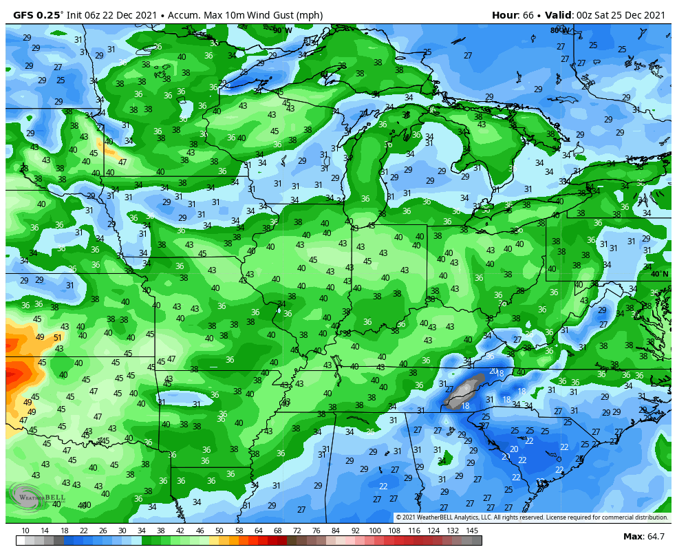
As we look towards the all-important Christmas forecast, quiet weather will carry us into Christmas Eve. That’s when we’ll tighten the pressure gradient and build in southwest gusts of 30 to 40 MPH.
Those southwesterly winds will transport a few scattered light showers into the region Christmas Eve evening into Christmas Day, but these won’t be a big deal. “Scattered” and “light” are the key words.
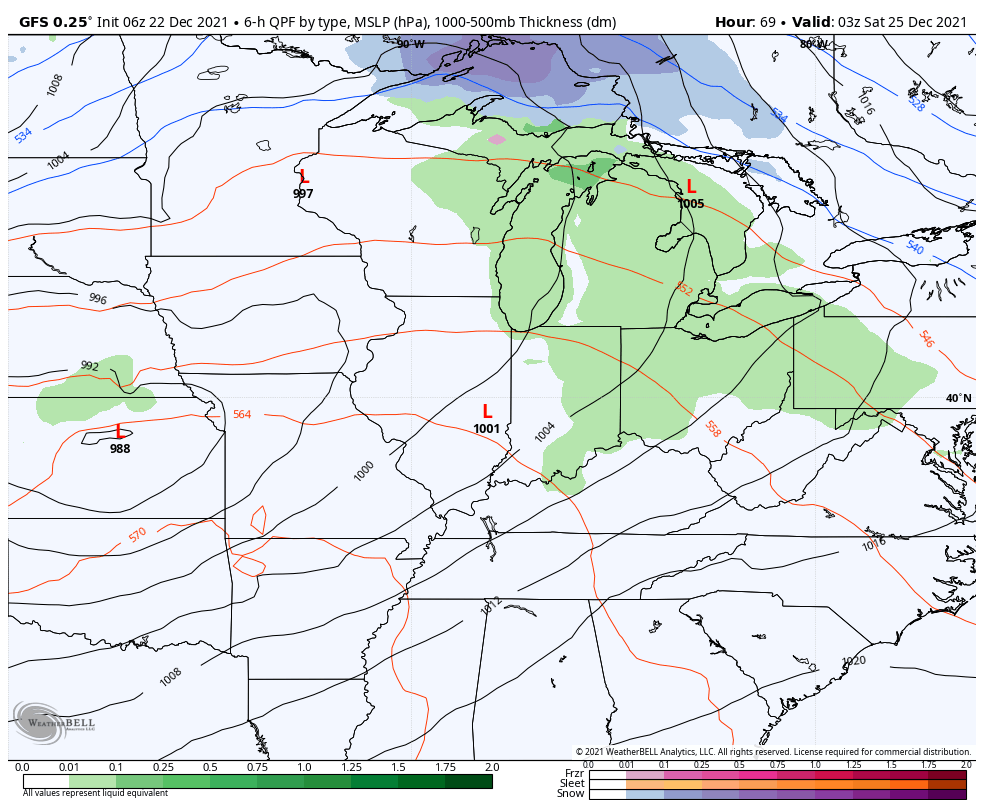
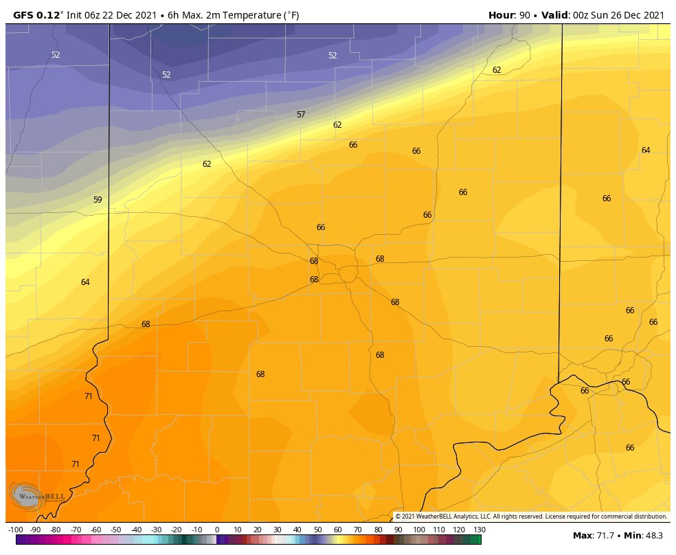
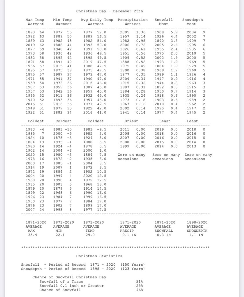
What will be a big deal are the temperatures. In fact, latest guidance is pointing towards a new record high on Christmas Day. Should we see any sunshine get into the mix, this will be easily achievable.
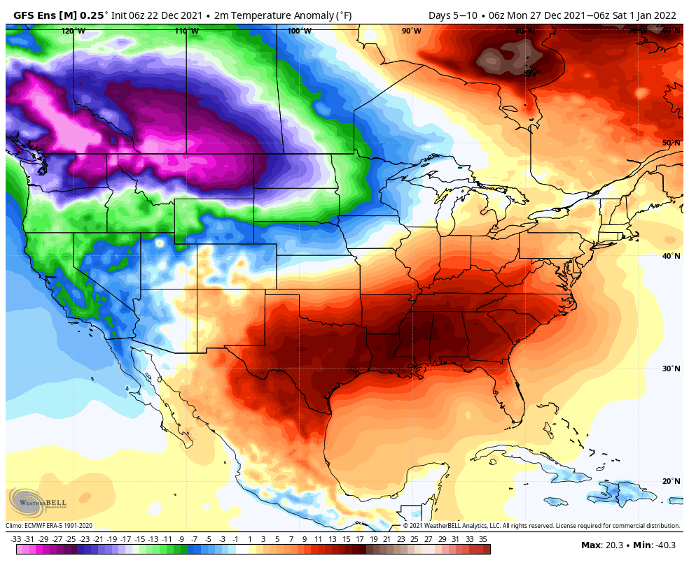
Thereafter, the same general pattern remains intact, locally (- PNA ridge), but notice the cold bleeding into the West between Christmas and New Year’s. Does this eventually make progress east? We think so as we get into January…

Permanent link to this article: https://indywx.com/2021/12/22/the-beat-goes-on-and-on-and-on/