Updated 02.27.21 @ 10:15a
You must be logged in to view this content. Click Here to become a member of IndyWX.com for full access. Already a member of IndyWx.com All-Access? Log-in here.

Feb 27
Updated 02.27.21 @ 10:15a
You must be logged in to view this content. Click Here to become a member of IndyWX.com for full access. Already a member of IndyWx.com All-Access? Log-in here.
Permanent link to this article: https://indywx.com/2021/02/27/video-analyzing-latest-short-term-heavy-rain-trends-guidance-trends-colder-for-the-eastern-seaboard-days-5-10/
Feb 27
Updated 02.27.21 @ 3a
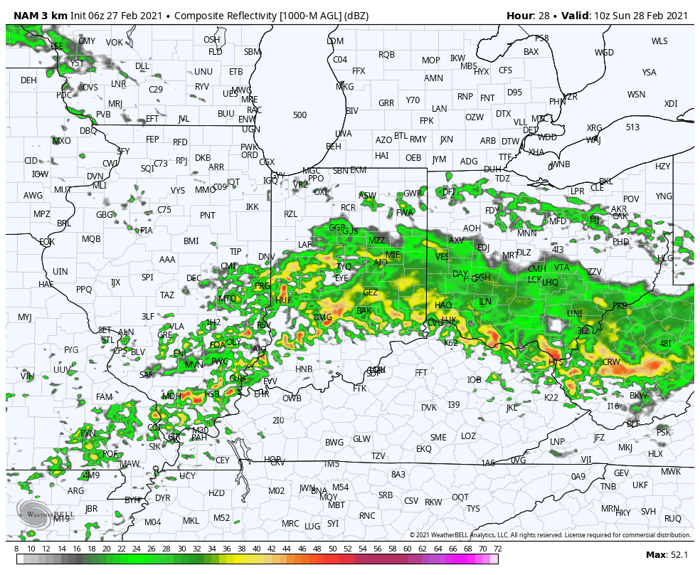
While we’re dealing with areas of light rain early this morning, most of our Saturday will be precipitation-free. That will all begin to chance during the overnight and predawn hours Sunday. Computer model guidance has begun to trend north with the heavy rain axis during this time frame. Southern portions of the state will still get in on the heavy rain show, but it now appears as if there will be a window for heavy rain across more of central Indiana in the 2a-9a window Sunday.


More later this morning in our video update.
Permanent link to this article: https://indywx.com/2021/02/27/heavy-rain-axis-shifts-north/