
I. Isaias set to impact the eastern seaboard early week.
II. Unseasonably cool air dominates the period from the Plains into the Ohio Valley.

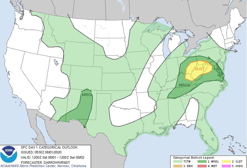
Severe: Widespread severe weather isn’t anticipated this week, with the exception of just east of the track of our surface low today (eastern KY, southeast OH, and northern VA) and into the Northeast Sunday.
Forecast Period: 08.01.20 through 08.07.20
Our weather will be dominated by a trough and associated low pressure through the early portion of the work week. Initially it’s a surface low that will provide periods of rain and embedded thunder through the weekend, but by the time we get to Monday and Tuesday, it’s upper level energy that will be responsible for scattered showers and thunderstorms. Periods of heavy rain can be expected this afternoon into tonight, especially across east-central Indiana. Thereafter, drier air will arrive for midweek. With the drier airmass in place, temperatures will fall into the mid-upper 50s (average low is in the middle 60s). Our next weather feature (a weak cold front) will arrive next Friday with the potential of scattered showers and storms.
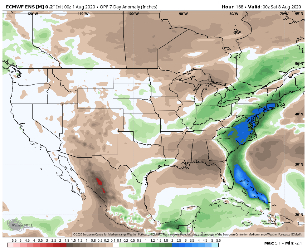
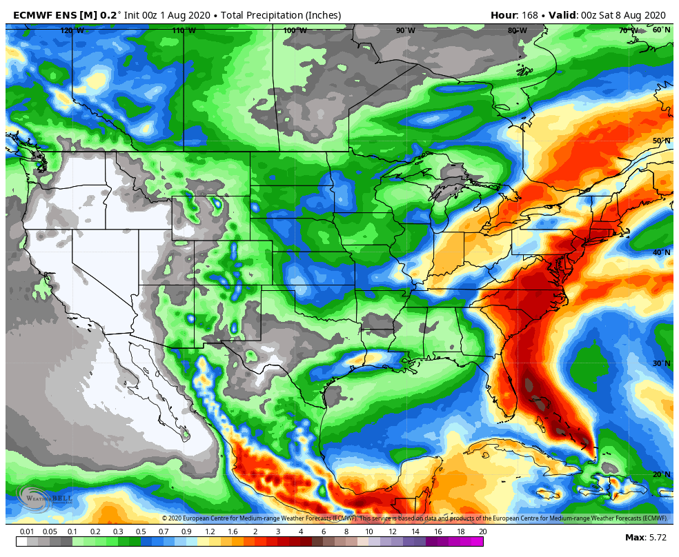
Isaias will skirt the eastern seaboard through the early portions of the week. While not a particularly well organized storm, tropical storm and low end cat. 1 hurricane force winds can be expected from eastern portions of the Florida peninsula and up the Carolina coast, into New England by midweek.