Type: Impactful Wintry Weather

What: Potential of accumulating snow, sleet, and freezing rain
When: Multiple rounds:
I. Tuesday evening through Wednesday morning
II. Wednesday evening through Thursday evening
Temperatures: Upper 20s to lower 30s
Wind: Northeast 20 to 30 MPH and gusty Tuesday night, shifting to the north, northwest 5 to 15 MPH Wednesday night into Thursday.
Blowing/ Drifting: Non-existent
Pavement Impacts: Salting/ plowing also will likely be required in the “snow zone.”
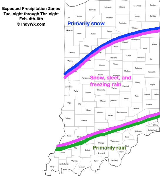
A complex weather pattern will result in a multitude of precipitation types across the state in the Tuesday night through Thursday night time period. Here’s our early thinking where we think the various types of precipitation setup shop:

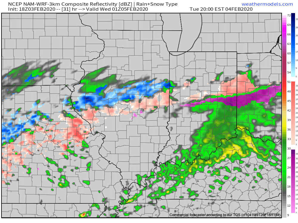
As we time things out, rain is expected to overspread most of the state Tuesday morning. Heaviest and most concentrated rainfall should occur along and south of the I-70 corridor. A downright balmy start to the day will trend significantly colder (especially around and after lunchtime). As cold air continues to ooze south, renewed precipitation is expected to break out Tuesday evening into Wednesday morning, courtesy of a wave moving along the cold front. With colder air in place, this precipitation is expected to primarily fall in the form of sleet and freezing rain through the “heart” of central Indiana with snow across northern parts of the state. With temperatures falling below freezing Tuesday evening, slick spots on area roadways are anticipated to develop- even despite the recent warm weather of the past couple of days.
Most of the daytime should feature a relative “lull” in the precipitation with nearly steady temperatures across central and northern Indiana (around or just below freezing). The briefly quiet times will give way to another round of more widespread and heavier precipitation Wednesday evening, continuing into the day Thursday as a stronger wave of low pressure moves northeast from northern MS, along the Ohio River, and into eastern Ohio. Like what we’ll experience tomorrow evening, the precipitation forms will vary significantly based on your locale. We think another round of sleet (perhaps some freezing rain across south-central Indiana) will dominate across central Indiana, with primarily snow across northern Indiana. Within the highlighted “snow zone,” amounts of 3″ to 6″ certainly seem possible by the time all is said and done Thursday evening.
Confidence: Medium
Next Update: Tuesday morning
