
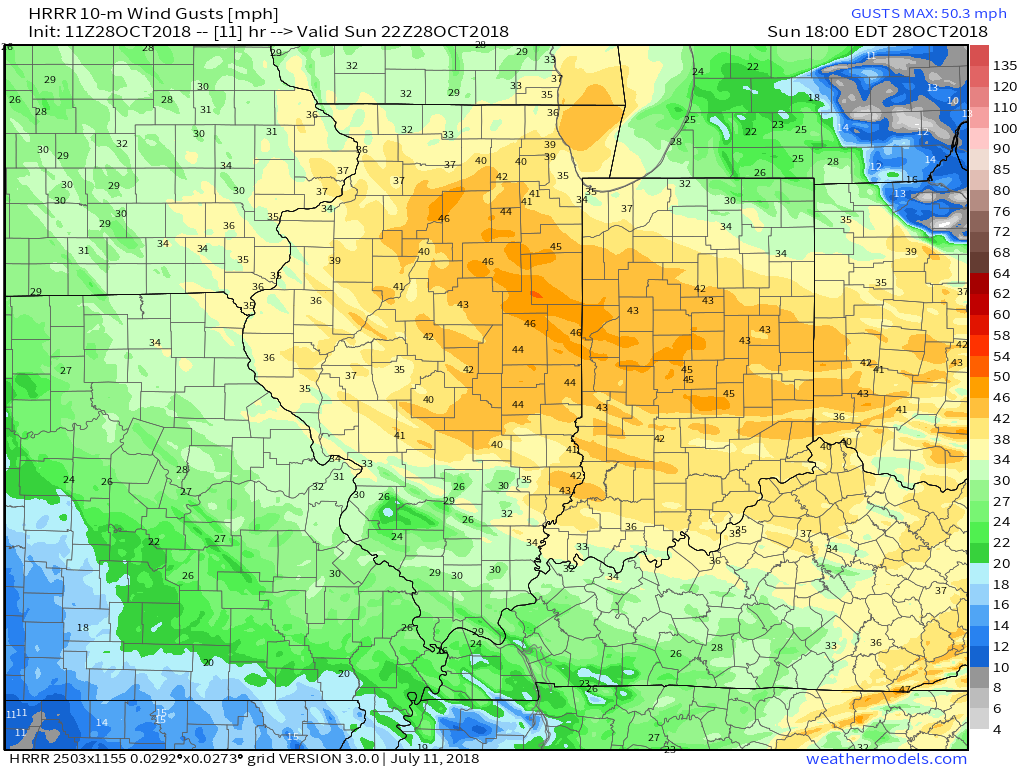
I. Showers followed by wind: A fast moving storm system will sweep through the Ohio Valley as we close the weekend. Showers will accompany the leading edge of this storm system (this morning), followed by strong and gusty winds (even stronger than this morning) this afternoon and evening. In some cases, winds will gust 45 to 50 MPH. Hunker down!
 II. Wet Halloween: A cold front will approach the state Tuesday evening into our Halloween. Widespread rain is expected Wednesday, BUT the silver lining may be that the bulk of precipitation will be shoved to our southeast before most trick-or-treaters take to the streets.
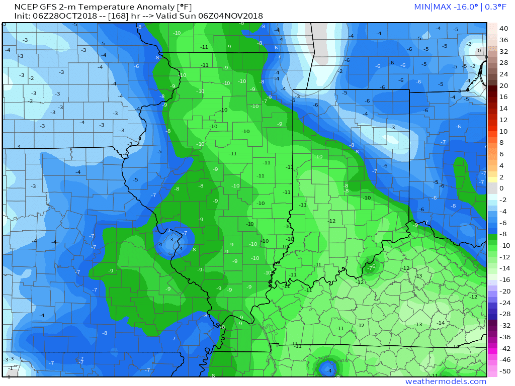
 III. Chilly Open To November: Reinforcing chilly air will blow into town behind the cold front and set the stage for an unseasonably chilly open to November. Generally, lows will fall into the middle 30s and highs will top out in the upper 40s for the first few days of the month.
 IV. Raw Saturday: It’s a “rinse and repeat” scenario as next weekend opens raw and wet thanks to a new storm system moving through the region. Gusty showers and unseasonably cool temperatures can be expected Saturday. Note the possibility of wet snow to fall on the northern periphery of the storm system through IA, MN, and WI. (Signs of the times).
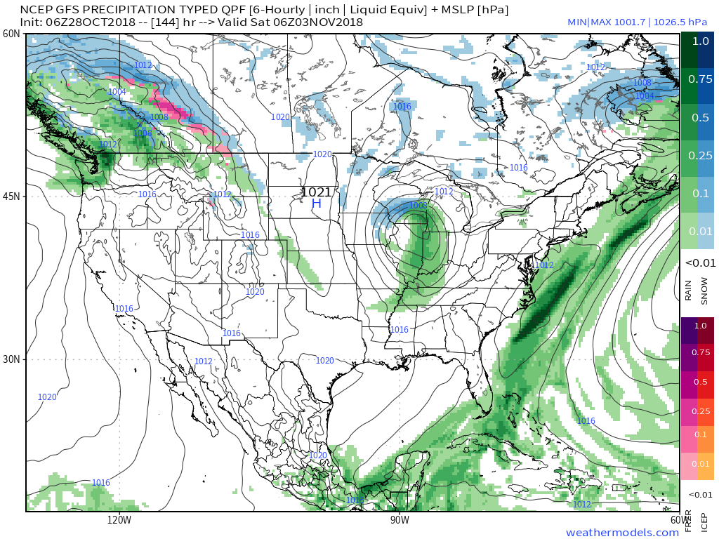 V. Wet Pattern: After a long stretch of dry weather through the balance of October, a big shift in the pattern is taking place now and will continue to promote well above normal rainfall as we move through the first couple weeks of November. In some cases, the upcoming (10) days alone may yield 3″ to 4″ of rain in some areas of the region.
