I. A weak weather maker will help spread a mixture of light rain and snow across the state later today, particularly this afternoon and evening. Precipitation amounts will remain light and insignificant, but serve as a nuisance as you go about your weekend plans.
 II. We’re hopeful for much needed sunshine Sunday as we’ll be in between storm systems, however any sun that we see won’t last long.
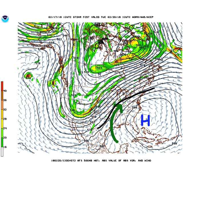
A rather ominous setup for heavy rain will take place Monday into Wednesday. This will include a combination of ingredients as a strong southeast ridge will prevent much forward motion of a “wavy” front that will drape itself across the Ohio Valley region. Additionally, the subtropical jet will transport moisture-rich air northward into the area (true Gulf of Mexico connection).
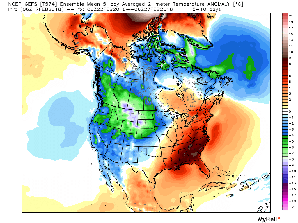
 While this is an unseasonably warm pattern (we forecast highs of 50°, or above, 5 out of 7 of the upcoming days, and at least 2 60°+ days), it’s one that will likely result in periods of heavy rain not only next week, but in waves over the upcoming 10 days.

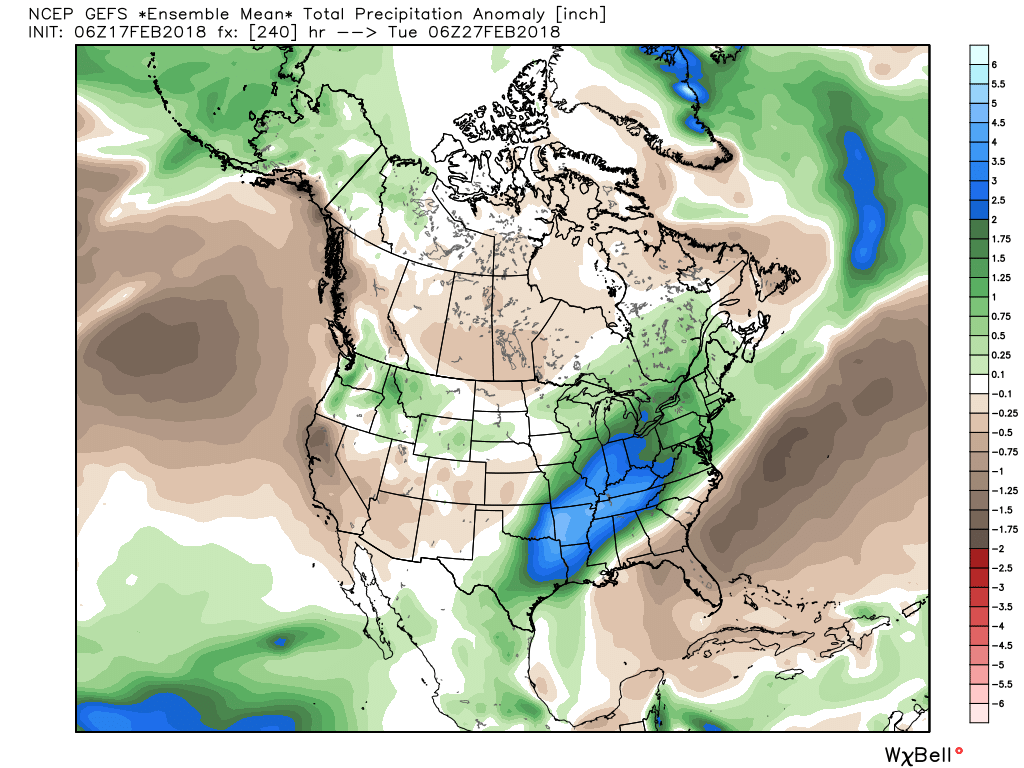
 Widespread 10-day rainfall numbers of 3″ to 4″ will be likely in this setup, including locally heavier amounts of 5″ to 6″ in spots. Certainly, if you live near waterways we suggest having a plan in place as it’s not a matter of if, but when flooding takes place in spots across the region with such a setup.
III. Longer-term, we still need to be wary of the potential of a colder pattern returning as we get into March. That forecast deep negative arctic oscillation (AO) has to raise an eyebrow for the possibility of making up for lost time in the cold weather department before we can signal “all clear” on winter…

