April 27, 2017 archive

Reviewing The Latest JMA Weeklies…

The new JMA Weeklies paint a wet and active picture for Week 1, but begin to suggest we get into a milder, drier pattern as we push into the middle and latter portions of May…

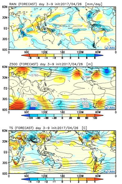
Week 1:

The “mean” upper air pattern places coastal ridges with a cool trough settling into the central.  The end result will be a wet and active regime, locally, this weekend into next week.  Though we’ll see a “spike” in temperatures Sunday, the overall theme is a chilly one as we open the month of May.  In fact, temperatures will trend significantly cooler than average as we push into next week.
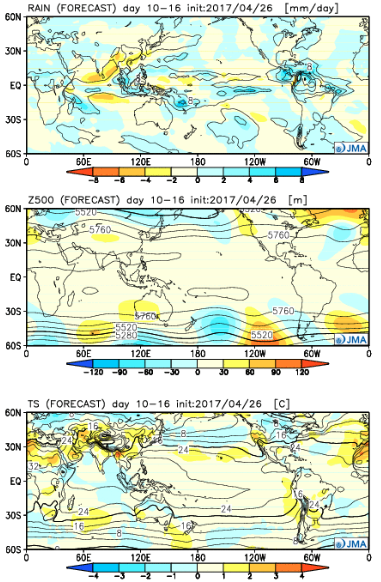
Week 2:

While it still looks chilly (compared to average), the JMA Weeklies suggest a “calmer” weather pattern moving in.  Wet anomalies are noted through the Rockies and Central, but a drier trend across the east, including the Ohio Valley.
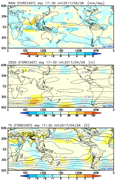
Weeks 3-4:

Wet times remain across the Central and spread into more of the southern tier, as well.  Slightly cooler than normal temperatures are also forecast across the Southeast.  Budding warmth seems to develop over the West.
Permanent link to this article: https://indywx.com/2017/04/27/reviewing-the-latest-jma-weeklies/

Busy Weather Pattern…

Highlights:

  • AM showers then cooler and windy
  • Stormy weekend ahead
  • Cooler next week

Busy Times In The Weather Office…A cold front will sweep through the state this morning with lingering showers and an abrupt wind shift.  Gusty westerly winds and cooler air (we’ve already seen our high for the day) will be with us this afternoon, along with a variably cloudy sky.

Unfortunately, we don’t have many changes to the ongoing idea of hefty weekend rains.  A warm front will begin to slowly lift north Friday into Saturday and this will be the focal point for heavy rain and thunderstorms.  Overall coverage and intensity of rain and thunderstorms will increase as we rumble through the second half of Friday.  A couple of storms could be strong to severe- especially across southern Indiana Friday afternoon and night.

The aforementioned warm front will lift north and be located across the southern Great Lakes region Sunday.  This will put our neck of the woods squarely into the warm and humid air mass Sunday.  Though storm coverage will likely be more scattered in nature when compared to Saturday, heavy thunderstorms will develop, especially during the afternoon and evening hours.  With a deep-rooted tropical connection along with saturated soils in place from early weekend rains, flood and flash flood potential will be high as we go into early portions of next week.

As we open up the work week, we’ll shift gears from a moisture-rich southerly flow to one that’s out of the northwest and much cooler.  Showers will continue through Monday.  Our next storm system will then set it’s eyes on the region by the middle of next week.

Upcoming 7-Day Precipitation Forecast:

  • Snowfall: 0.00″
  • Rainfall: 2.50″ – 3.50″

Permanent link to this article: https://indywx.com/2017/04/27/busy-weather-pattern/

IndyWx.com