 Highlights:
- Unsettled times ahead
- Weekend heavy rain
- Much cooler and windy early next week
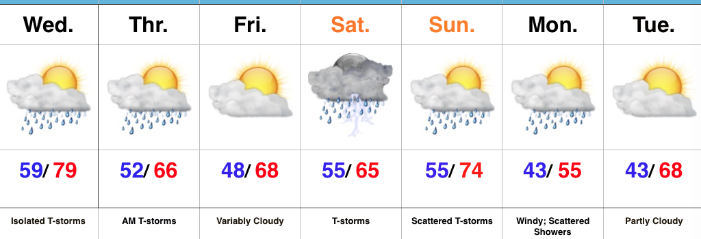
Enjoy The Dry Time While You Can…While most of Wednesday will remain rain-free, we do note the potential of a diminishing line of thunderstorms that could impact portions of far northwest sections of the state Wednesday morning. As mentioned, these should diminish relatively quickly and give way to a mostly dry day. A cold front will approach the state Wednesday night into Thursday morning and result in more widespread showers and thunderstorms during that time. Briefly drier air will arrive Thursday evening into Friday and we should wrap up the work week mainly dry.
We’ll take whatever dry weather we can get as the weekend still looks wet and stormy. We discussed the weekend setup this morning and thoughts haven’t changed a bit. Today’s model data continues to suggest we’re looking at periods of heavy rainfall with widespread weekend totals of 2″-3″ (locally heavier amounts possible). Of the two days, Saturday appears to offer up the most widespread rains, but we caution that the scattered showers and thunderstorms that develop Sunday will have the potential of depositing hefty totals in relative short order. Due to the projected steering currents, we’re also concerned for the possibility of “training” of heavy rain and that would quickly create a flash flood concern in localized areas. Stay tuned. Another item of interest is the possibility of “bust potential” with regard to the temperature forecast Saturday. Latest modeling wants to keep the warm front just south of the immediate region for most of the day now and, as such, we’ve trended cooler with Saturday’s temperatures before that warm southwesterly air flow wins out Sunday.
The warmth won’t last long as we quickly transition to a cooler west and northwest regime to open the work week. Along with the much cooler air, scattered showers and strong and gusty winds will be with us. We’ll finally begin to calm down with a very pleasant Tuesday expected.
Upcoming 7-Day Precipitation Forecast:
- Snowfall: 0.00″
- Rainfall: 3.00″ – 4.00″

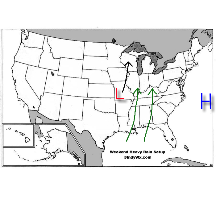
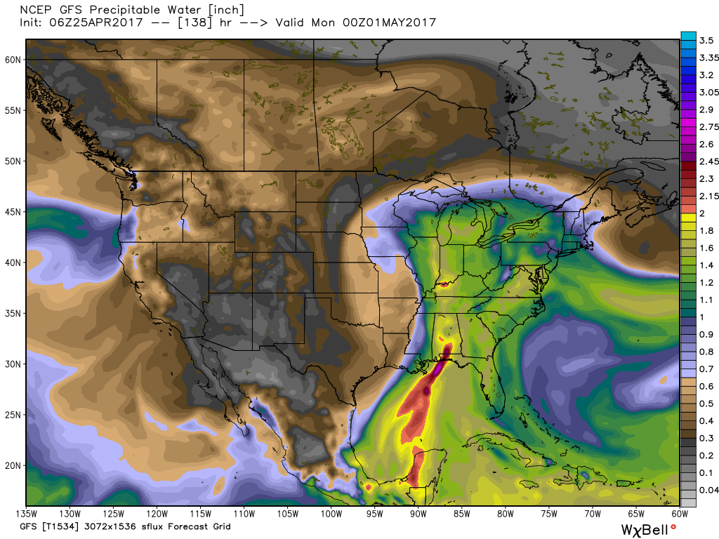
 An area of high pressure will be located off the Mid Atlantic coast while surface low pressure develops in the southern Plains and tracks north over the weekend. The combination of these two ingredients will help pull abundant Gulf of Mexico moisture northward into the Ohio Valley. With a true Gulf connection, moisture-rich air will overspread the region this weekend. In addition to feeling truly muggy for the first time this year, this will also aid in periods of heavy rain this weekend.
 From this distance, it appears like widespread 2″ to 3″ of rain will fall over the weekend, but localized heavier totals are expected where thunderstorms “train” over the same areas. While it won’t rain the entire weekend, times of wet weather will outnumber dry hours and if you live near a creek or stream, keep abreast of this developing weather situation as significant water rise is expected over the weekend.