After a blustery and chilly Saturday (and temperatures in the upper 30s to start our Sunday), a gorgeous close to the weekend is ahead. Wall-to-wall sunshine is expected with moderating temperatures this afternoon. Our average high on the 23rd of April is 66° and we should be very close to that later this afternoon. Enjoy!
High pressure will remain entrenched over our area as we progress through the early portions of the work week. This will provide pleasant weather and plentiful sunshine. With a dry airmass in place, expect significant temperature swings. Overnight lows in the 40s will quickly rise into the 70s Monday and Tuesday.

High pressure will dominate our early-week weather.
A southerly flow will help pull a more humid air mass northward Wednesday and as a cold front slices into the unseasonably warm and muggy airmass, we expect showers and thunderstorms to increase Wednesday evening into Thursday morning. We still have some time to watch things evolve, but from this distance, we feel strong to severe thunderstorm potential is present during this period. Locally heavy rains are also possible as PWATs zoom to 1.5″ +.

Precipitable water values will increase to 1.5″+ Wednesday and support the threat of locally heavy rain.
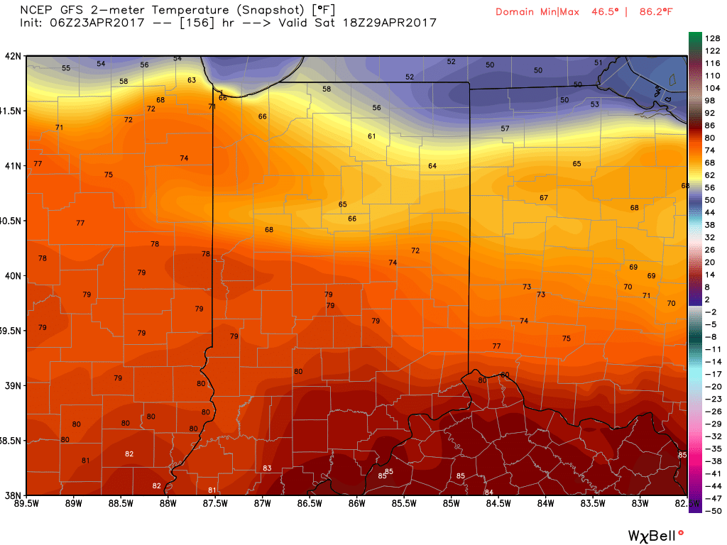
We’ll get into some briefly drier air to wrap up the work week, but a warm front will blow through the region Saturday and will likely be accompanied by thunderstorms as it lifts north. Once the warm front passes, unseasonably warm and humid air will make a return and set the stage for a true summer-like feel next weekend. We expect highs to go into the lower to middle 80s with a muggy feel, as well.

 Finally, after Saturday morning thunder, we think the majority of next weekend is dry before a cold front brings a return to widespread showers and thunderstorms late Sunday.

