 Highlights:
- Active stretch of weather begins
- Moderating trend into midweek
- Ice concerns Friday-Saturday
Sunglasses NOT Required…We’re entering the beginning of an active stretch of weather, with an extended period of overcast skies and gloomy conditions. Let’s dive in and take the challenges one-by-one:
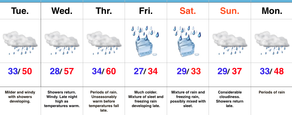
Showers develop this afternoon as a cold front moves into the state. Ahead of the front, strong southwest winds will gust upwards of 45 MPH+. A “big hair warning” is in effect. 🙂
A brief shot of colder air will arrive late tonight into Wednesday, but just as soon as it arrives, it’ll leave and temperatures will approach 60 Wednesday night as showers return.
Thursday will be a wet day with periods of rain and slowly falling temperatures during the afternoon/ evening.
Friday is much colder as the arctic front will be to our south, but most of the day looks dry. Moisture will lift north Friday afternoon and evening and with cold air in place, the precipitation should take the form of a mixture of freezing rain and sleet. Periods of freezing rain likely continue Saturday. It’s far too early to discuss amounts and we also want to reiterate the difference of 1-2 degrees will mean a world of difference between areas dealing with ice versus a cold rain. The “battle zone” looks to take place across central IN. If you have travel plans Friday night and Saturday, please keep abreast of later forecasts and updates.
Regardless of whether or not we’re dealing with icy conditions across central IN during the first half of the weekend, temperatures will warm during the second half of the weekend and change any frozen/ freezing precipitation over to plain ole cold rain Sunday into Monday.
Upcoming 7-Day Precipitation Forecast:
- Snowfall: 0.00″
- Rainfall: 1.50″ – 2.00″
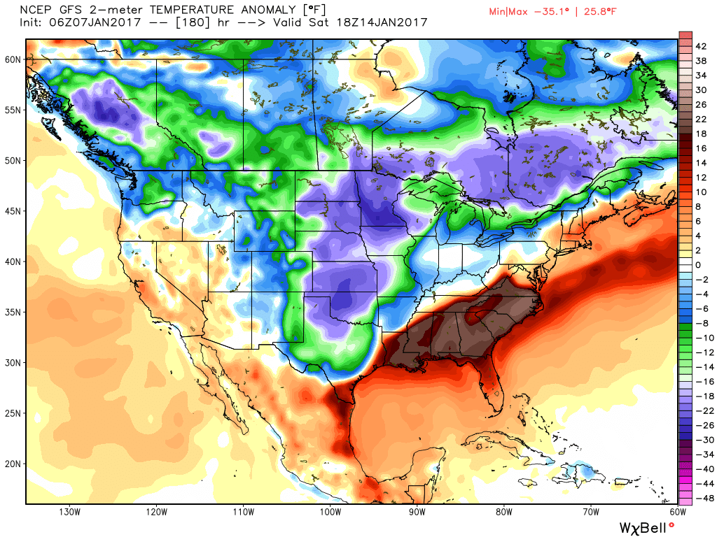
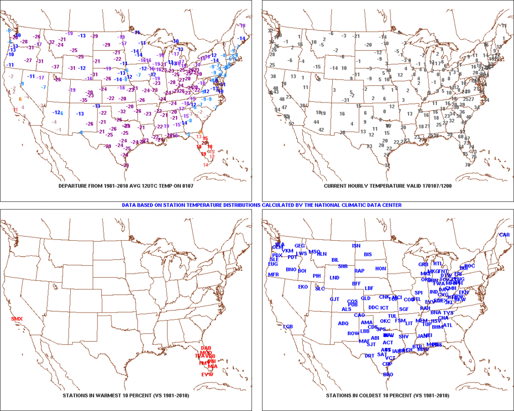 2.) Expanding Snowpack: 65.4% of the country is covered in snow this morning. The cold, arctic high suppressed the winter storm threat south as we alluded to in previous posts. Places across the Deep South that aren’t used to wintry precipitation are waking up to snowy and icy conditions this morning, including MS, AL, GA, SC, and into the Mid Atlantic. Heavier snowfall accumulated across east TN, including 5″-8″ in the high country. Heavy snow also fell through western and central NC and Blizzard Warnings are up in rare areas including VA Beach this morning.
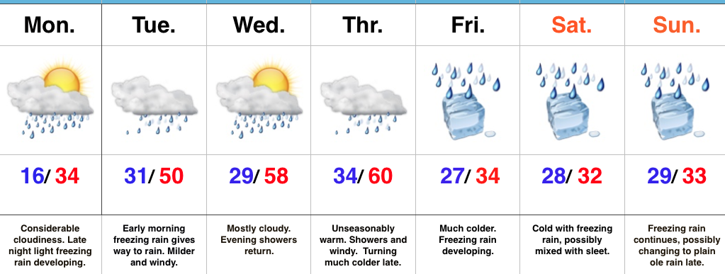
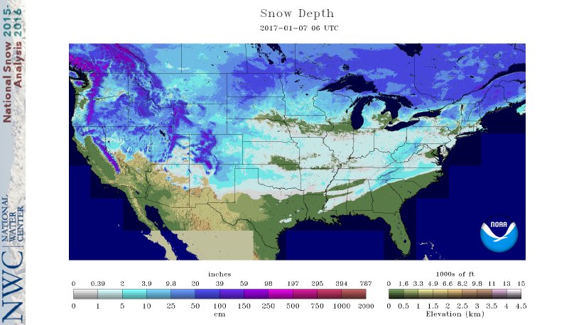 3.) Moderating Temperatures: Our air flow will back around to the southwest and this will help temperatures begin to moderate early next week (around freezing Monday and all the way to around 50 Tuesday). As the moderating trend gets underway, we may have to deal with a brief period of freezing drizzle/ freezing rain Monday evening.
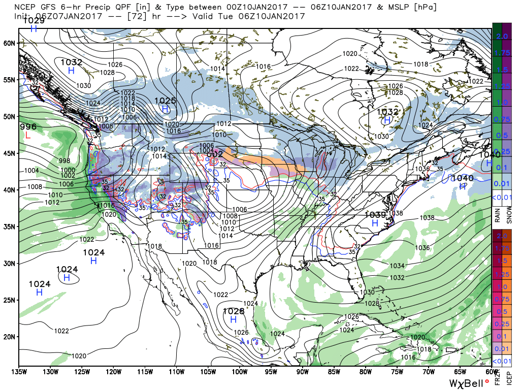 4.) Rainy Midweek: A more significant surge of moisture will arrive midweek and result in periods of moderate to heavy rain Wednesday PM into Thursday. Potential is present for 1″+ during this timeframe.
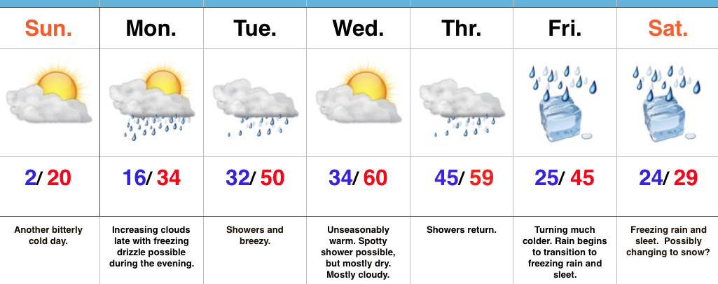
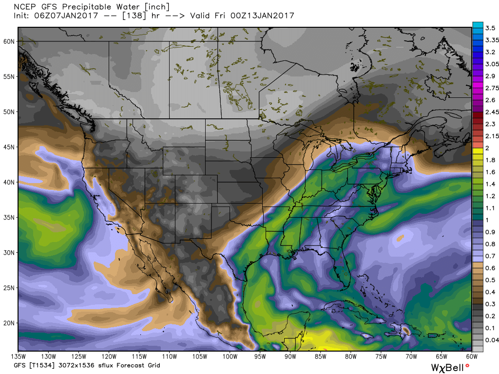 5.) Weekend Wintry “Fun And Games?” A tremendous battle will take place next weekend between a strong and sprawling arctic high pressure system and the southeast ridge. In between it’ll be fascinating to watch things unfold, and as you’d imagine, that includes Indiana. Despite the southeast ridge flexing it’s muscle, the concern here is that the shallow dense arctic air will “ooze” south and present an icy set-up for portions of the Ohio Valley and Mid West for the weekend. We still have some time to watch this, but the potential of significant icing is very much present for some and this will require a close eye through the week.