December 2016 archive

Pattern Moderates, But Stays Busy…

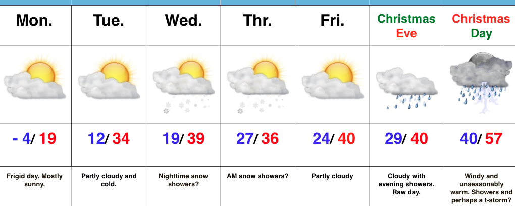
screen-shot-2016-12-20-at-6-17-58-pmHighlights:

  • Fast-moving storm system scoots north
  • Wintry mix Friday night?
  • Christmas night t-storm?

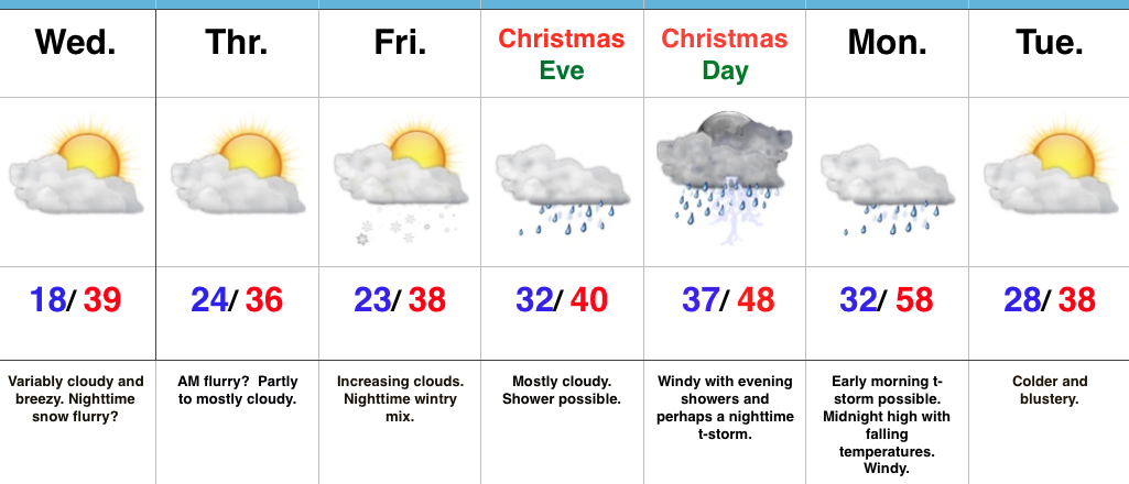
Chilly, But “Less Harsh”…The average high and low in central Indiana to wrap up December fall in the upper 30s and lower 20s, respectfully.  While much milder than we’ve been, temperatures will be very close to seasonal norms as we rumble into Christmas weekend.  A fast-moving storm system will scoot across the Great Lakes region Wednesday afternoon.  Reinforcing chilly air (not of arctic origin) will blow in Wednesday night and Thursday.  While a flurry could fly Wednesday night into Thursday morning, this won’t be a big deal.

We’ll then shift our focus to Christmas.  An initial wave of moisture could result in a light wintry mix as early as Friday night.  Initial thinking is that this won’t be a big deal as a quick transition to rain should take place early morning Christmas Eve, but, nonetheless, we’ll keep a close eye on things.  A light shower may still be around Christmas Eve, especially during the first part of the day.  Christmas Day, itself, should feature mostly dry, windy, and mild conditions.  Wind-blown showers are possible by afternoon before intensity increases Christmas night, including the potential of a strong thunderstorm.  The cold front will sweep through the state Monday morning with colder and windy conditions continuing Monday into Tuesday.

Longer-term, we remain confident that the “relaxed” state in the bitterly cold pattern will continue.  However, please know that doesn’t mean we won’t have to deal with wintry threats over the next couple of weeks.  An active storm track will continue through the Ohio Valley…

Upcoming 7-Day Precipitation Forecast:

  • Snowfall: Dusting – 1″
  • Rainfall: 0.50″ – 1.00″

Permanent link to this article: https://indywx.com/2016/12/20/pattern-moderates-but-stays-busy/

Frigid Open To The Week; Wet Christmas?

screen-shot-2016-12-19-at-8-58-45-amHighlights:

  • Bitterly cold to open the week
  • Mid week snow chances
  • Wet Christmas

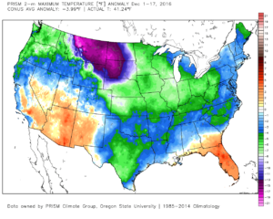
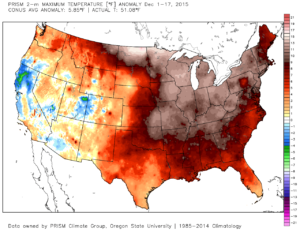
Bundle Up…The frigid theme of December 2016 continues as overnight lows dipped to between 3 and 6 below zero for most central IN reporting sites.  By the way, IND is running (6) degrees below average, month-to-date.  Needless to say, December 2016 (top) is nothing like December 2015 (bottom).

conus_mtd_t2max_anom_2016

conus_mtd_t2max_anom_2015

Though still chilly, temperatures will moderate into mid week before our next system rolls in.  Clouds will increase Wednesday and give way to a chance of snow showers Wednesday night into Thursday morning as upper level energy rotates overhead.  Models likely will have to play “catch up” again with this mid week system and we’ll keep a close eye on data.

As we look at Christmas, itself, a warmer regime looks to build in, courtesy of a southwest flow.  This is in response to the southeast ridge flexing it’s muscle and driving a rather intense storm system northwest through the Plains states.  Blizzard conditions will likely result northwest of the low track while showers and thunderstorms develop in the warm sector, including the MS Valley into the Ohio Valley.  We’ll introduce a chance of thunderstorms into our Christmas Day forecast, as well.

Longer-term, a rather significant pattern shift will continue to close the month of December into early January and this will drive a shift from the bitterly cold conditions to much milder times as we open 2017.  Winter fans, have no fear, the seeds are already being planted for a return to frigid and active times just beyond the new year…

Upcoming 7-Day Precipitation Forecast:

  • Snowfall:  Dusting – 1″
  • Rainfall: 0.50″ – 1.00″

Permanent link to this article: https://indywx.com/2016/12/19/frigid-open-to-the-week-wet-christmas/

Icy Concerns Grow Again Tonight…

After a night of freezing rain, many roadways throughout central IN remain glazed over and hazardous as of this update.  If you absolutely don’t have to travel today, please don’t.  Allow road crews to do their job.  Additionally, we have growing concerns of a new round of freezing rain to sleet and eventually snow tonight.  Lingering moisture on roadways will result in “flash freeze” conditions and treacherous travel tonight into Sunday.

First, a tip of the hat to short-term modeling, including the NAM, for suggesting we’d have a very difficult time eroding the shallow arctic air at the surface across most of central IN today.  While we never bought into the mid/ upper 50s idea the GFS and Euro were once suggesting, we did initially think 40s were in store today.  Forget about it.  Mid to potentially upper 30s are the best we can do today and temperatures will crash this evening as not one, but two, arctic fronts push through central IN.  Even if we didn’t have additional precipitation inbound tonight, “flash freeze” conditions would develop from lingering moisture and lead to renewed problems on area roadways.  Throw in another wave of low pressure riding along the pressing arctic front and a whole slew of problems will develop yet again from a freezing and frozen precipitation perspective.

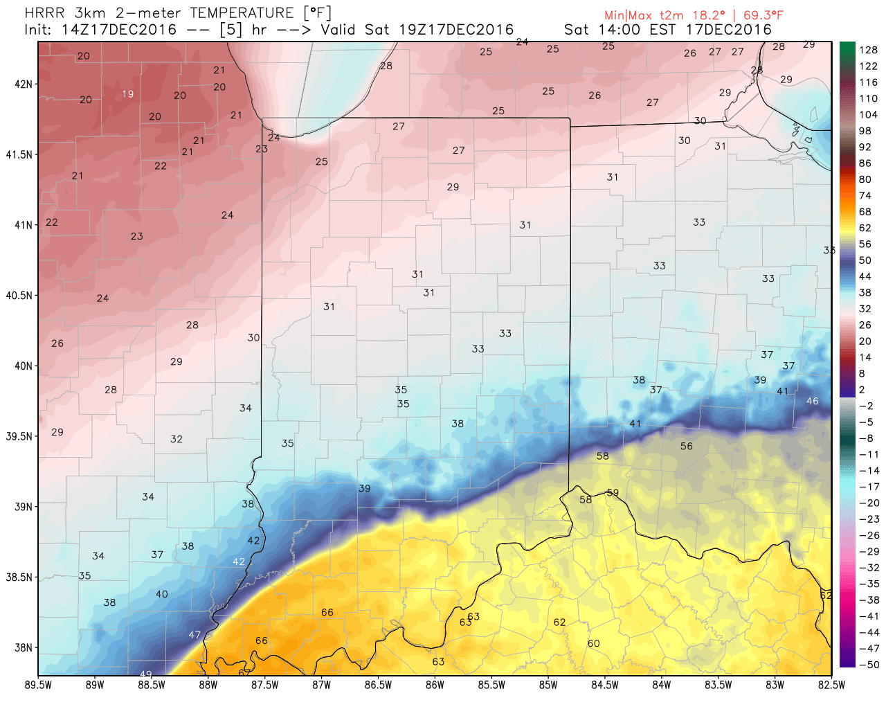
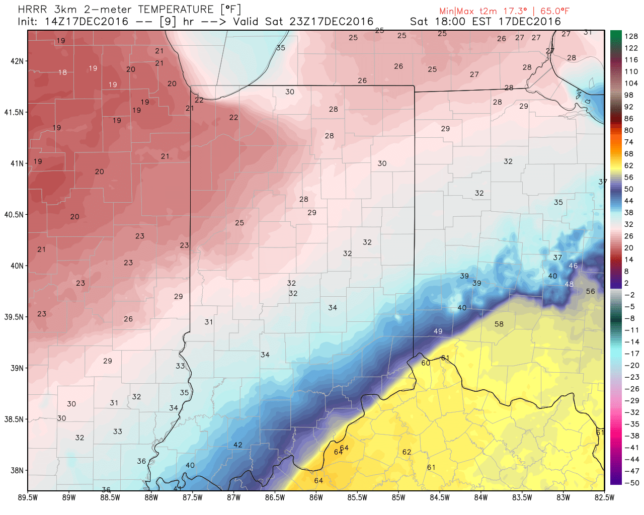
Note the incredible temperature gradient from downstate to central and northern Indiana early this afternoon.

hrrr_t2m_indy_6The heavy, dense, arctic air will win out as evening turns into nighttime.  Indianapolis is back to the freezing mark around 6p and into the 20s by 9p.
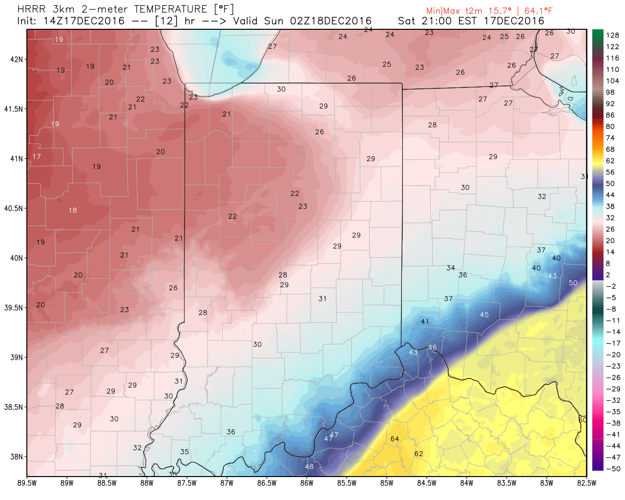
hrrr_t2m_indy_10

hrrr_t2m_indy_13Temperatures will continue to fall through the day Sunday and by Monday morning central Indiana will be in the single digits, with below zero readings across northern parts of the state.
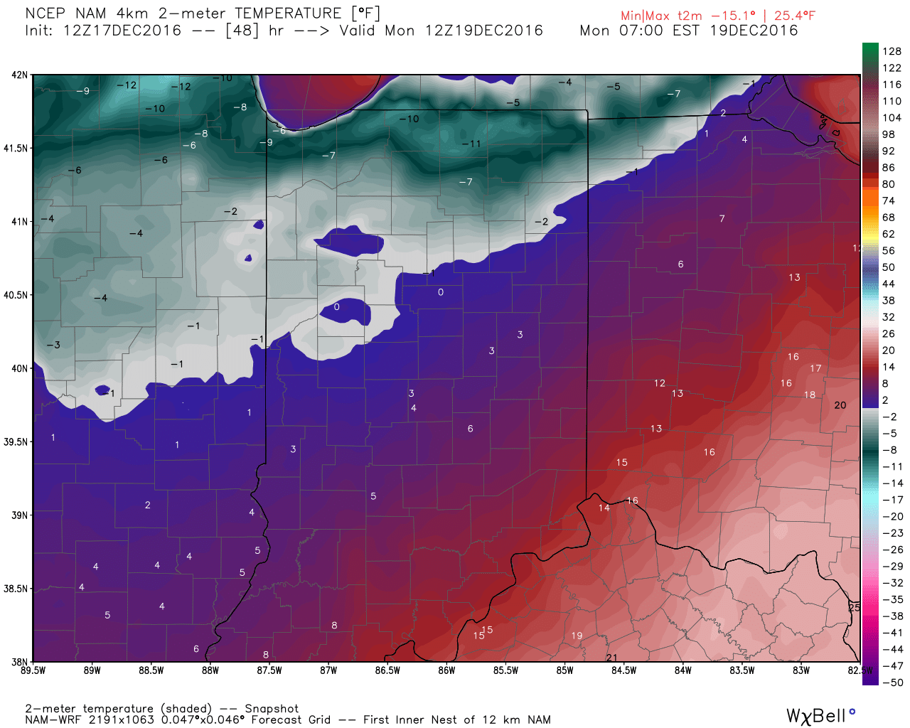
hires_t2m_indy_49Wind chill values of 10 to 20 degrees below zero will be common by Sunday night into Monday morning across central Indiana.
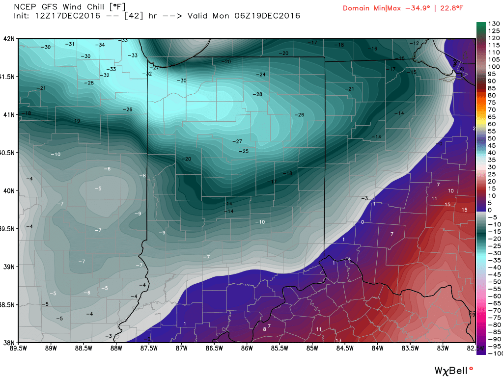
gfs_windchill_indy_8Areas of drizzle and freezing drizzle will continue across the region into the early afternoon, but begin to expand in coverage and intensity once again by evening.  Note the area of freezing rain expand across central IN, including Indianapolis, between 4p and 7p.
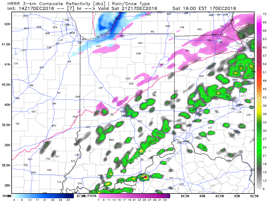
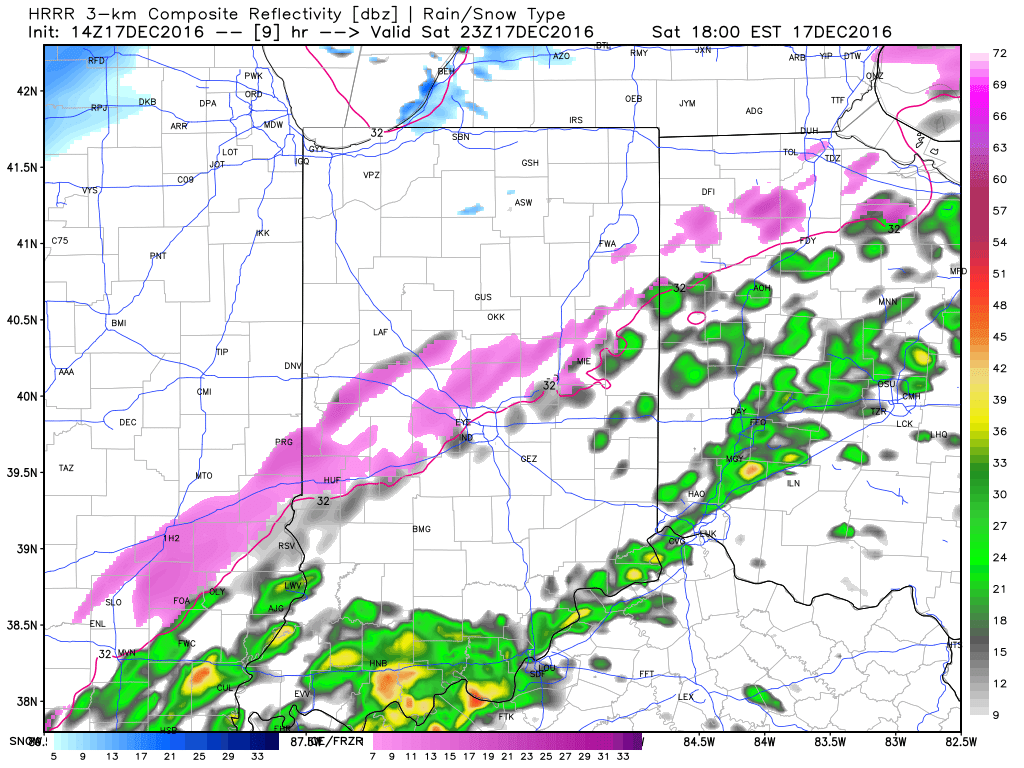
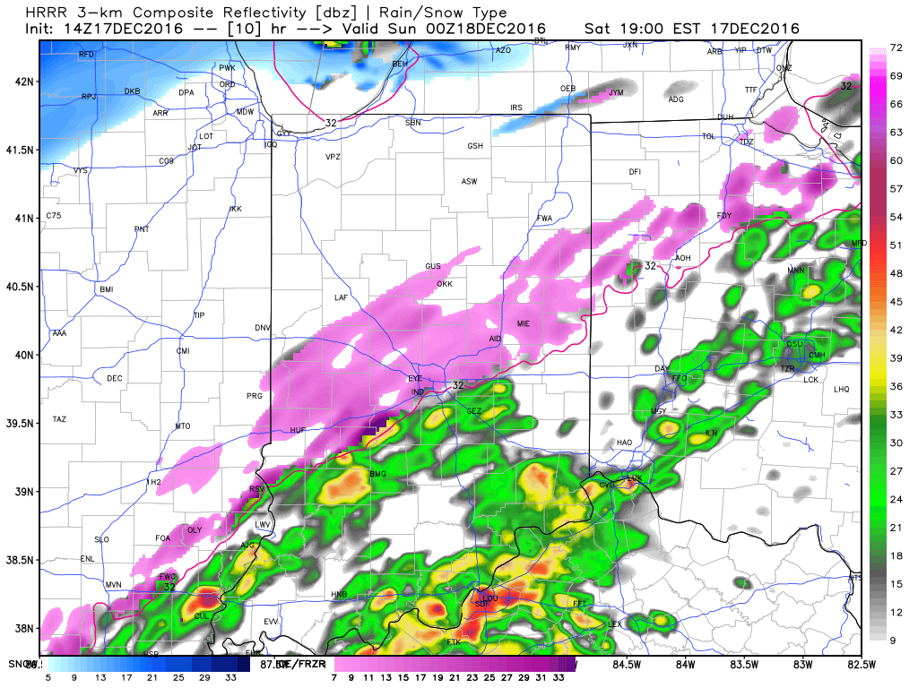
4p

6p

7pFreezing rain will eventually begin to mix with sleet and eventually transition to light snow during the overnight from northwest to southeast.  A coating of snow to less than 1″ is a good bet on the new icy glaze that develops tonight.
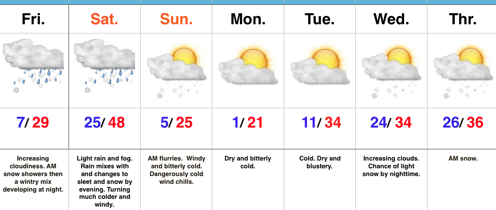
When you factor in the current hazardous conditions in place along with the fresh push of arctic air and precipitation tonight, it’s a good idea to hunker down inside and remain off area roadways.  We have big concerns of new travel problems developing by evening across central Indiana.  By this time tomorrow, our attention will turn to the bitterly cold air and dangerous wind chill values developing.

More later, including prospects of snow around Christmas.  As always, you can follow our updates on social media by following us on Twitter (@indywx) and Facebook.  Stay safe!


Permanent link to this article: https://indywx.com/2016/12/17/icy-concerns-grow-again-tonight/

Active Winter Pattern Rumbles Along…

screen-shot-2016-12-15-at-7-44-16-pmHighlights:

  • Busy weather weekend
  • Fresh shot of bitterly cold air
  • Christmas week snow chances

Buckle Up For A Busy Winter Pattern…Thursday featured the coldest December 15th high (13 degrees) in a whopping 27 years. Talk about impressive.  This was good for an amazing 26 degrees below average.  Let that sink in…

We’ll wrap up the work week and head into the busy weekend before Christmas with a new round of challenges.  A couple of warm fronts will lift north through central IN Friday.  Snow showers may accompany the first warm front early Friday before the second warm front lifts north Friday night.  This will result in more widespread wintry precipitation, likely to begin as a period of light snow before a quick transition to sleet and freezing drizzle during the overnight.  Temperatures will warm overnight Friday and precipitation will change to light rain Saturday morning.  That’s when our attention turns to the first of two cold fronts that will sweep through the state.  The first cold front will lead to a quick changeover to sleet and snow Saturday evening (thinking between 6p-8p as of now).  As a secondary wave of moisture moves northeast along the boundary, expect a light accumulation of snow Saturday night.  The second cold front (arctic) will blow through late Saturday night and early Sunday morning and lead to a frigid Sunday.  That 25 degree high you see Sunday will come at midnight as temperatures crash through the day.  Add in a stiff northwest wind and wind chill values will fall below zero (yet again) in the Sunday-Monday time frame.

We’ll briefly calm things down during the early Christmas week period and remain cold.  Our next storm system is slated for a mid week arrival and could deliver a round of accumulating snow Wednesday night into Thursday morning.  More on that after this weekend system.

Upcoming 7-Day Precipitation Forecast:

  • Snowfall: 2″ – 4″
  • Rainfall: 0.20″ – 0.40″

Permanent link to this article: https://indywx.com/2016/12/15/active-winter-pattern-rumbles-along/

“Not Fit For Man Nor Beast;” Winter Issues This Weekend…

screen-shot-2016-12-14-at-9-20-36-pmHighlights:

  • Bitter feel
  • Weekend storm
  • Reinforcing arctic air to open Christmas week

Heavy Winter Gear Required…An arctic cold front slammed into central IN Wednesday evening with plummeting temperatures, strong and gusty (40 MPH) winds, blowing snow, and just a downright “rude” feel.  Those bitter conditions will remain through the close of the work week, including dangerous wind chills Thursday.  In fact, we still expect wind chills to fall into the 10-20 degree below zero range through the morning, and remain below zero most of the day.

We’ll flip the page and turn our attention to our next storm system as we rumble into the weekend.  Clouds will increase Friday and moisture will begin to override the cold air locked in place at the surface by the evening and nighttime.  With sub-freezing air still present, this moisture will likely fall as a combination of sleet and freezing rain across central Indiana Friday night.  Eventually, temperatures will warm (briefly) above freezing Saturday morning and allow precipitation to transition to light rain.  Before that takes place, slick road conditions could develop Friday night from the sleet/ freezing rain mixture.  Needless to say, we’ll keep a close eye on the latest data as it comes in.

Almost as fast as we go above freezing Saturday, temperatures will begin to fall once again during the afternoon and evening as heavy, dense, arctic air “oozes” southeast.  As this is happening, a second wave of moisture will ride northeast along the pressing arctic cold front.  We expect precipitation to break out yet again Saturday evening and night, and fall as a wintry mix before ending as snow.  (Additional light ice and snow accumulation potential).

Temperatures will fall through the day Sunday along with strong and gusty NW winds.  Wind chills will once again fall below zero Sunday evening into Monday morning…

While the frigid conditions will “relax” as we go into the middle of Christmas week, we have an eyebrow raised for the potential of “fun and games” just beyond the current 7-day period.  Far too early for specifics, but the potential of wintry prospects around Christmas are alive and kicking…

Upcoming 7-Day Precipitation Forecast:

  • Rainfall:  0.25″ – 0.50″
  • Snowfall:  1″ – 2″


Permanent link to this article: https://indywx.com/2016/12/14/not-fit-for-man-nor-beast-winter-issues-this-weekend/

Wednesday Morning Weather Rambles…

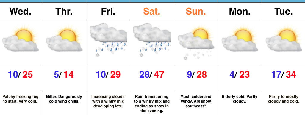
1.)  Talk about number-busting cold.  With a fresh snowpack and clear skies overnight, temperatures plummeted (even colder than some high resolution data suggested yesterday evening). Officially, it’s the coldest December morning in Indianapolis since Christmas Eve 2013.  We note even a few communities below zero (talking about you Crawfordsville, Zionsville, and Greenfield).

Even colder air rushes in tonight behind a secondary arctic cold front.  Expect an increase in cloudiness, scattered snow flurries, and strengthening NW winds by late afternoon and early evening.  As the reinforcing bitter air pours into the region, wind chill values will fall to 10-20 below zero tonight into Thursday morning.  That’s dangerous stuff, friends, and requires limited time outdoors.  The National Weather Service has issued a *Wind Chill Advisory* 10p this evening until 11a Thursday.

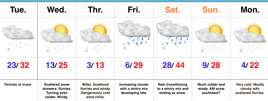
gfs_windchill_indy_62.)  Our next storm will approach Friday evening. Clouds will increase and thicken as the day gives way to evening and a wintry mix of snow, sleet, and freezing rain will overspread central IN Friday night.  With snow on the ground and the recent bitter blast, we have concerns the cold air won’t be “dislodged” as quickly as last weekend.  The end result may be a period of accumulating freezing rain/ sleet Friday night into early Saturday morning.  We’ll keep a close eye on things.
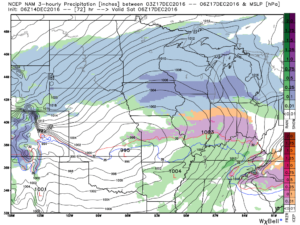
nam_ptype_slp_mc_25Regardless, icy precipitation will transition to rain during the day Saturday as temperatures briefly surge above freezing.  “Brief” is the key word there as temperatures plummet Saturday night, courtesy of fresh arctic air oozing back in.  A secondary wave of moisture may result in additional wintry issues Saturday night.  Additionally, with sharply colder air returning, “flash freeze” concerns loom Saturday night, as well.

3.)  Another “lobe” of arctic air will plunge into the area Saturday night and help set-up a frigid close to the weekend.  We’ll have to be on sub-zero watch again.

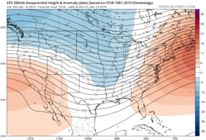
d44.)  Our attention then shifts to what may very well be an active Christmas week in the weather department.  We continue to think the frigid times of this week will relax.  That said, it’ll remain cold enough with a favorable storm track to result in wintry issues as Christmas nears.  Far too early for specifics with this 10+ days out, but keep it in the back of your mind that the weather pattern continues to look active and at least present a threat of wintry precipitation at times Christmas week.
ecmwf-ens_z500a_us_10

Permanent link to this article: https://indywx.com/2016/12/14/wednesday-morning-weather-rambles-2/

Bitter Times Ahead; Weekend Storm…

screen-shot-2016-12-13-at-6-20-11-pmHighlights:

  • Bitterly cold
  • Weekend storm delivers a little bit of everything
  • Cold reloads over the weekend

Cold That Hurts…Tuesday was a snowy day across central IN. Most snow reports checked in around 3″, but there were a few “lucky” folks who accumulated north of 4″.  Not bad at all!

Two pieces of arctic air will invade mid week.  The first piece is arriving on the scenes as we type this forecast Tuesday evening.  It’ll send lows into the single digits to lower teens by Wednesday morning.  Patchy freezing fog will also be noted in spots.  Needless to say, don’t get too confident on area roadways.  Despite the phenomenal work central IN road crews do (seriously, thank you), there will be icy spots tonight and Wednesday morning.  Slow down!  🙂

A second surge of arctic air will arrive Wednesday afternoon and evening.  Everyone gets in on the single digit party Wednesday night and Thursday morning.  In fact, don’t be surprised by a few folks checking in with a below zero report here and there.  Winds will be strong and gusty and lead to wind chill values of 10-20 below zero into Thursday morning.  Heavy winter attire will be required.

Our attention then shifts to a developing weekend storm that will deliver a wintry mix late Friday followed by a transition to rain as temperatures zoom (briefly) into the 40s Saturday.  The milder surge won’t last long as arctic air oozes back into central parts of the state Saturday afternoon and evening.  As this is happening, a second wave of moisture will ride up along the arctic front.  We expect rain to mix with and change to a wintry mix of sleet and freezing rain before ending as snow Saturday night/ early Sunday morning.  This may be another accumulating wintry event and we’ll keep a close eye on things.

Cold, dry weather will be with us as we kick off Christmas week.  Speaking of Christmas week, the bitterly cold air will “relax,” but the pattern remains active.  Despite the relaxation in the frigid times, conditions will remain cold enough for wintry potential leading up to, or around, Christmas…

Upcoming 7-Day Precipitation Forecast:

  • Snowfall: 1″ – 3″
  • Rainfall:  0.25″ – 0.50″

Permanent link to this article: https://indywx.com/2016/12/13/bitter-times-ahead-weekend-storm/

VIDEO: Snowy Tuesday…

Quickly touching base on what’s going to be a snowy Tuesday.  It’s a busy pattern, as mentioned, folks, so hunker down.  Bitterly cold air sets up shop for mid week…

You must be logged in to view this content. Click Here to become a member of IndyWX.com for full access.  Already a member of IndyWx.com All-Access?  Log-in here.

Permanent link to this article: https://indywx.com/2016/12/13/video-snowy-tuesday/

Snowy Tuesday; Bitter Mid Week Ahead…

screen-shot-2016-12-12-at-5-55-48-pmHighlights:

  • Snowy Tuesday
  • Bitter Mid Week
  • Weekend Storm

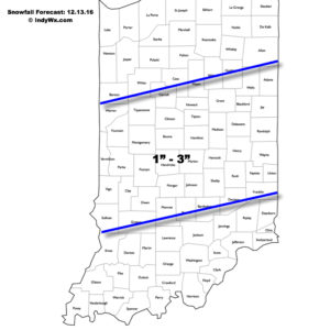
Accumulating Snow Event…Upper energy will combine with an approaching arctic front to lead to an accumulating snowfall event for many across central Indiana Tuesday.  We expect snow to increase in coverage and intensity just prior to sunrise before turning moderate to briefly heavy from mid to late morning on into the early afternoon hours.  In general, we paint a band of 1″-3″ through the heart of central Indiana, but do have some concerns localized banding features could result in a 4″ pop here and there (impossible to pinpoint the precise locations these bands may set-up across central IN as of this update).  Expect a messy morning commute.

121316snowfallforecastFresh arctic air will pour into the region tomorrow evening, along with a gusty NW wind.  Tuesday’s snow should be rather wet in nature so we don’t anticipate blowing/ drifting issues to result as the arctic hounds roar into town.  However, there will likely be periods of flurries and scattered snow showers as the bitterly cold air arrives in the Wednesday-Thursday time frame and this could lead to light additional coatings in spots.  The big weather story through mid and late week will be the bitter air.  “Air that hurts” is what we’re calling it and wind chill values will approach 20 degrees below zero Wednesday night/ Thursday morning.

Our next storm system is still slated to arrive for the weekend.  As of now we forecast snow and a wintry mix Friday evening.  This will then change to rain Saturday before arctic air quickly oozes back in here and leads to a potentially messy Saturday night-Sunday morning.  Rain will transition to freezing rain and sleet Saturday evening before ending as a period of snow.  It’s back to the ice box we’ve come to know all too well Sunday into Monday.

Upcoming 7-Day Precipitation Forecast:

  • Snowfall: 2″ – 5″
  • Rainfall: 0.50″

Permanent link to this article: https://indywx.com/2016/12/12/snowy-tuesday-bitter-mid-week-ahead/

VIDEO: Accumulating Snow Tuesday…

You must be logged in to view this content. Click Here to become a member of IndyWX.com for full access.  Already a member of IndyWx.com All-Access?  Log-in here.

Permanent link to this article: https://indywx.com/2016/12/12/video-accumulating-snow-tuesday/

IndyWx.com