September 2016 archive

Cool, Damp Open To The Weekend…

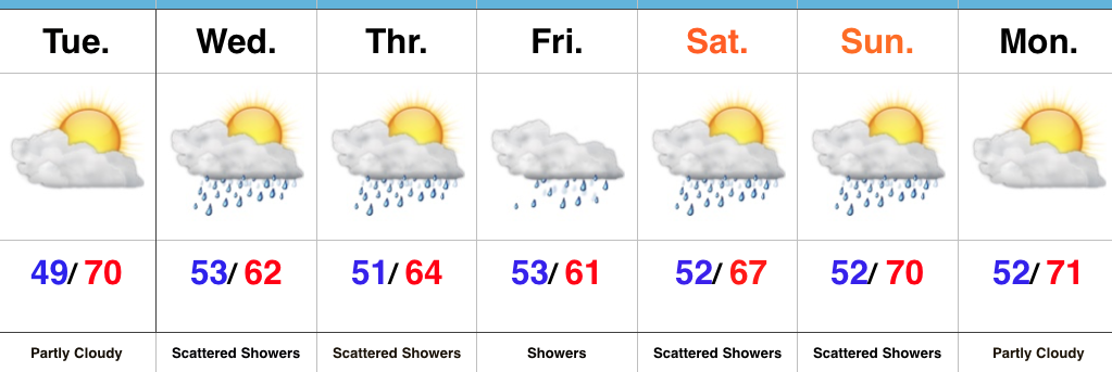
As we get set to open the weekend, our weather pattern remains unchanged from the past couple of days. The Ohio Valley will continue to be dominated by a cut off area of low pressure sitting and spinning overhead. Unseasonably cool air, along with periods of showers will be the result. Similar to Wednesday, stronger showers could contain small hail, particularly during the afternoon.

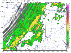
Steadiest and most concentrated rain appears to come during the morning hours Friday. Here’s what the radar may look like predawn and mid morning Friday. Rain will be tracking west or southwest (pivoting around the upper low).

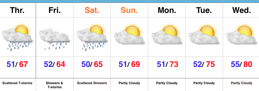
Additional scattered showers and embedded thunder will remain in our forecast Saturday.


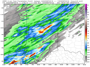
In general, additional rainfall should be in the 0.50″-1″ range, but there will be isolated heavier totals under more persistent rain bands.


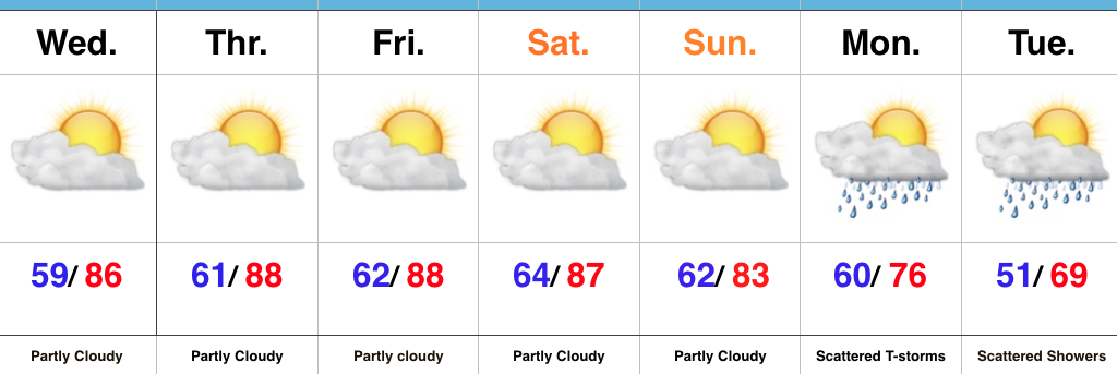
It’ll be a continued cool stretch with highs both Friday and Saturday in the mid 60s (at best).

The second half of the weekend certainly looks like the better of the two, but we caution that these cut off lows can be fickle and surprises can result in regards to timing. At any rate, a drier pattern will build in early next week, along with moderating temperatures. 

Looking ahead, a significant storm system looms just beyond the 7-day that will require our attention in the days ahead.

Permanent link to this article: https://indywx.com/2016/09/29/cool-damp-open-to-the-weekend/

Rinse And Repeat…

screen-shot-2016-09-28-at-8-43-04-pmHighlights:

  • Continued unsettled and unseasonably cool
  • Drier time arrives Sunday
  • Moderating temperatures early next week

Rinse And Repeat Pattern…Our weather pattern will be dominated by a “cut off” upper low through Saturday.  While it won’t rain the entire time, we’ll maintain mention of scattered showers and embedded thunderstorms each day.  It still appears as if Friday will serve up the most widespread rain coverage.  Similar to today, stronger thunderstorms could contain small hail, especially during the afternoon hours.  Temperatures will remain significantly cooler than normal through the period.

A drier regime will build in late this weekend into early next week. Ridging will continue to expand as we move into mid week with needed dry time and moderating temperatures.  Our next storm system appears to be slated for an arrival next Thursday.  Storms will accompany the front followed by much cooler air.

Upcoming 7-Day Precipitation Forecast:

  • Snowfall: 0.00″
  • Rainfall: 0.50″ – 1.00″

Permanent link to this article: https://indywx.com/2016/09/28/rinse-and-repeat/

Cool And Unsettled Is The Theme…

You must be logged in to view this content. Click Here to become a member of IndyWX.com for full access.  Already a member of IndyWx.com All-Access?  Log-in here.

Permanent link to this article: https://indywx.com/2016/09/28/cool-and-unsettled-is-the-theme/

VIDEO: Tuesday Morning Update…

You must be logged in to view this content. Click Here to become a member of IndyWX.com for full access.  Already a member of IndyWx.com All-Access?  Log-in here.

Permanent link to this article: https://indywx.com/2016/09/27/video-tuesday-morning-update/

Grab The Jacket…

screen-shot-2016-09-26-at-6-27-14-pmHighlights:

  • Tuesday sunshine gives way to increasing clouds
  • Unsettled, unseasonably cool stretch of weather ahead
  • Beginning to dry things out late in the weekend

Prolonged Stretch Of Unseasonably Cool; Unsettled Weather…A cold front swept through the region this morning with a round of showers and thunderstorms followed by a push of drastically drier and cooler air for the PM.  The coolest night since spring is dialed up with a mostly clear sky.  Many central IN neighborhoods should be in the mid/ upper 40s Tuesday morning.

Enjoy the sunshine Tuesday as clouds being to increase during the second half of the day.  A cut off upper level low will drop south and “meander” around our neck of the woods for mid and late week.  This will supply considerable cloudiness, periods of scattered showers, and unseasonably cool temperatures.  Even some small hail is possible (with the stronger showers) during the afternoon hours, thanks to the cold air aloft.

We’ll slowly begin to dry things out and allow temperatures to moderate heading through the back half of the weekend, continuing into early next week.

Upcoming 7-Day Precipitation Forecast:

  • Snowfall: 0.00″
  • Rainfall: 0.25″ – 0.75″

Permanent link to this article: https://indywx.com/2016/09/26/grab-the-jacket/

Time Is Ticking On Summer-Like Feel…

A cold front has it’s eyes set on Indiana and will pass through the state Monday morning.  Ahead of the front, scattered thunderstorms that we’re seeing on radar this evening (around 8p as we type this up) will transition into more widespread showers and embedded thunder during the wee morning hours Monday as the front moves through.

Forecast radar 7a Monday.

Forecast radar 7a Monday.

In general, rainfall totals should be around one half inch, but we do note some locally heavier totals can be expected where evening thunderstorms track.

Storm total rainfall should be around half an inch for most.

Storm total rainfall should be around half an inch for most.

Once the front blows through Monday morning, winds will shift to the northwest and help usher in a much cooler feel of things.  In fact, we expect highs tomorrow afternoon only in the upper 60s for most neighborhoods.  Temperatures will then fall quickly into the 40s tomorrow night.

It'll feel like fall tomorrow.

It’ll feel like fall tomorrow.

The majority of the upcoming work week will feel much more like fall, including an extended stretch of lows in the 40s to lower 50s and highs in the 60s.  We’ll have to keep a close eye on the late week forecast for rain prospects in association with a cut off upper low.  More details on that in the AM.  Make it a great evening.

An unseasonably cool week is dialed up.

An unseasonably cool week is dialed up.

Permanent link to this article: https://indywx.com/2016/09/25/time-is-ticking-on-summer-like-feel/

Changes Brewing…

screen-shot-2016-09-24-at-8-07-32-amHighlights:

  • Dry weekend
  • Rain arrives late Sunday night/ early Monday
  • Feeling much more like fall next week

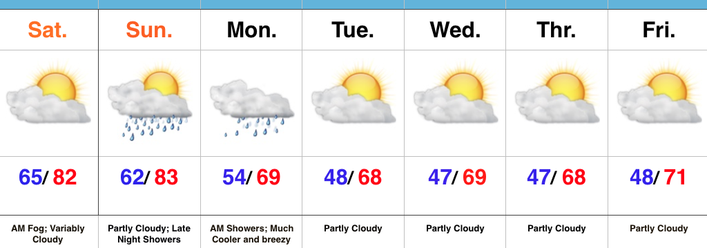
Heat Is Limited…Despite areas of low clouds and fog, we’re looking at a mostly dry weekend. A large temperature contrast will be noted from northeast parts of the state to the southwest corner this afternoon as a backdoor cold front continues to press south.  Showers will build in late Sunday night (well after most folks head to bed).  This is in association with an autumn cold front that will sweep through the region Monday morning.  Showers will continue through the morning hours before a northwest wind shift helps usher in a drier and much cooler air mass Monday afternoon.  You’ll want to reach for the jacket and your favorite pumpkin beverage Monday evening…

Unseasonably cool air will be with us for the balance of the upcoming work week, along with a northwest flow.  It’ll feel much more like fall and the cooler, drier air mass will really help ignite the fall color change across central IN.

Upcoming 7-Day Precipitation Forecast:

  • Snowfall: 0.00″
  • Rainfall: 0.25″ – 0.50″

Permanent link to this article: https://indywx.com/2016/09/24/changes-brewing-2/

Much Cooler Air On Deck…

screen-shot-2016-09-23-at-7-11-26-amHighlights:

  • Dry, warm close to the work week
  • Warm weekend
  • Much cooler air awaits

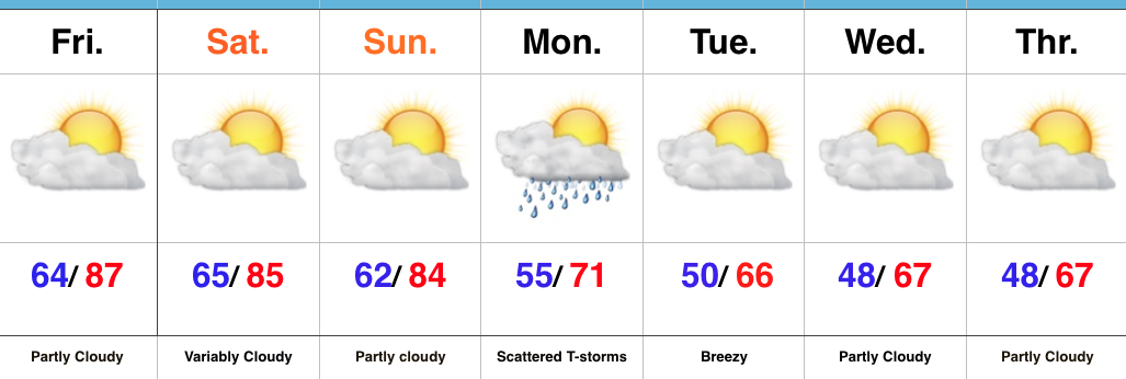
Summer Feel Gives Way To An Autumn Chill…A backdoor cold front will press into central IN over the weekend and will serve as a focal point for increased clouds at times (northern portions of the state today and more of central IN Saturday).  While an isolated to widely scattered shower is possible with this front, most will remain rain-free straight through the weekend.  Temperatures will remain well above normal across the region.

A stronger cold front will march towards the area to open the work week.  Showers and embedded thunder will accompany the frontal boundary as it pushes through the region.  We’ll then note a marked NW wind shift by evening and that will help usher in a true push of fall air.  A stretch of mornings with lows in the 40s and highs in the 60s during the day will take us through mid week.  Those cooler readings will really being to ignite the color change across central IN.

Upcoming 7-Day Precipitation Forecast:

  • Snowfall: 0.00″
  • Rainfall: 0.50″

Permanent link to this article: https://indywx.com/2016/09/23/much-cooler-air-on-deck/

Hot, Dry Pattern Continues For Now; MUCH Cooler Next Week…

The remainder of the work week and this weekend will remain dry and unseasonably warm.  Highs will generally be in the mid to upper 80s with overnight lows in the lower to middle 60s through the period. Strong ridging will keep us rain-free with plentiful sunshine.

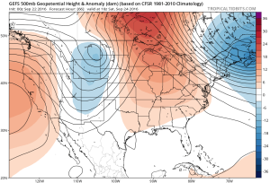
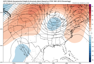
gfs-ens_z500a_us_12A “backdoor” cold front will approach the region from the northeast late in the weekend, but won’t have enough “umph” to push the drier, cooler air our friends across the northeast and mid Atlantic will enjoy our way.
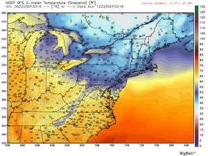
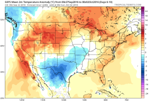
gfs_t2m_b_ma_14The evolution of the pattern from an unseasonably warm, dry regime to a much cooler, autumnal feel will, undoubtedly, feature showers and thunderstorms as we transition.  Modeling continues to waffle back and forth in regards to rainfall totals.  As of now, we’ll highlight Monday-Wednesday with increased rain chances.
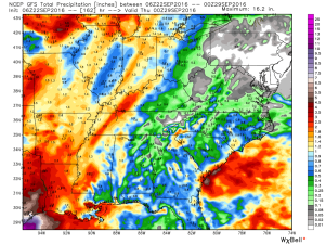
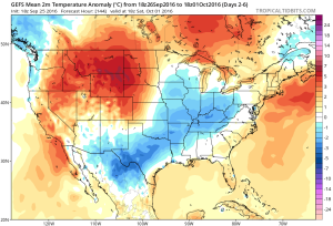
gfs_tprecip_ky_28Thereafter, we turn MUCH cooler.  Data suggests Tuesday-Friday features temperatures much more like we’d expect for late September.  Lows in the 45-50 degree range, along with highs between 65-70 can be expected.
gfs-ens_z500a_us_24

gfs-ens_t2mamean_us_6

Permanent link to this article: https://indywx.com/2016/09/22/hot-dry-pattern-continues-for-now-much-cooler-next-week/

Hot Now, But Changes Coming…

screen-shot-2016-09-21-at-7-53-41-amHighlights:

  • Warmth continues
  • Dry weather through the weekend
  • Timing issues early next week

Sunglasses Required…The first half of the period is as easy as the second half is difficult so we won’t waste any time on it.  Look for lots of sunshine, unseasonably warm temperatures, and dry conditions through the weekend.  A “backdoor” cold front will be close to the region Sunday, but the impact it has on our immediate region will be minimal.  Eastern portions of the state will experience a cooler second half of the weekend with a breezy easterly flow.

The challenging period arrives to open up the work week and the GFS and European couldn’t be further apart.  There’s a 48 hour difference between when the GFS slides the strong cold front through (Monday) and European (Wednesday).  You can imagine, the sensible weather differs from a continuation of the unseasonably warm and dry conditions until Wednesday (European) or a true blast of fall air arriving Monday (GFS).

For the purpose of this forecast, we’ll lean more towards the GFS.  While it hasn’t been perfect, it’s easy to argue it’s been handling things in a much more consistent manner than the European as of late.  Furthermore, when the European completely “lost” this front earlier in the week, the GFS at least kept the idea alive and kicking.  Now the European model is having to play “catch up.”  With all of that said, we expect the cold front to deliver scattered showers and thunderstorms Monday followed by a significant drop in temperatures Monday night.  Unsettled weather would continue Tuesday with the much cooler air.  Stay tuned.

Upcoming 7-Day Precipitation Forecast:

  • Snowfall: 0.00″
  • Rainfall: 0.50″ – 0.75″

Permanent link to this article: https://indywx.com/2016/09/21/hot-now-but-changes-coming/

IndyWx.com