 Highlights:
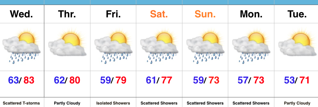
- Scattered Midweek Storms
- Cooler and unsettled this weekend
- Cooler than average open to next week
Haves And Have Nots…A cold front will move through the region Wednesday evening and result in scattered showers and thunderstorms, especially in the afternoon and evening hours. While there will be some localized heavy downpours, not everyone can expect heavy rain tomorrow. We’ll note a wind shift and drier air Thursday.
As we progress into the upcoming weekend, a trough will begin to carve itself out over the region. Not only will this provide a cooler air mass, but multiple upper level disturbances will track through the region, helping keep things rather unsettled at times this weekend into early next week. While we’re not talking about heavy rain, there will be rainy periods at times as these pieces of upper level energy move through.
Upcoming 7-Day Precipitation Forecast:
- Snowfall: 0.00″
- Rainfall: 0.50″-1.00″ (locally heavier totals)
