
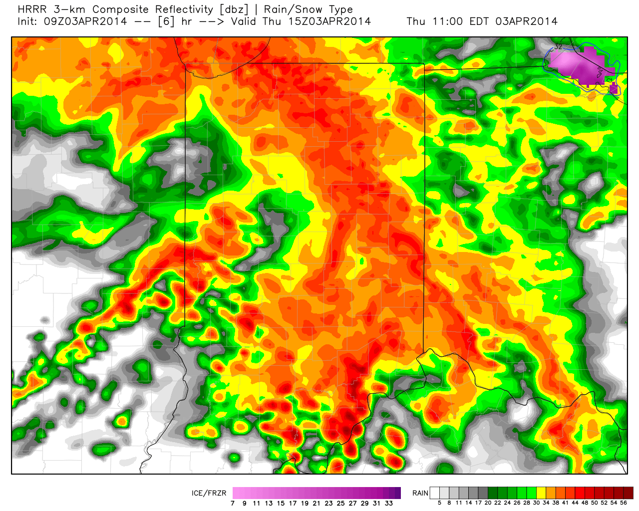
It’s a wet and stormy morning across central Indiana, including heavy rain and embedded stronger storms. The latest HRRR short-term data paints a continued stormy picture through the morning.
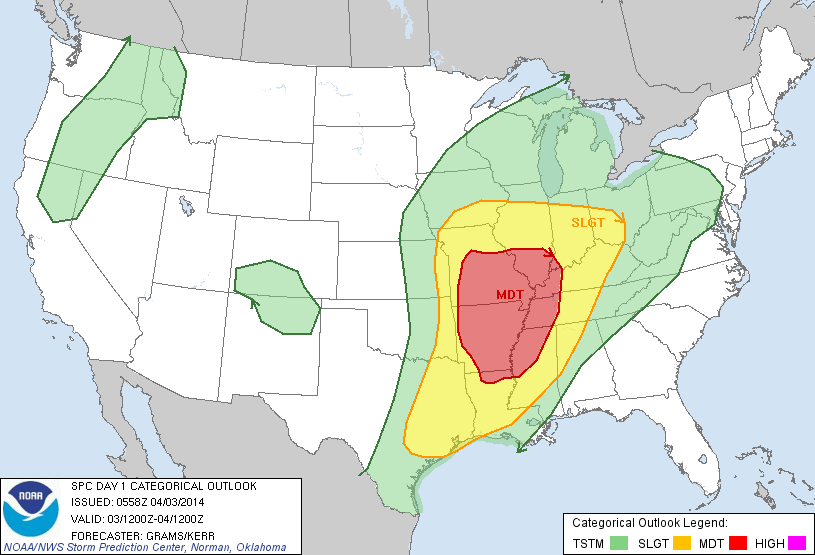
That said, we’ll get into some dry time late morning into the afternoon, but the atmosphere will be priming itself for another noisy night ahead. The Storm Prediction Center (SPC) outlines the region under a slight risk of severe weather, including damaging wind, damaging hail, and a potential tornado. The greatest risk of severe is to our south, but we must remain on our toes tonight into the wee morning hours Friday. Please keep your weather radios on alert mode tonight.
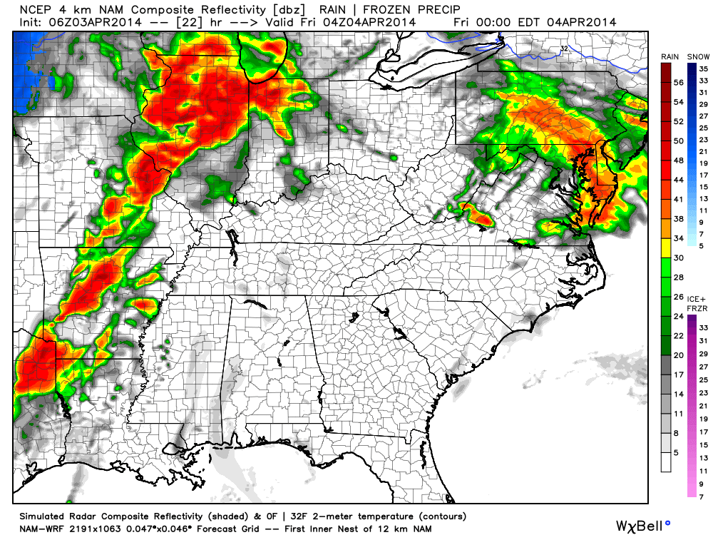
The simulated radar shows thunderstorms re-firing to our west late tonight, moving in during the overnight hours.
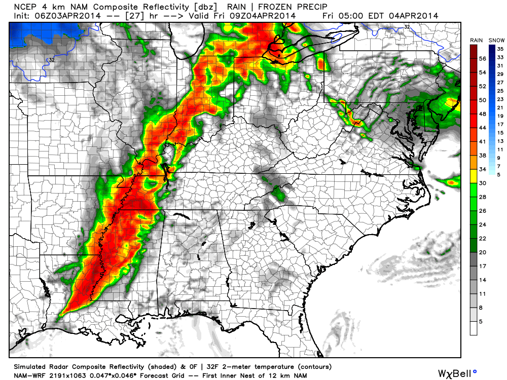
When all is said and done (and accounting Wednesday’s rain) we still forecast widespread 2-3″ of rain across the region, with locally heavier totals. Additionally, we bracket late tonight into the early Friday morning hours for the greatest chance of severe weather across our region. Hail and straight line wind damage are of the greatest concerns, but a tornado can’t be ruled out. The cold front will sweep the state clean Friday afternoon and help set up a very nice, although cooler, weekend.