 Highlights:
- Wintry weekend
- More widespread snow Sunday
- Reinforcing cold next week
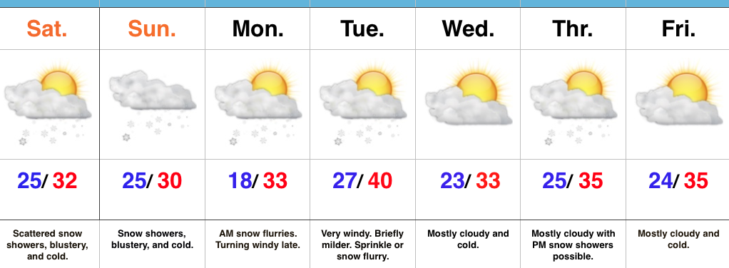
Scattered Snow Showers Turns To Steadier Snow Sunday…Upper level energy will continue to track across the region this weekend, setting off periods of snow showers and embedded heavier squalls (case in point this evening). The strongest upper level energy will pass Sunday evening and the result should be a period of more widespread snow Sunday- especially in the afternoon and evening. A light accumulation (1″-2″ potential) is possible.
The new work week will begin with early flurries Monday and then we’ll kick in a strong and gusty southwest wind Monday night, continuing into Tuesday. We’ll turn milder briefly Tuesday, but strong winds will remain. We’ll continue to monitor the Tuesday night-Wednesday morning period as some modeling wants to deliver a round of light snow with the reinforcing chill. We’ll give it another round of model runs, but we may need to hit snow a little harder in the Tuesday night period.
Another disturbance will race through the region Thursday with snow showers and then we’ll eye the potential of a stronger system next weekend…
Upcoming 7-Day Precipitation Forecast:
- Snowfall: 1″ – 3″
- Rainfall: 0.00″
