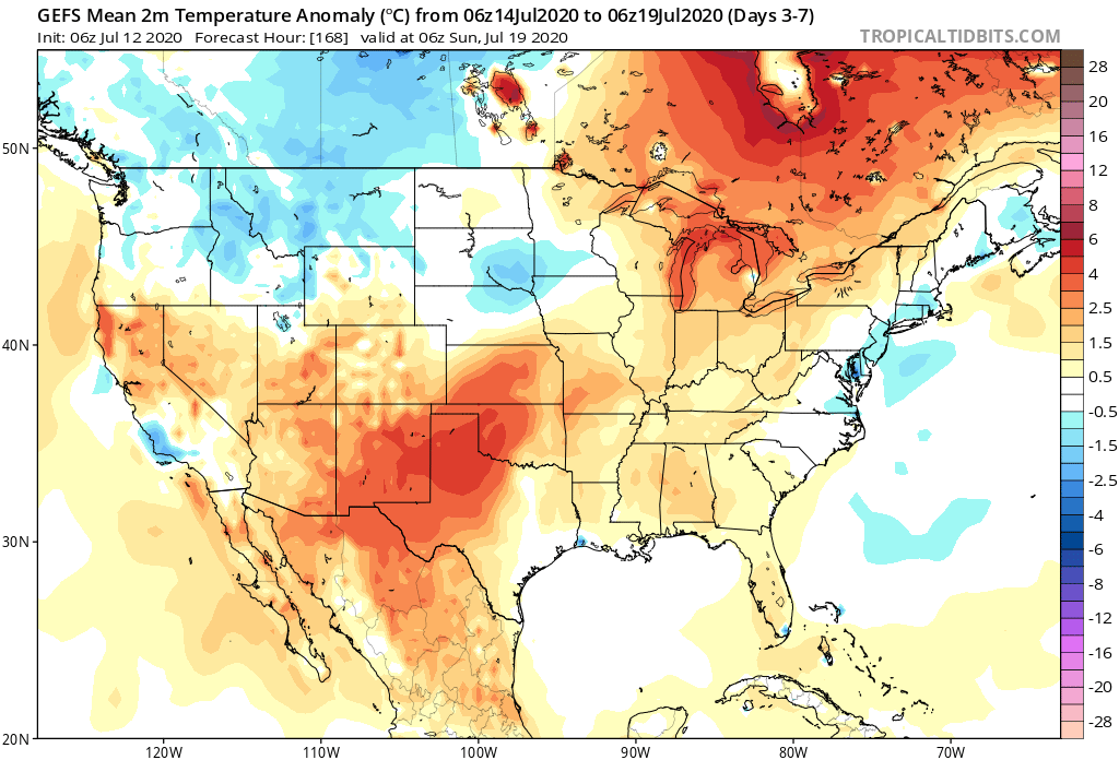
I. Heat and humidity builds as we move through the 2nd half of the week.
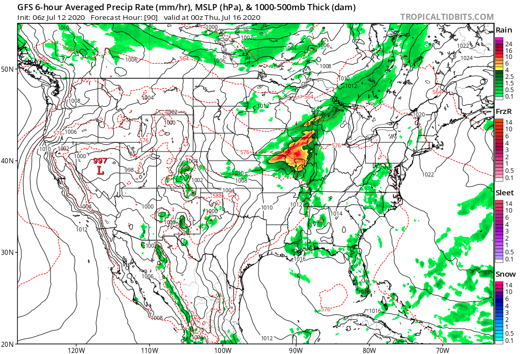
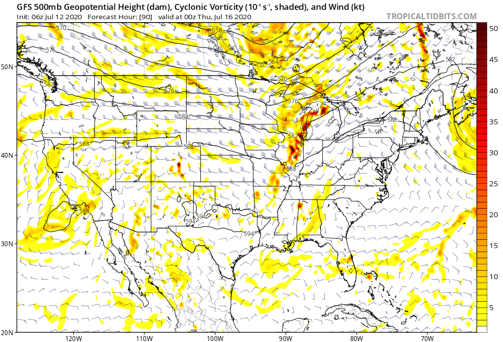
II. Pattern once again turns active and unsettled mid and late week.


Though the Storm Prediction Center doesn’t currently have a Day 4 severe weather risk highlighted, we need to keep close eyes on this feature for the potential of strong to severe thunderstorms late Wednesday. Large hail and damaging winds are of greatest concern.


Forecast Period: 07.12.20 through 07.19.20
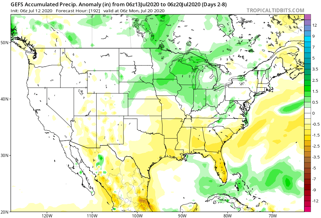
Additional scattered showers and thunderstorms will fire today but shouldn’t be nearly as intense or widespread as what last night delivered. We’ll then welcome a couple of days of cooler, less humid air with dry conditions. Enjoy as the heat, humidity, and storms will return by midweek. In fact, as mentioned above, the potential is present for some stronger storms late Wednesday and it wouldn’t surprise us if the Storm Prediction Center includes portions of the region in a severe weather risk over the next day or two for this threat. This will come on the leading edge of hotter and more humid weather for the 2nd half of the week, continuing into next weekend. As we look longer range (Week 2 time frame), the upper level ridge is expected to retrograde west and open us up to a northwesterly flow aloft. There are strong signals this will lead to a rather busy time of things as we wrap up July, including above to well above average rainfall. Before this takes place, we’re likely looking at another 6-7 day stretch of highs in the lower 90s.
