1.) Talk about number-busting cold. With a fresh snowpack and clear skies overnight, temperatures plummeted (even colder than some high resolution data suggested yesterday evening). Officially, it’s the coldest December morning in Indianapolis since Christmas Eve 2013. We note even a few communities below zero (talking about you Crawfordsville, Zionsville, and Greenfield).
Even colder air rushes in tonight behind a secondary arctic cold front. Expect an increase in cloudiness, scattered snow flurries, and strengthening NW winds by late afternoon and early evening. As the reinforcing bitter air pours into the region, wind chill values will fall to 10-20 below zero tonight into Thursday morning. That’s dangerous stuff, friends, and requires limited time outdoors. The National Weather Service has issued a *Wind Chill Advisory* 10p this evening until 11a Thursday.
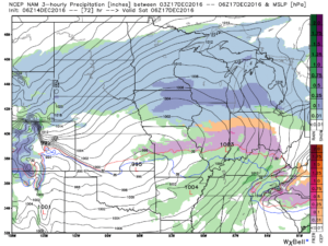
 2.) Our next storm will approach Friday evening. Clouds will increase and thicken as the day gives way to evening and a wintry mix of snow, sleet, and freezing rain will overspread central IN Friday night. With snow on the ground and the recent bitter blast, we have concerns the cold air won’t be “dislodged” as quickly as last weekend. The end result may be a period of accumulating freezing rain/ sleet Friday night into early Saturday morning. We’ll keep a close eye on things.
 Regardless, icy precipitation will transition to rain during the day Saturday as temperatures briefly surge above freezing. “Brief” is the key word there as temperatures plummet Saturday night, courtesy of fresh arctic air oozing back in. A secondary wave of moisture may result in additional wintry issues Saturday night. Additionally, with sharply colder air returning, “flash freeze” concerns loom Saturday night, as well.
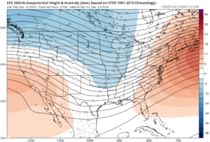
3.) Another “lobe” of arctic air will plunge into the area Saturday night and help set-up a frigid close to the weekend. We’ll have to be on sub-zero watch again.
 4.) Our attention then shifts to what may very well be an active Christmas week in the weather department. We continue to think the frigid times of this week will relax. That said, it’ll remain cold enough with a favorable storm track to result in wintry issues as Christmas nears. Far too early for specifics with this 10+ days out, but keep it in the back of your mind that the weather pattern continues to look active and at least present a threat of wintry precipitation at times Christmas week.

