 Highlights:
- Warm SW winds
- Cooler air arrives mid week with rain
- Much cooler to close the week
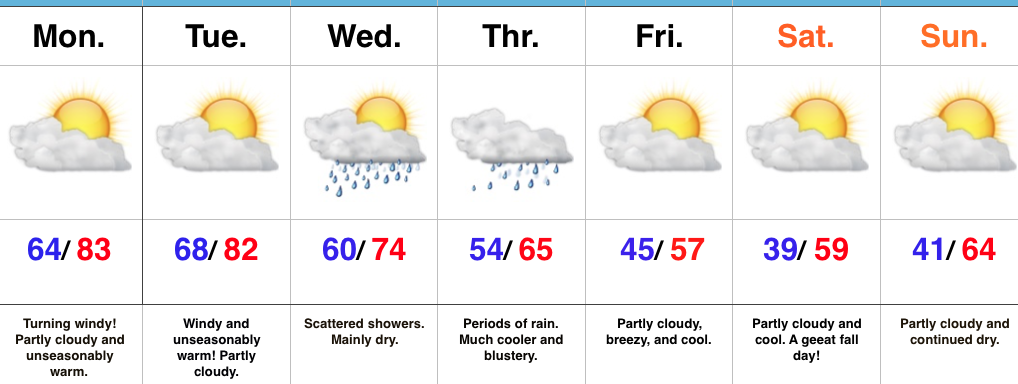
A Little Something For Everyone…The big story over the next 24-48 hours will be unseasonably warm temperatures, but equally as impressive, strong and gusty winds (30-40MPH). Enjoy the extended period of shorts and short sleeves, but please note a “big hair warning” is in effect through Tuesday night. 🙂
A cold front will slip through the state Wednesday (from north to south) and could spark a scattered shower as it drifts south. Eventually the front will stall along the KY border. This is in response to an area of low pressure developing to our southwest. The surface low will lift northeast and help spread widespread soaking rain across the state Thursday. Additionally, we’ll note a much cooler air mass and winds that will shift around to the north in the PM, helping drive a much cooler close to the week. Moderate to locally heavy rainfall can be expected Thursday.
As we get set to put a wrap on the week, we’ll get back to weather we’d expect for this time of year: dry, cool, and crisp! In fact, patchy frost is possible Saturday morning across outlying areas away from the city.
Upcoming 7-Day Precipitation Forecast:
- Snowfall: 0.00″
- Rainfall: 1.00″ – 1.50″
