 Highlights:
- Heavy rain
- Unseasonably cool
- Turning warmer
- Active, stormy time later in the week
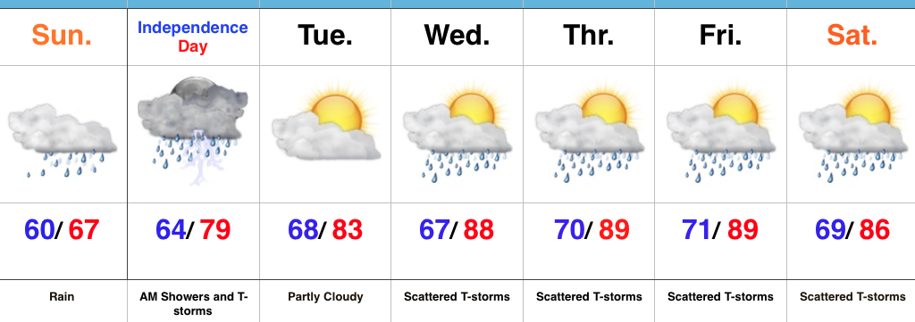
Jacket And Rain Gear Needed…The first of two rounds of widespread, soaking rains is pushing across central IN this morning. Periods of moderate to heavy rains will develop later tonight as round two arrives on the scene. Localized flooding is likely tonight and Monday morning. The overall set-up is one that features a stationary front draped across the region with ripples of energy (low pressure) moving along the boundary. In addition to the wet weather, this will also set up quite the temperature gradient across the state today. Here across central IN, jackets will be needed all day with highs struggling to climb much out of the middle 60s. Downstate, temperatures will zoom into the 80s with a severe component added into the mix tonight for southern IN (with the focus primarily being straight line winds).
Showers and thunderstorms will continue Independence Day, but we’re still hopeful in thinking we begin to dry things out for the afternoon and evening. That’s great news for the fireworks and festivities planned tomorrow evening.
We begin to heat things back up and add storms into the mix for mid and late week as the region gets into an active NW flow regime. The potential is there for a couple of rather noisy storm complexes later this week. We’ll keep a close eye on things.
Upcoming 7-Day Precipitation Forecast:
- Snowfall: 0.00″
- Rainfall: 3.5″-4.5″ (locally heavier amounts)
