 Highlights:
- Unsettled open to the week
- Turning colder Tuesday
- Couple snow chances, but low confidence
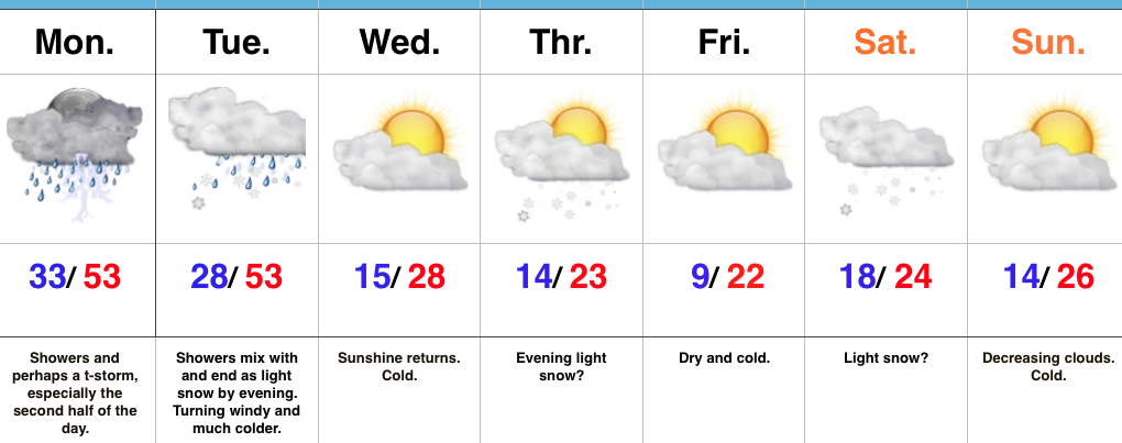
Wet Open To The Week…Clouds waited to increase until after sunset Sunday and the more than expected sunshine led to a downright beauty of a kickoff to 2017, complete with mild temperatures. Unfortunately, those pleasant conditions won’t last as we deal with increasing coverage of showers and perhaps a thunderstorm Monday. Rain coverage appears greatest during the evening into the nighttime hours.
An arctic cold front will sweep through the state Tuesday afternoon and lead to a dramatic temperature plunge for the rest of the week. Showers Tuesday will end as a touch of wet snow before precipitation moves out.
Forecast models are still struggling with handling Pacific energy for mid and late week. This is leading to a lower than normal confidence level with two potential systems Thursday and again Saturday. For now, we’re eyeing the threat of light snow with both and believe modeling will come around to more of a weather maker once time draws closer. Stay tuned. Cold weather remains as we progress through next weekend.
Upcoming 7-Day Precipitation Forecast:
- Snowfall: 1″ – 3″
- Rainfall: 0.50″ – 1.00″
