With the unseasonable warmth this week, our thoughts begin to shift to the coming spring months ahead. Of course with spring comes the potential of storms- some of which include severe weather outbreaks.
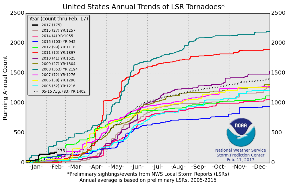
Already, 2017 has wasted no time in the tornado department, year-to-date- more than double the (10) year average across the United States.
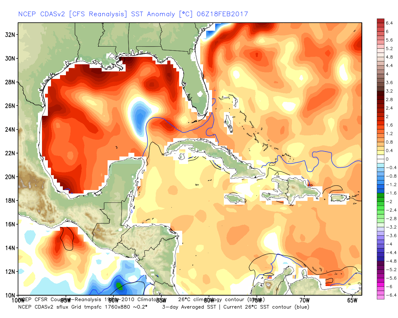
 The Gulf of Mexico is boiling warm (running 1°-3° C above normal) and this will aid in transporting moisture-rich air north. As storms eject out of the Rockies and Plains, one would tend to believe anomalously warm dew points and precipitable water values will be available.
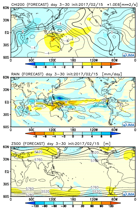
 The JMA Weeklies show an active stretch developing as we progress through the next few weeks.
 As we rumble deeper into the spring months, the mean trough position should be located across the west. The end result should be a mean storm track that runs into the Ohio Valley- courtesy of resistance from an eastern ridge (that warm water in the Gulf and East Coast screams the mean ridge position should be located across the east coast). Confidence is greater than normal on a busy severe weather season.
Much more later as spring evolves.
