While we still have a few weeks left of meteorological summer, we’re hard at work finalizing our fall outlook and prep continues for winter. By the way, our fall outlook will be online Friday morning, the 28th.
From this distance, there’s obviously a risk involved with seasonal data that we’re reviewing and tweaks (particularly to the initial winter idea) will undoubtedly have to be made. In short, we anticipate a weak La Niña to dominate the fall and winter, with a robust MJO.
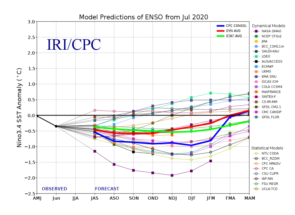
Of course, it’s important to remember, no La Niña is like the other and a simple “broad brush” approach never works.
Without question, the tropics will claim headlines through the fall. Unfortunately, like others, we anticipate a significant uptick in activity late August into October. A few major hurricanes are likely, as well. The Gulf of Mexico and Carolina coast appears particularly vulnerable…

Most computer model data is leaning towards a warm autumn. We’d agree, overall, but leaning wetter than the majority of data right now, due in large part to tropical impacts.
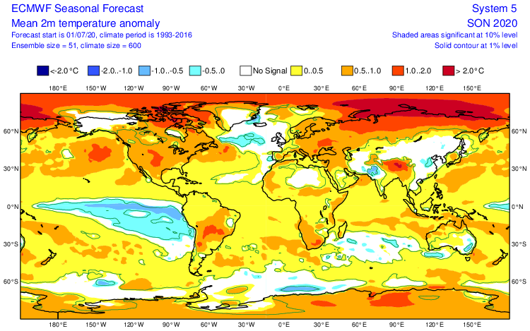
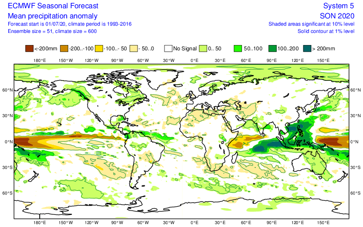
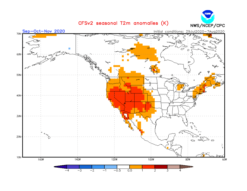
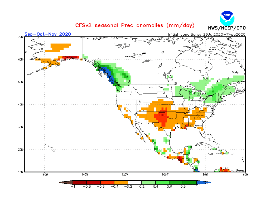

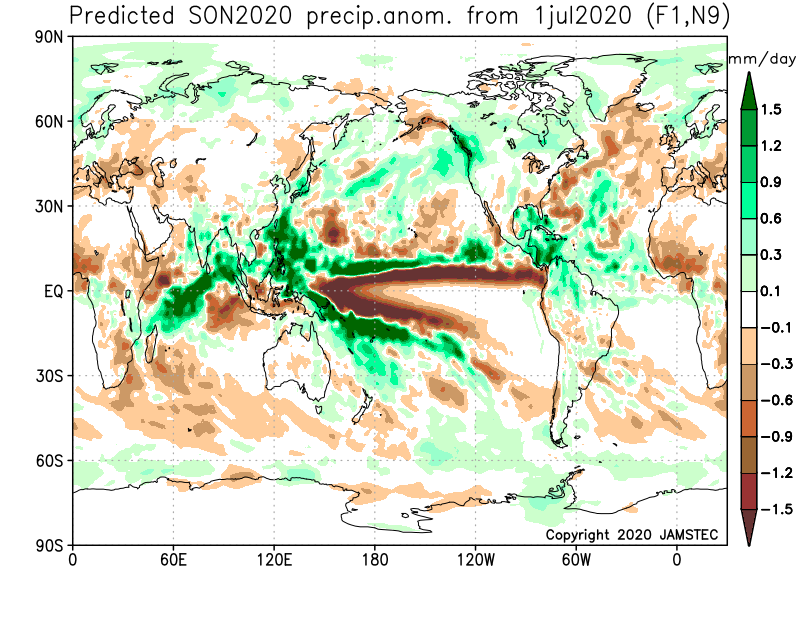
The coolest of the seasonal data is the CFSv2. It’s easy to interpret a cooler Central and East if the ridge and associated heat is so strong across the West. We will keep close tabs on trends over the next few weeks. Nina falls are notorious for at least a few weeks early on of unseasonably cool weather as well. Stay tuned.
As for winter, from this distance we’re bullish on a wetter, warmer than normal season, locally. Below normal snowfall is expected as of now. A dominant southeast ridge is expected to carry the day, at times flexing north into the TN and Ohio Valley.


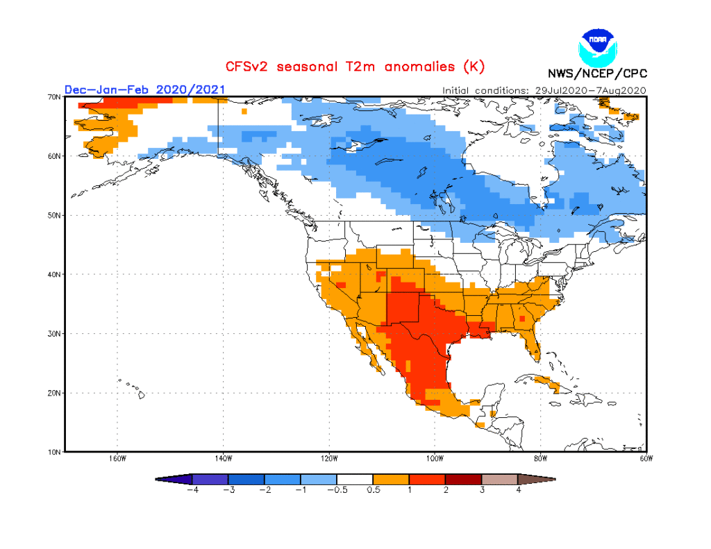
Interesting, like fall, the CFSv2 is the “coolest” of the big 3 seasonal models. Again, we’ll continue to keep close eyes on trends. Given performance of recent winters past, you may say I’ll just go with the opposite of what these seasonal models say. You’d have good reason for doing so. Unfortunately, that southeast ridge almost seems like a lock though. It’s also becoming more difficult to ignore the trends over the past decade or two.
Much more later on both fall and winter! Enjoy your Sunday!
