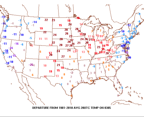
1.) It’s another unseasonably pleasant afternoon across central Indiana. Despite a gusty SW breeze (open county is approaching 40 MPH throughout central IN Sunday afternoon), the sunshine and warm temperatures are providing a phenomenal second half of the weekend.

Temperatures are running 20+ degrees above normal this afternoon.
2.) Clouds will begin to increase tonight and give way to showers as we open the work week. There will be plenty of dry time Monday morning into the afternoon, but a passing shower will remain in our forecast. Heavier rain and embedded thunderstorms will arrive on the scene Monday night into the wee morning hours Tuesday. As a whole, we expect between 0.50-1″ of rain, overall, by Tuesday morning.

Greatest rainfall coverage will arrive overnight Monday night.
3.) We’ll trend cooler for the mid week stretch, but nothing “cold” for this time of year. In fact, temperatures will remain above average as high pressure provides dry conditions.

Weak high pressure builds in for mid week.
4.) Confidence is high on an active period of weather arriving for the weekend into potentially early parts of next week. That said, despite overall high confidence on a busy time of things, the specifics remain “murky,” at best. It’ll be important to check back for updates on the weekend forecast as we progress through the upcoming week. Solutions range anywhere from a period of rain and storms to possibly some wintry “mischief.” One thing seems certain and that’s for a period of colder air (below normal) arriving in the 8-10 day period. In fact, the latest European model suggests overnight low in the 10s late next weekend.

The weather turns active next weekend.
