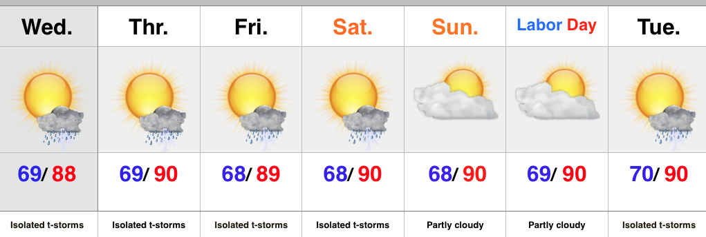
- Isolated slow moving storms
- Hot and humid air mass remains
- Stagnant pattern
An upper level disturbance will push slowly east into Ohio Wednesday, but will remain close enough to have some impact on our local weather. Coverage of storms won’t be as widespread as those of today, but we’ll likely see a few slow moving, strong storms develop across central IN all the same.
We’ll maintain mention of isolated storms into the weekend, but the big weather story will be the unseasonably hot and humid air mass in place. It’s all part of the big weather picture that includes a strengthening high pressure ridge (hot dome) over the Lakes and SE Canada as we rumble into the long holiday weekend.
Looking ahead, there are indications that more active times are around the corner once to mid month.
Upcoming 7-Day Rainfall Forecast: 0.25″ – 0.50″ (locally heavier totals)
Storms rumbled across portions of central IN today, but the “@cryptics cam” caught a glorious sunset from Danville this evening.


