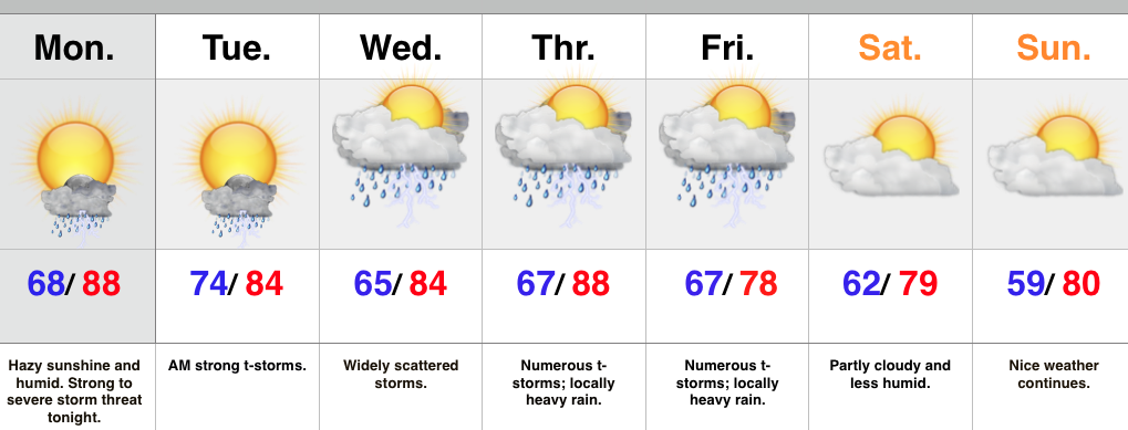
- Strong to severe t-storm potential tonight-Tuesday morning
- More widespread rain and storms late week.
- Much drier and less humid this weekend.
We’re off to a warm, humid, and hazy start to the day and most of your Monday will be a dry one. That said, all eyes will be to our NW as we eye thunderstorm complexes that will gain strength this afternoon and evening before tracking southeast. One storm complex will likely target the northern half of the state late tonight and on into the wee morning hours Tuesday. Damaging wind, vivid lightning, and localized flooding are of greatest concern.
Typical “splash and dash” storm coverage will be with us during the mid week period before a cold front delivers more widespread rain and storms for late week. Locally heavy rain will accompany this front. As of now, the timing couldn’t be better. We anticipate a much drier regime to blow into town behind the cold front, setting the stage for a beautiful weekend.
Upcoming 7-Day Rainfall Forecast: 2″ – 2.5″

