 Highlights:
- Dense morning fog
- Tuesday showers
- Severe potential Friday
- Much colder this weekend
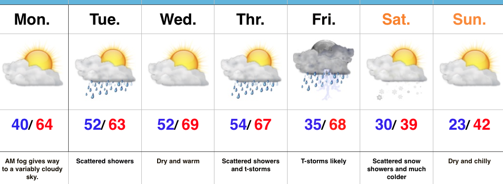
Two Seasons This Week…We’re starting the work week with dense fog across central Indiana. This will eventually burn off to a variably cloudy sky by afternoon, along with continued unseasonably warm temperatures.
A weak weather system will press through the state Tuesday and this will help lead to a period of showers Tuesday morning into the early afternoon hours. This won’t be a big event (most neighborhoods should accumulate between 0.10″-0.25″ of rain), but plan to pack the rain gear as you leave the house Tuesday morning.
A much stronger storm system will impact the region Thursday into Friday. As strong low pressure passes by to our northwest it’ll help pull anomalously warm, moist air northward Friday. Strong to severe thunderstorms may occur along the strong cold front that will pass late Friday. While we still have time to “fine tune” details on timing, early thinking would place greatest emphasis on large hail and damaging wind potential. Stay tuned.
Much colder air will hit with authority Friday night and set-up a wintry weekend. The spring-like feel of this past weekend will be all but a distant memory and flurries may fly Saturday morning in the colder, blustery air.
Upcoming 7-Day Precipitation Forecast:
- Snowfall: Trace
- Rainfall: 0.50″ – 1.00″
