Latest data in house still suggests a plowable snow is ahead for most of central Indiana this weekend. We think wintry precipitation expands northeast to encompass all of the region between 7pm-9pm Friday evening (southwest to northeast). This wintry precipitation still appears to take the form of all snow for IND and points north, but we caution that south-central Indiana communities will have to deal with a mixed bag of precipitation, including sleet and perhaps some freezing rain along with the snow. The primary snow zone will have no trouble seeing snow amounts of 4-5 inches, but for south-central Indiana neighborhoods, snowfall accumulations appear to be closer to 2 inches, with additional accumulations of sleet also possible. Needless to say, we feel pretty good about our initial snowfall forecast posted last night in our 7-Day forecast video (always available to the right of these posts in the video player). The limiting factor, in our opinion, of even higher snowfall totals will be due to the speed of the system. We think this is primarily a quick 6-8 hour “thump and go” type snow storm followed by some lingering light snow/ snow showers and gusty winds Saturday PM. The sunshine returns for Sunday along with another surge of bitterly cold air with highs in the 20s.
Friday night-Saturday Snow Storm Highlights:
- Wintry precipitation arrives between 7p-9p Friday across central Indiana.
- Primarily all snow from Indianapolis and points north
- Mixed precipitation south of IND will include sleet and freezing rain
- Snowfall accumulations of around 2″ south-central Indiana, increasing to 4-5″ amounts along and north of the I-70 corridor.
- Accumulating snow tapers off late Saturday morning.
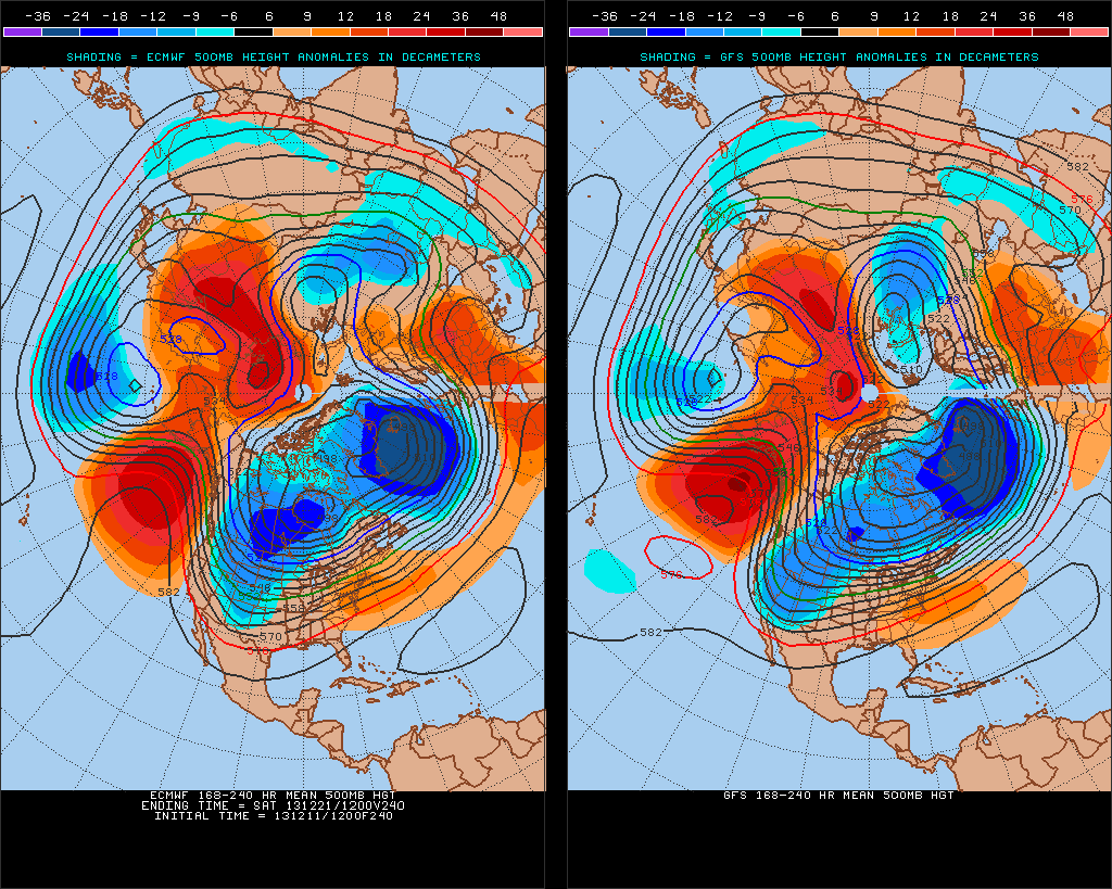
Our attention then turns to what may lie ahead Christmas week. After the chance of some brief “relaxation” from the current bitterly cold pattern, we look to reload the cold with authority around Christmas week. In fact, if latest data comes to fruition, the current cold would pale in comparison to what lies ahead. Additionally, a rather significant storm system could precede the arctic blast. It’s far too early to talk specifics on precipitation type or amounts, but don’t be surprised if a storm of “significance” is on the maps as we approach Christmas week…
The latest ensemble plot from the GFS and European (below) agree on first class cross-polar flow setting up shop, which will help refrigerate the Lower 48 with some seriously bitter air just in time for Christmas. Stay tuned…

