 Highlights:
- Prolonged period of scattered snow showers
- Much colder and windy
- Winter returns
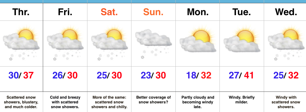
Scattered Snow Showers; Steadier Snow Sunday? Let’s cut right to the point: The January “thaw” is over. Yes, it was nice while it lasted, but we all knew it couldn’t continue (right?)! 😉
A much colder brand of air will be with us as we close the work week and head into the weekend. Additionally, upper level energy will keep periods of snow showers in our forecast. A more vigorous piece of upper level energy will push southeast to close the weekend and this should create more widespread snow showers. We’ll “enjoy” a colder and blustery weekend.
As the dawn of a new work week arrives, the weather will slowly improve. Colder than normal conditions will remain, but we’ll return to dry conditions Monday.
Our next system will pass Tuesday with gusty winds and colder air for mid week, complete with a return of snow showers.
Looking for potential of “more significant” snow? That may loom just past the current forecast period…
Upcoming 7-Day Precipitation Forecast:
- Snowfall: 1″ – 2″
- Rainfall: 0.00″
