 Highlights:
- Scattered t-storm chances return
- Mostly dry, pleasant weekend
- Rain chances return early next week
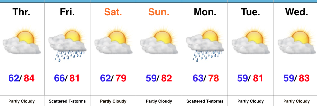
Frontal Boundary Moves In Friday…Another sunny, pleasant late-summer day is on tap before a cold front approaches late tonight. This frontal boundary will be responsible for creating scattered thunderstorms Friday across central IN. Current indications suggest rain won’t be widespread or particularly heavy, but don’t be surprised by a local downpour or two as we wrap up the work week.
Dry and pleasant weather will return over the weekend, complete with plentiful sunshine. Our next storm system approaches Sunday night into Monday with the potential of more widespread rain. With that said, there’s considerable model disagreement with regard to overall rain coverage and amounts Monday (European is the most aggressive with widespread rain). We’ll go with a blend of the two for now (scattered thunderstorm chances) and hope for better agreement later today. We’ll provide updates after taking a good look at 12z data.
Upcoming 7-Day Precipitation Forecast:
- Snowfall: 0.00″
- Rainfall: 0.50″ – 1.00″
