 Highlights:
- Rain turns heavy tonight; Storm threat, too
- Trending colder to open December
- Next storm arrives over the weekend
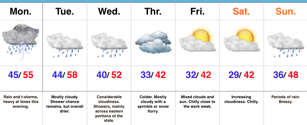
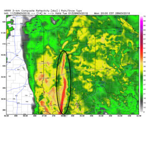
A Wet Kick-Off To The Work Week…Moisture is streaming northeast over the Hoosier state this morning and this is really just the beginning of a wet and, eventually, stormy open to the work week. We may see a brief “lull” in the rain around the lunchtime hour, but heavy rain will increase in coverage this evening and continue into tonight. Additionally, we’ll introduce thunder into the mix this evening. In fact, some of the higher resolution, short-term, forecast models hint at a skinny line of thunderstorms that may impact central IN tonight. Strong wind gusts are of biggest concern with this line. Here’s an idea of what the radar may look like around 8p.
 Considerable cloudiness will remain Tuesday and Wednesday, but both days will be much drier than today. A secondary wave of low pressure will move northeast along a pressing cold front Wednesday. Best rain chances Wednesday will fall across eastern sections of the viewing area.
The second half of the week will trend colder. A sprinkle or flurry is possible Thursday. The next storm we’re tracking will arrive over the weekend. Clouds increase Saturday and Sunday offers up the next good chance of rain. Though details are sketchy at this point, the prospects of a storm system with more wintry significance may arrive just beyond the 7-day period. Stay tuned. December is looking quite active and wintry…
Upcoming 7-Day Precipitation Forecast:
- Snowfall: Trace
- Rainfall: 1.50″ – 2.00″
