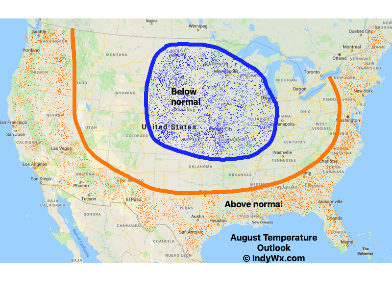
The short-term period will be dominated by a cooler than normal theme as we put the final touches on August and open September.

This will only serve to push those already below normal for the month even cooler than average and turn a lot of the area bordering these cool anomalies “over the top” from seasonal to slightly cooler than normal by month’s end. Meanwhile, warmth will continue to dominate along the coasts
Here’s a look at month-to-date temperature anomalies, compared to our initial August forecast (issued July 21st).


The negative EPO suggests any sort of warmth will be hard to come by and transitional through the 1st 1/3 of the month.

After a wet time of things as of late, we’ll dry things out the middle part of the week. A couple of moisture-starved and rather weak systems may lead to scattered showers Friday and again at times over the holiday weekend, but significant rain isn’t anticipated. We would agree with the drier than average theme displayed from the most recent CFSv2 Weekly product to open September:

The one potential “fly in the ointment” to the dry open to September would be whatever comes from current Tropical Storm Dorian (moving through the Windward Islands as of this update). There’s relatively good model agreement that Dorian will move northwest and eventually be in a position to impact the eastern Florida coastline by the Labor Day weekend as a Tropical Storm.

It’s far too early to speculate from this point, but the pattern may promote Dorian to then track into the Gulf of Mexico. While unlikely Dorian’s remnant moisture ever impacts our immediate region, this will be something that we’ll keep an eye on over the next week to 10 days.
