
You must be logged in to view this content. Click Here to become a member of IndyWX.com for full access. Already a member of IndyWx.com All-Access? Log-in here.
Permanent link to this article: https://indywx.com/tuesday-evening-video-update-4/
Nov 17
Couple Storms To Watch And Much Colder Air…
 Highlights:
- Periods of rain
- Turning cooler
- Next storm offers up wintry precipitation for parts of the state
- Early arctic blast
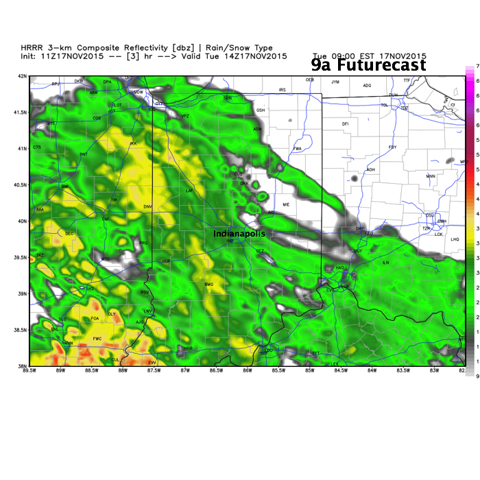
Periods of rain will continue into the mid to late afternoon across central IN as “wave 2” of our current storm system moves through. We’ve added a couple simulated radar images below, courtesy of Weatherbell.com.
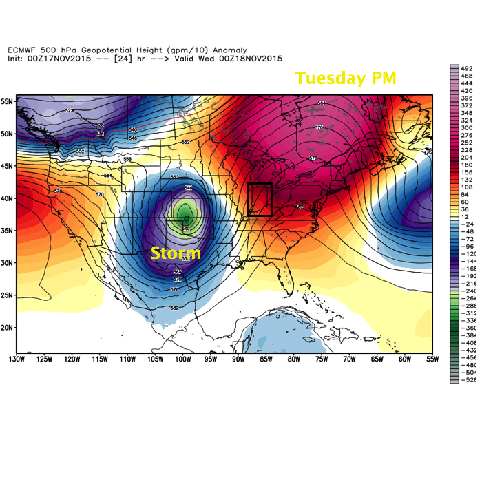
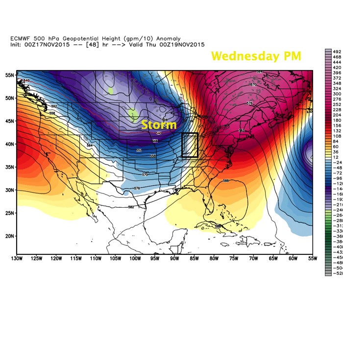
 This is all in association with a significant autumn storm system that’s been responsible for delivering hefty snows across the Rockies, blizzard conditions across the High Plains, and severe weather across the central and southern Plains. This storm will lift northeast over the next 24-36 hours.
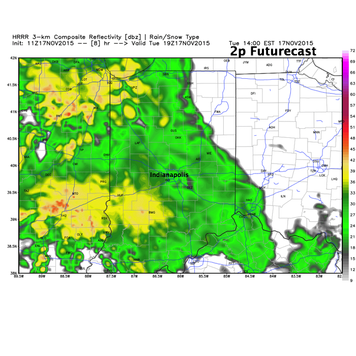
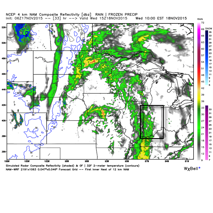
 A third, and final, wave of moisture will push through the state Wednesday, in a weakened state from what our friends to the west will experience (where another round of severe is expected today and tonight). This is what the radar may look like mid-morning-ish Wednesday.
 When all is totaled up from rain that began Monday afternoon and ends Wednesday afternoon, many locales will pick up 1.5″-2″ of needed rainfall. While significant, those numbers are lower than what originally model data implied, but we’ll take what we can get to push closer to average for November rainfall.
All eyes will then shift to our second storm system that will arrive over the weekend. There are still more questions than answers in regards to track of this next “wave” of low pressure, but with much colder air in place and pouring in behind the system, snow will fly across northern IN. As of now we forecast the majority of this event to fall in a liquid form across central IN, but even here precipitation may end as light snow showers the way things stand now. Stay tuned as we continue to fine tune the track. Regardless, much colder air will be with us to end the period.
Permanent link to this article: https://indywx.com/couple-storms-to-watch-and-much-colder-air/
Nov 16
El Nino Update; Updated Winter Thoughts…
As we rumble closer to the start of meteorological winter, we wanted to provide some updated thinking around what lies ahead. Before we dig into some of the latest data and dissect the updated SST profile, here’s a recap of our winter outlook posted 10.17.15. You can read the complete outlook here.
- Worst of winter, from a cold and snow perspective, is during the back half of the season.
- Colder than average winter ahead by 1 deg. (F) on average.
- Slightly less snow than normal at 20″ (first flake to last flake).
At first glance upon looking at the latest SST profile, there aren’t many huge changes from (6) weeks ago. However, there are some interesting trends, mostly pertaining to El Nino region 1+2 versus 3.4.
 1.) In the most recent El Nino monthly recap, Region 1+2 cooled .09 degrees (F) from September to October. Meanwhile, Region 3.4 warmed .32 degrees (F) during the same period. This trend is interesting and something we think continues looking over the data. Central-based, Modoki El Nino events argue for a colder east across a more widespread basis.
2.) The warm, or positive PDO, continues. This argues for eastern cold. Remember the past two winters that ran colder than normal across our region? The positive PDO played a big role in powering those.
3.) Though admittedly much more of a wild card, the current SST configuration in the northern Atlantic continues to argue for a developing negative NAO as mid and late winter arrives. Personally we feel the NAO impact, locally, is felt more in the later winter period. A negative NAO would also argue for colder than normal.
The latest Sea Surface Temperature Constructed Analog (SSTCA) model is in and remains firm on the idea of a cold east and south.

The warm PDO continues through winter and the warm PAC anomalies continue “spreading” west.

The central and eastern regions are favored for colder than normal temperatures through meteorological winter.

The predominant upper air pattern shows central and western Canada ridging with southern and eastern troughiness- also a sign of an active southern stream (storm track).
As we move into the Thanksgiving and Christmas seasons, rest assured we’ll continue to keep close tabs on the “sensible” weather the evolving pattern will deal the region. As a whole, we feel confident we remain on the right track and think plenty of wintry “fun and games” lie ahead this year.
Here’s a photo from Christmas 2007 out in Breckenridge, CO with my brother. Could this be the scene for Christmas this year here? “I’m dreaming of a white Christmas…”

Permanent link to this article: https://indywx.com/el-nino-update-updated-winter-thoughts/
Nov 15
Nice Today Before Our Next Storm Arrives…
 Highlights:
- Beautiful Sunday
- Clouds and rain return
- Colder late week
- Eyeing a potentially wintry end to November
Our next storm system is coming ashore along the West Coast this morning. That storm will impact our weather this week, but today we’ll focus on the sunshine and beautiful conditions. Temperatures will climb into the lower to middle 60s. With what lies ahead, we’d highly suggest taking advantage of the nice weather today and finish up any of that outdoor work you may have.
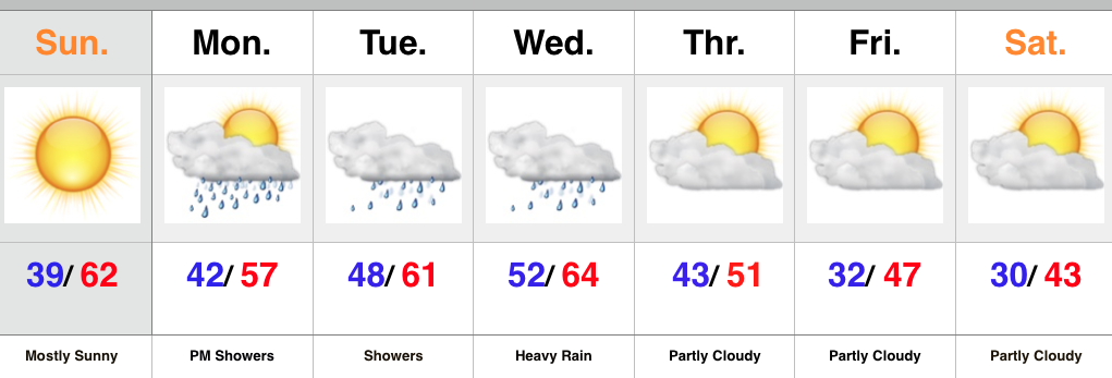
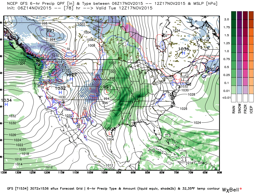
Clouds will increase Monday and the initial surge of moisture will provide showers and light rain by afternoon and evening. A strong southerly flow continues Tuesday into Wednesday with periods of rain. It won’t rain the entire time, but more times than not. A push of heavy rain still appears likely Tuesday night into Wednesday.
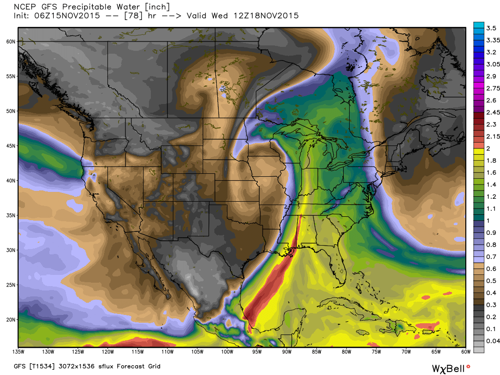
The image below is a look at forecast PWATs, thanks to Weatherbell.com, for Tuesday night. When these values reach 1.5″-2″ that’s a good indication for very heavy rains. We’ll continue to forecast widespread 2″+ type rainfall with this storm system.
 Once this next storm moves out, we’ll get back to drier and colder times to end the work week. Attention will then shift to a colder, potentially wintry, end to the month, including the Thanksgiving holiday. It’s too early for specifics on storminess, but model data does hint at a storm of “interest” around Thanksgiving. With colder air making a return, it’s certainly possible this next storm has a wintry component to it…
The latest GFS ensemble temperature anomaly chart shows the colder than average pattern setting in to wrap up November.
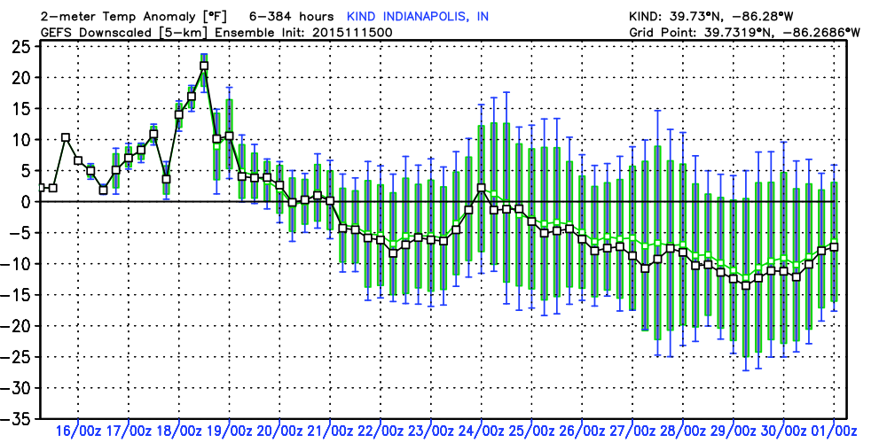
Permanent link to this article: https://indywx.com/nice-today-before-our-next-storm-arrives/
Nov 14
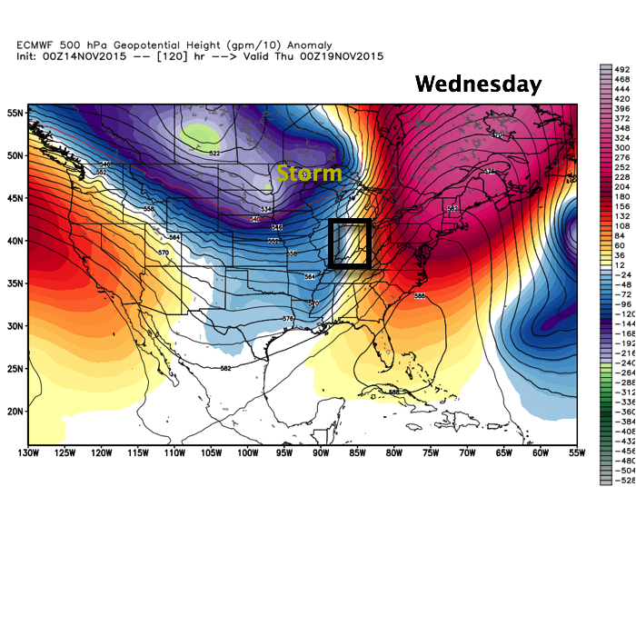
Big, Wet Storm System Sitting On Deck…
Enjoy the weekend, my friends, as a big and wet storm system awaits on deck to impact early to mid week across the region.
November, so far, has followed suit of the past few months in a much drier than normal regime. Over the past (7) days heaviest rains fell across SE portions of the state. On the month so far, IND sits around 1″ below normal.
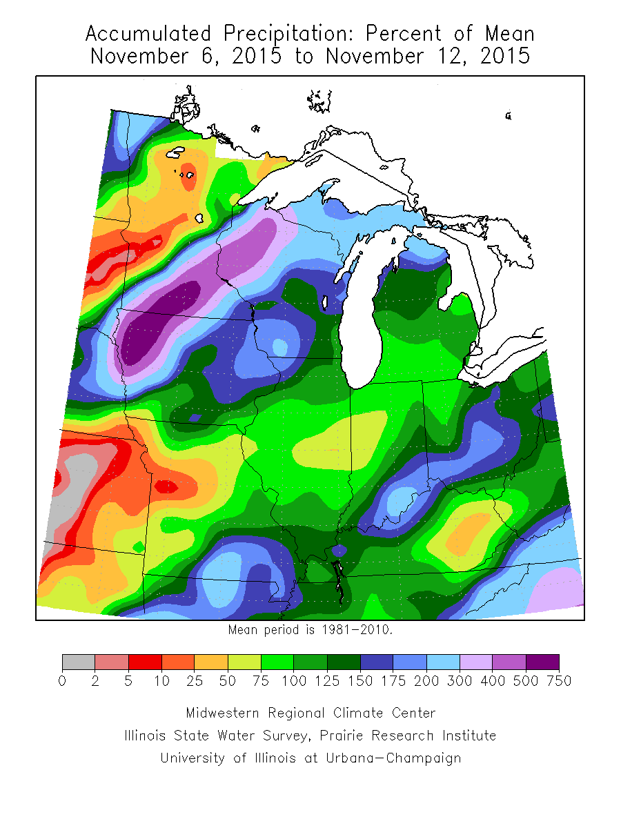
Past 7 day precipitation anomalies, courtesy of the MidWest Climate Watch.
That rainfall deficit may be eaten up over the course of a couple days as our next storm system rolls off the Rockies and into the Plains. (Track sound familiar)?
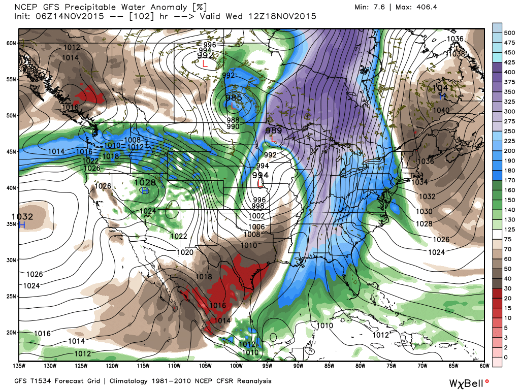
 The storm will tap into the Gulf of Mexico and include a deep southerly flow plenty capable of producing a heavy rain event across the region. Note PWATs (precipitable water) nearly 300% of normal.
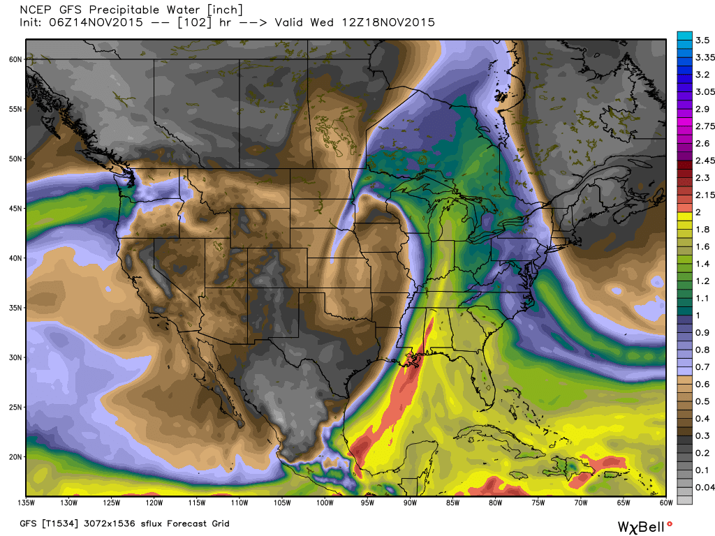
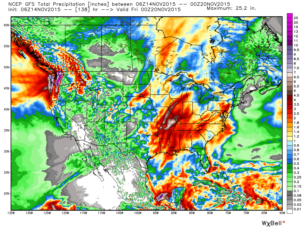
We target Tuesday night-Wednesday as the focal point for heaviest rain potential and model data remains firm on general consensus of 2″-3″ falling with this next storm system, including locally heavier totals.
 After this next storm, attention will begin to shift towards a colder pattern setting up for late November, including Thanksgiving…
Permanent link to this article: https://indywx.com/big-wet-storm-system-sitting-on-deck/
