
You must be logged in to view this content. Click Here to become a member of IndyWX.com for full access. Already a member of IndyWx.com All-Access? Log-in here.
Permanent link to this article: https://indywx.com/monday-morning-video-update-2/
Jul 10
Wrapping Up The Weekend On A Nice Note…
 Highlights:
- Dry weather continues
- Wet, active pattern returns mid week
Beautiful Sunday…High pressure will remain in control of our weather as we wrap up the weekend. As a result, we can expect lots of sunshine and comfortable temperatures, including low humidity levels. All-in-all, we really can’t ask for better weather this time of year.
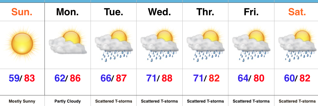
Monday will remain dry, but the deeper we progress into the week, rain and storm chances will go up. While we include the mention of rain and storms in the forecast each day from Tuesday on, please know that it won’t rain the entire time and there will be many dry hours each day. That said, it does appear as if we’re entering another active stretch, and fine tuning will be required to pinpoint specifics around timing and track of storm complexes in the days ahead.
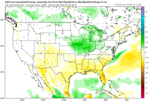
Upcoming 7-Day Precipitation Forecast:
- Snowfall: 0.00″
- Rainfall: 0.75″-1.50″
Permanent link to this article: https://indywx.com/wrapping-up-the-weekend-on-a-nice-note/
Jul 09
Great Weekend Weather…
 Highlights:
- Dry and pleasant weekend
- Moisture and storms return next week
- Another push of cool air next weekend?
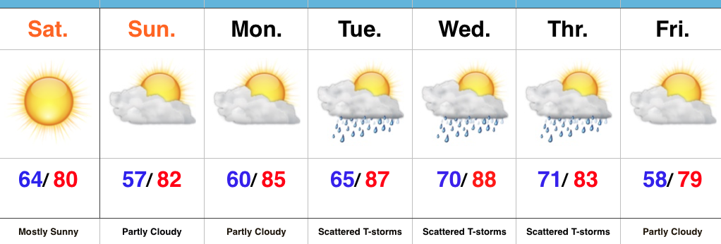
Sunglasses Required…What a great feel we’re greeted with out there this morning! Low humidity and pleasant temperatures will be with us through the weekend, along with lots of sunshine. Sunday morning will feature many neighborhoods in the middle to upper 50s across central IN. Mid-July, what?! 🙂
Moisture will slowly return as we back our air flow around to the SW early next week. Additionally, we’re tracking multiple disturbances mid week that will promote increased chances of thunderstorms.
An early look at late week shows potentially another push of dry and cool air to set-up a beautiful close to the work week. We’re getting spoiled.
Upcoming 7-Day Precipitation Forecast:
- Snowfall: 0.00″
- Rainfall: 0.75″-1.50″ (locally heavier totals)
Permanent link to this article: https://indywx.com/great-weekend-weather/
Jul 08
Friday Morning Rambles…
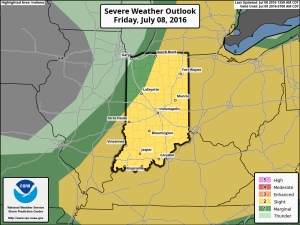
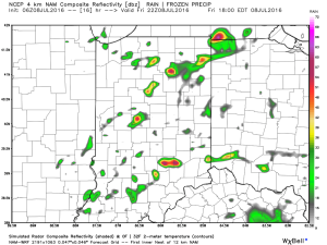
1.) We’ve got another warm, humid day dialed up and as a cold front moves in this afternoon, scattered strong to severe storms are possible. We think east-central Indiana stands the greatest threat at experiencing a severe storm later this evening.
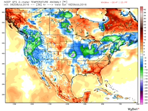
 2.) The aforementioned cold front will sweep through the state tonight and allow a much drier and cooler air mass to push in for the weekend. We’ll enjoy a downright pleasant feel this weekend, including lots of sunshine. Enjoy!
 3.) Dry weather should continue into early next week, but wet and stormy weather will return as early as Tuesday, continuing into the latter portions of the week.
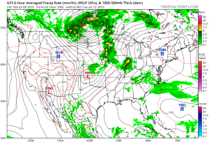 This is the start of what should be a rather wet period for mid and late month.
 4.) This is also a continued “transient” pattern through the end of the month, meaning we really don’t see any sort of sustained dry, hot weather in the foreseeable future…
Permanent link to this article: https://indywx.com/friday-morning-rambles-3/
Jul 07
Thursday Morning Video Update…
Severe potential is there tonight, but how does convection to our west during the day impact the situation downstream (locally) for tonight? We’re monitoring closely, but for the purpose of…
You must be logged in to view this content. Click Here to become a member of IndyWX.com for full access. Already a member of IndyWx.com All-Access? Log-in here.
Permanent link to this article: https://indywx.com/thursday-morning-video-update-3/
