 Highlights:
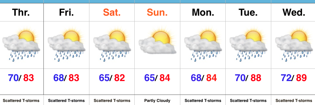
- Lots of sunshine
- Best storm chances Friday this week
- Turning less humid this weekend
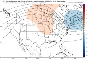
Sunglasses Required…The storm axis has set itself up to our west, including IA and MO. At one point, data and upper level steering currents seemed to align in a manner that would be further east, but that’s obviously not the case. The end result here will be a drier forecast, overall. We’ll still have to remain on our toes for storm potential through week’s end, but the confidence is low and the drier regime looks good this morning.
Less humid air will push in this weekend, along with continued sunny conditions. All in all, the first weekend of August looks very pleasant. Plans to go to the State Fair anyone?
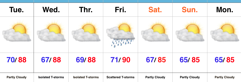
Upcoming 7-Day Precipitation Forecast:
- Snowfall: 0.00″
- Rainfall: 0.25″-0.50″ (locally heavier totals)

 The atmosphere will be loaded with moisture and precipitable water values (2″+) will promote localized flash flooding within the storm complexes.
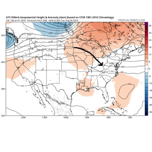
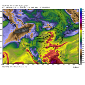 We think the initial wave of storms will ride southeast late tonight and early Monday and could encompass SW portions of the forecast area. The pattern is favorable for additional storm complexes to travel southeast Tuesday and Wednesday, however.
 That said, things will change as we progress into the prime heating hours of the afternoon and evening. Upper level energy will rotate east out of the Plains (this morning) and across Indiana this afternoon and evening.
 This will help ignite thunderstorm development during the afternoon and evening. While a storm could impact any given neighborhood this evening, best concentration of storms should lie north of the I-70 corridor. Locally heavy rain will be a good bet with the stronger storms. Localized rainfall amounts in excess of 2″ will be possible.
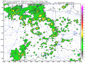 Additional scattered thunderstorm activity will continue Saturday, but there will be many more dry hours than wet/ stormy.